|
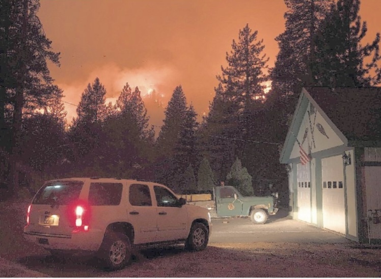
Today marks the 6th week since the beginning of the Caldor fire. With over 220,000 acres burned and my entire district’s population (which runs from Pollock Pines to Stateline to Tahoma) evacuated at some point in time, this was truly an extraordinary event. 782 homes were destroyed, many within hours of the start of the fire. It is the 15th largest fire in our state’s history – and it is still going…
I personally evacuated for 17 days, staying in 8 different locations, and took Zoom meetings to a new level (one somewhere in the middle of Nevada). But somehow, my home of 40 years in Christmas Valley was spared, as was everyone else’s in our small community. The same could not be said for those in the way of the fire on the other side of the mountain. Grizzly Flats, Kyburz, Aspen Creek and Philips tracts – all sustained major losses. My heart goes out to those who lost their homes and cabins – pets, livestock and livelihoods all gone so fast...
My sincere and undying gratitude goes to the firefighters, first responders and mutual-aid law enforcement that allowed everyone a safe evacuation. I will never forget my neighbor’s video alarm going off on that crazy Monday night because a spot fire had started in their yard. The camera picked up the first to respond – a CHP unit - followed by a fire truck, both responding within a minute or two. It is amazing how our first responders consider their courage and determination as “just doing their job”- they are truly an incredible group of human beings. As we run away from danger, they run head-first towards it to keep us safe – amazing…
Unfortunately, Sierra-Tahoe (El Dorado County’s only ski resort west of Echo Summit) was not spared. They sustained major damages, with $5 million in losses to their equipment alone and 80% of their trees damaged or destroyed. With over 600 employees annually hired at the resort, this is a huge loss for not only the resort, but to the workers who depend on Sierra as a living, as well as our county’s economic well-being and the communities they serve. I want you to know that I have been working tirelessly to get help for the homeowners, USFS cabin owners and businesses such as Sierra-Tahoe. I have spoken to USFS officials, Cal OES, state leaders and federal officials. I have asked our County to reach out to all points of contacts to get the ball rolling for recovery of those who need help navigating through the myriad of agencies and their regulations. This is not an easy or quick process – but it is one that I promise to work on until we get the help needed to allow our citizens the ability to move on with their lives and our businesses the ability to open once again.
And we are still not out of the woods. With a new cold front entering the area today, we must remember to keep our guard up – stay connected to whatever news agency you listen to. If you have repopulated and are living in an area under evacuation warnings, be prepared to leave if conditions change. Please stay safe out there. I pray for the safety of our fire personnel and first responders – you rock our world!
Caldor Fire
Incident Update
September 27, 2021
INCIDENT FACTS
- Unified Command Agencies: CAIIMT 12; Eldorado National Forest and Tahoe Basin Management Unit
- Incident Location: 2 miles east of Omo Ranch, 4 miles south of Grizzly Flats community
- Incident Start Date: August 14, 2021
- Incident Start Time: 6:54 PM
- Incident Type: Wildland Fire
- Cause: Under Investigation
- Size: 221,774 Acres
- Containment: 76%
Expected Full Containment: 10/16/2021
- Structures Threatened: 1,353
- Structures Damaged: 81
- Single Residences Destroyed: 782
- Total Personnel: 1,490
- Helicopters: 10
CURRENT SITUATION
Last night, crews were on call to respond to reports of heat and smoke. A strike team responded to and extinguished a heat signature off highway 50. Heat was also reported in Division Romeo early this morning, and crews are on scene to investigate.
We are currently under a Red Flag Warning through 5:00am Tuesday, September 28 due to low humidity and high winds. Southwesterly gusts along the ridgetops are expected to peak between 40 and 60 mph by late this evening. The region is in a critical fire weather period; fire personnel are prepared responding accordingly.
Fire behavior will intensify with the increasing winds, leading to increased smoke production and burning in the interior of the fire’s footprint. These conditions can cause fires to move quickly and transition from the ground to the canopy. Incident command is coordinating with CalFire and local municipal agencies to place additional
resources in tactical patrol within the Lake Tahoe Basin and the Placerville areas to secure control and containment lines. Crews are also prepared to respond to spot fires, where winds carry hot embers long distances and cause fires outside of control lines.
Southwesterly winds may push smoke into the Lake Tahoe area, and residents may see decreasing visibility and air quality throughout the day.
The incident is currently undergoing a transition: California Interagency Incident Management Team 12 will be handing off to California Interagency Incident Management Team 13 on Wednesday, September 29 at 7:00am. Incident commander Michael Nobles will be transferring command to Incident commander Michael Wakowski.
USDA FOREST SERVICE
FOREST CLOSURE INFORMATION
-
EL DORADO NATIONAL FOREST: A forest-wide closure (03-21- 14) remains in effect until September 30. Access and orders will be refined over time.
More information: https://www.fs.usda.gov/eldorado/
-
LAKE TAHOE BASIN MANAGEMENT UNIT:
- Caldor Fire Emergency Closure (19-20-06) for portions of the Lake Tahoe Basin Management Unit remains in effect through December 31, 2021. Access and orders will be refined over time. More Information: LTBMU Emergency Fire Closure Forest Order 19-21-06 - InciWeb the Incident Information System (nwcg.gov)
- Backcountry closure (Forest Order 19-21-07) for the following areas: Desolation Wilderness, Meiss Backcountry, Barker Pass Road and McKinney/Rubicon Trail remains in effect until October 20, 2021.
More information including maps: https://inciweb.nwcg.gov/photos/CAENF/2021-08-15-0910-CaldorFire/related_files/pict20210821-104121-0.pdf
-
BURNED AREA EMERGENCY RESPONSE TEAM (BAER): A BAER team continues work in the Caldor Fire area. This is a rapid assessment of burned watersheds by a BAER team to identify imminent post-wildfire threats to human life and safety, property, and critical natural or cultural resources on National Forest System lands and take immediate actions to implement emergency stabilization measures before the first post-fire damaging event.
See Caldor Post Fire BEAR Inciweb site: https://inciweb.nwcg.gov/incident/7842/
EVACUATIONS
AMADOR COUNTY - WARNING
-
ZONE 4A – South of Highway 88 along the Amador/El Dorado County Line from Dufrene Road, north of the line due East from Dufrene Road to the Amador/Alpine County Line, west of the line due south from Highway 88 to
the east end of Salt Springs Reservoir.
-
ZONE 5A – South of Highway 88 along the Amador/El Dorado County Line, north of the line due east from Dufrene Road to the Amador/ Alpine County Line, east of the line due south from Highway 88 to the east end of Salt Springs Reservoir, west of the Amador/Alpine County Line.
View the interactive evacuation map here: https://tinyurl.com/AmadorEvac
EL DORADO COUNTY - ORDER
-
CAPLES CREEK – This section is south of Highway 50 east of Kyburz up to 41 Milestone Tract and south all the way to Highway 88 between 1 mile east of Mormon Emigrant Trail up to Caples Lake following the County Line.
-
DESOLATION – This section extends south of the Placer County Line in the area of the Rubicon Trail between Spider Lake and Sourdough Hill and extends south into Desolation Wilderness all the way to Highway 50 to include the areas of Rockbound Lake, Rubicon Reservoir, Highland Lake, Horseshoe Lake, Schmidell Lake and Twin Lakes south to Highway 50 between Wrights Lake Road and Twin Bridges. The eastern edge of this area is in line with Clyde Lake and Pyramid Lake.
-
DESOLATION EAST – The area north of Echo Lake, following the Desolation Wilderness north staying west of Fallen Leaf Lake, Cascade Lake and Emerald Bay up to the Placer County Line
-
DESOLATION NORTH – This is the area of Desolation Wilderness south of the Placer County Line extending to Emerald Bay but staying within Desolation Wilderness.
-
HELL HOLE – Northeast of Highway 89, west of the Alpine County line, and south of Tahoe Paradise Golf Course
-
NORTH ECHO – North of Highway 50 between Twin Bridges and Echo Summit, extending to the north just past Upper Echo Lake.
-
SOUTH ECHO – South of Highway 50 starting at Camp Sacramento to the top of Echo Summit then proceeding due south to the Alpine County Line.
-
TRIMMER – The area east of Pioneer Trail to the Alpine County Line stopping south of Heavenly Ski Resort, excluding all residences off Pioneer Trail.
View the interactive evacuation zone and road closure map here: https://tinyurl.com/ElDoradoEvac
EL DORADO COUNTY - WARNINGS
-
HEAVENLY – East of Pioneer Trail between Larch and Al Tahoe, to include the area of Heavenly Ski Resort out to the Alpine County Line and the Nevada State line on the east.
-
MET TO HWY 88 – South of Mormon Emigrant Trail to Highway 88. Weston Highway 88 to Hams Station.
-
US 50 SOUTH TO KYBURZ – South of Highway 50 from Ice House Road to Silver Fork Road, to include the community of Kyburz, excluding the area south of the south fork of the American River. East of Mormon Emigrant Trail to Highway 88.
-
CRYSTAL BASIN B – From Ice House Road east to the border of desolation wilderness and from the Placer County line, south to Granite Springs Road and the area south of Granite Springs Road to Highway 50 at Wrights Lake Road
-
CHRISTMAS VALLEY – All residences accessed from Highway 89 south of Highway 50 in Meyers through Christmas Valley and including all of South Upper Truckee.
- SLY TO 36 MILESTONE
ALPINE EVACUATION - WARNINGS
-
ZONE 21A – Highway 89 at Pickett’s Junction west to the Alpine/El Dorado County Line
-
ZONE 22A – Pickett’s Junction Northeast to Fay Luther Canyon
- Horse Thief Canyon to Fay Luther Canyon
View the interactive evacuation map here: https://tinyurl.com/AlpineEvac
COOPERATING AGENCIES
Alpine County Sheriff’s Department, Amador County Sheriff's Office, AT&T, Barton Health, Cal EMSA, Cal OES Fire, Cal Trans, CCC, CDCR, CHP, El Dorado County Dept of Agriculture, El Dorado County DOT, El Dorado County EMSA, El Dorado County Fire, El Dorado County OES, El Dorado County Sheriff's Office, El Dorado Irrigation District, Heavenly Ski Resort, Kirkwood Mountain Resort, Liberty Utilities, Marshall Medical Center, North Lake Tahoe Fire Protection District, North Tahoe Fire Protection District, NV Energy, Paragon Gaming LLC, PG&E, Pioneer FD, Shingle Springs Band of Miwok Indians FD, Sierra-at-Tahoe, SMUD, South Lake Tahoe EOC, South Lake Tahoe Fire Department, South Lake Tahoe Police Department, South Lake Tahoe Public Utility, District, Tahoe Douglas Fire Protection District, Verizon, Volcano Telephone, Washoe Emergency Operations Center, Washoe Tribe of Nevada and California.
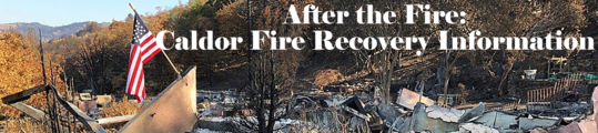 El Dorado County has set up a webpage for those citizens who are dealing with the recovery stage of the Caldor Fire. The webpage has links to Debris and Tree Removal, Right of Entry forms, Property Tax Relief, US Forest Service information, and general FAQ pages. Go to Caldor Fire Recovery (edcgov.us) for more information.
El Dorado County Redistricting Map Alternatives Released
Your County Supervisor Could Change in 2022
As part of the redistricting process currently underway in El Dorado County,
alternative maps under consideration for Board of Supervisors districts are now available for public viewing.
Following the August 19, 2021, release of census data for the redistricting effort, El Dorado County’s Geographic Information System (GIS) staff and the Redistricting Team finalized a system to display the data and for the drawing of new boundaries for each of the County’s five supervisorial districts. The Surveyor’s Office has created four maps, each of which meets the requirements for equal population distribution among
the districts, as well as geographic contiguity, integrity of local communities of interest and cities, consideration of natural and man-made barriers, and compactness. These preliminary alternatives can be found at the County’s Redistricting web page under “Draft Maps”.
The public mapping application provides instructions for use and allows the public to provide comments on specific areas of the County and the map alternatives overall. The public may also access and download data and the census files to create their own maps for consideration.
A review of map alternatives provided by the Redistricting Team as well as any submitted by the public will be provided at the next scheduled Redistricting public meeting scheduled for October 14, 2021.
The U.S. Constitution requires a national census every 10 years, after which Congressional and state legislative district lines are redrawn to reflect changes in population. California law requires boards of supervisors to use the federal census data to redraw supervisorial districts.
Due to this redistricting process there will be changes to the District V borders.
|