gee creek watershed restoration - WSU Clark County Extension ...
gee creek watershed restoration - WSU Clark County Extension ...
gee creek watershed restoration - WSU Clark County Extension ...

Create successful ePaper yourself
Turn your PDF publications into a flip-book with our unique Google optimized e-Paper software.
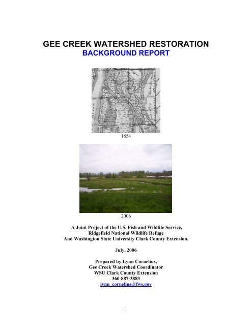
GEE CREEK WATERSHED RESTORATIONBACKGROUND REPORT18542006A Joint Project of the U.S. Fish and Wildlife Service,Ridgefield National Wildlife RefugeAnd Washington State University <strong>Clark</strong> <strong>County</strong> <strong>Extension</strong>.July, 2006Prepared by Lynn Cornelius,Gee Creek Watershed Coordinator<strong>WSU</strong> <strong>Clark</strong> <strong>County</strong> <strong>Extension</strong>360-887-3883lynn_cornelius@fws.gov1
TABLE OF CONTENTSAcknowledgement 2Introduction 3Executive Summary 3Location and Environmental Setting 6Land Use History 12Recent Land Use 19Salmon and Trout Use History 22Watershed Restoration History 28Watershed Conditions 32Past Restoration Recommendations 35Recent Events and Future Considerations 39References 42Appendix I Gee Creek Watershed Historical Timeline 48-71AcknowledgementsThis report was produced as a joint project between Washington State University <strong>Clark</strong><strong>County</strong> <strong>Extension</strong> and the U.S. Fish and Wildlife Service (USFWS), Ridgefield NationalWildlife Refuge, using funds provided through a USFWS Natural Resource DamageAssessment Restoration program award. Thanks are extended to the many citizens,agency staff, and technical experts who provided timely consultation, file information,and editing.2
Location and Environmental SettingGee Creek is a perennial stream tributary of the Columbia River and occupies anapproximately 12,000-acre <strong>watershed</strong> basin, emptying into the Columbia approximately¼ mile upstream from the mouth of the Lewis River in <strong>Clark</strong> <strong>County</strong>, Washington. 12 The<strong>creek</strong> originates on gently sloping topography along Interstate 5, flows west throughcanyons and the City of Ridgefield, and into a series of Columbia River floodplainlowland lakes and ponds on the Ridgefield National Wildlife Refuge. 14 Most of the<strong>watershed</strong> lies within Township 4N 1E, with the lowest elevation reach lying within 4N1W and a small area of the upper <strong>watershed</strong> reach within 3N 1E, all of the WillametteMeridian.Fig.1 Gee Creek Watershed,<strong>Clark</strong> <strong>County</strong>, Washington.The <strong>creek</strong> joins the Columbia River between the mouth of Lake River and the mouth ofthe Lewis River, at approximately river mile 87. Elevation of the Gee Creek basin rangesfrom approximately 300 feet down to less than 8 feet at the Columbia River. Thedrainage consists of a main stem of approximately 10 miles in length, which branches6
into headwater tributaries, and includes a small mid-reach tributary locally named TeeCreek. (See Figs.1 to 9 ).Gee Creek has been placed for <strong>watershed</strong> and salmon recovery planning purposes withinWater Resource Inventory Area (WRIA) #27 (Fig.2) although it is not a direct tributaryof the Lewis River. The lower 2 miles of the <strong>creek</strong> lie within the Carty Unit of theRidgefield National Wildlife Refuge (RNWR). The City of Ridgefield occurs along themiddle and upper reaches, and currently occupies approximately 13% of the <strong>watershed</strong>area. The proposed Ridgefield 2006 urban growth boundary when approved will occupyapproximately 16%. The majority of the drainage is largely privately owned. 12Three geographically similar stream <strong>watershed</strong>s occur to the north and south of GeeCreek – Allen Canyon, Flume Creek, and Whipple Creek. These four small basins havebeen collectively labeled ‘West Slope Watersheds’ by <strong>Clark</strong> <strong>County</strong> Public Works WaterResources Program. 14Fig.2. SW corner of WRIA #27, Lewis- Kalama. Washington State DOE.(http://www.ecy.wa.gov/services/gis/maps/wria/number/wria27.htm)7
Fig.3. Gee Creek <strong>watershed</strong> topographic setting.8
Fig. 4. 2006 satellite imagery - oblique view looking northwesterly down the Gee Creek Watershed. Note mostof the landscape has been cleared of forest for agriculture. (http://earth.google.com)9
Fig.5. Gee Creek channel soon after entering the Columbia River floodplain, Carty Unit,RNWR. April, 2006. Lynn Cornelius photo.Fig.6. Gee Creek upper <strong>watershed</strong> landscape with traditional rural land use. LynnCornelius photo May, 2006.10
Fig.7. Upper Gee Creek reach exiting from culvert under Interstate 5 Freeway. April,2006. Lynn Cornelius photo.Fig.8. Gee Creek gravelly reach at Abrams Park, City of Ridgefield, April, 06. LynnCornelius photo.11
Land Use HistoryThere is more history to be researched and documented regarding the Ridgefield area of<strong>Clark</strong> <strong>County</strong>. Only salient highlights pertinent to the condition of the Gee Creek<strong>watershed</strong> obtained during the term of this project are described here.A historical timeline worksheet of land use and specific <strong>watershed</strong> <strong>restoration</strong> highlightsfor the Gee Creek Watershed was compiled for this report and is attached as Appendix I.In reading the timeline, note that Gee Creek has been subject to not only direct land useon the <strong>creek</strong> and in the <strong>watershed</strong>, but also the effects of hydrology, water quality, andecosystem function changes from much larger land uses in the Columbia River<strong>watershed</strong>. These larger impacts have included more than 110 dams on the mainstem andtributaries of the Columbia River; dredging and diking of the river channel and associatedwetlands; pollutants from industry, towns and cities; introduction of non-native speciessuch as carp, shad, bullfrog, reed canary-grass, knotweed, and Himalayan blackberry;early beaver removal, salmon harvest and many other impacts.General early land use history in the <strong>watershed</strong> is typical of agricultural areas of thelower Columbia Region of the Pacific Northwest. Many of these general land use detailsare not repeated here. For a description of additional aspects of lower Columbia Riverhistory, the reader is referred to the Lower Columbia River Watershed Council: LowerColumbia-Clatskanie Watershed Assessment, [undated] Portland State University- IIHistorical Conditions Assessment http://www.lcrwc.com. 33Although Native Americans (the Multnomah band of the Chinook Nation) had lived andtraded on and around the lower Columbia River and specifically at the mouth of GeeCreek for hundreds of years, 51 it was the Euro-American settlement era of modern timeswhich brought large-scale changes to the native landscape and waters of the Gee Creek<strong>watershed</strong>.A brief, general discussion of Gee Creek <strong>watershed</strong> history follows and includes a fewphotos of the early 20 th -century Ridgefield area, providing a keyhole glimpse of early<strong>watershed</strong> conditions and land uses (Figs.11-13).Gee Creek is located in <strong>Clark</strong> <strong>County</strong>, Washington, the oldest county in the state and thesite of Fort Vancouver - established in 1825 and one of the earliest Euro-Americansettlements in the Pacific Northwest. The lower reach of Gee Creek itself was part of theearliest settled sites in the area due to the suitable landing shoreline of nearby Lake Riverand its connection to the water highway of the Columbia River. Gee Creek was crossedearly by a fur trading trail near the mouth, and in 1839 was directly settled by WilliamCarty (Figs.14, 15). 25,37,62 William Gee filed a land claim on the <strong>creek</strong> in 1851. 25,37Gee Creek therefore has been subject to early and direct land uses for the past 167 years,with concentrated settlement directly adjoining the lower reach. This early settlementlater grew into the town of Union Ridge, and the town was incorporated and renamed asthe City of Ridgefield in 1909. 25,3712
With the decline of river travel for access and commerce, and the advent of land-basedtravel, roads were developed in the upper <strong>watershed</strong> connecting Gee Creek to the nearbycities of Vancouver and Portland to the south. As early as 1888, many of the currentprimary road routes were already established, presumably with early versions of <strong>creek</strong>crossings, road grade fill, and associated stream impacts (Fig.16). 17,25,57a Roy Garrison,long-time Ridgefield resident, was born in 1932 on upper Gee Creek, ½ mile north of the<strong>Clark</strong> <strong>County</strong> fairgrounds. He reported that at Royle Road there was a bridge prior to the1960’s and 1970’s when the road was realigned. 25a John Burrows, another long-timeRidgefield resident (born 1915) lived 1½ miles north of town for many years. Herecalled that at the Main Street Crossing of Gee Creek there was a bridge at the bottom ofthe hill which was replaced with a culvert in the 1950’s when the road was straightened. 6aConstruction and maintenance of Interstate 5 (I-5) and associated untreated runoff are thelargest recent major road impacts in the <strong>watershed</strong>. Interstate 5 largely follows a routewhich was first established as a military road in the late 1800’s and later as Highway 99in the early 20 th century. 35aa I-5 construction occurred from the late 1950’s to the early1960’s in <strong>Clark</strong> <strong>County</strong>, starting from Vancouver and working northward. Grading andfilling of the original <strong>watershed</strong> contours was expanded with the building of I-5. 17,18a GeeCreek is restricted and confined by I-5 -- passing through 2 culverts, running in a narrowland divider between the north- and south-bound lanes for ½ mile, and finally passingthrough a third culvert beneath the entire road grade before exiting the freeway corridor(Figs.7, 9).In 1890, construction began on a branch railroad (RR) line from Vancouver to Kalamabut was suspended after 1 year. Work was resumed and the line completed in 1901. In1907-08, the Northern Pacific RR line was completed, expanding, straightening andimproving the line with a double track of standard gauge rail. 25 The RR crosses the GeeCreek floodplain on a fill roadbed-dike more than 15’tall, confining and constricting thestream through an 8’-diameter concrete culvert as it enters the Columbia River floodplainlowlands (Figs.10a,10b).Roy Garrison recalled that the Royle farm on Greek had a couple of sawmills. There wasa dam in the <strong>creek</strong> just upstream from the 15th St. Bridge below Royle Road. JohnnyRoyle used the pond behind it as a mill pond but no flume was there. The dam had beenbuilt by the railroad and ran a 6-8” diameter wooden pipeline all the way to the watertower at the RR Deport in Ridgefield to provide water for the steam locomotives. Royremembers seeing steam engines in Ridgefield as a boy. A lot of wood was cut for theboilers. He knows where remnants of the water pipeline can still be found. The dam hasbeen breached for some time.(Above paragraph) 25aThe upland portions of the Gee Creek <strong>watershed</strong> were originally dominated by nativeconifer forest in varying stages of fire succession (Fig.14). 25,62 An annotation from the1854 Cadastral survey written across much of the upper <strong>watershed</strong> and adjoining AllenCanyon drainage reads: “Land level and gently rolling Soil 2 nd rate clay loam gravelly inplaces Timber Fir Cedar Maple Hemlock &c. mostly burn and partly fallen with thick13
undergrowth”(Fig.15). A second annotation on the slopes just above the Columbia Riverfloodplain in the lowermost <strong>watershed</strong> reads: “Land Rolling Timber Fir Hemlock partlyburnt” (Fig. 14). Patches of oak woodland also occurred and are still found on the GeeCreek lowlands, associated with rock outcroppings and floodplain shoreline bluffs. Someoak groves can also be seen in the upper <strong>watershed</strong> where small woodland and/or prairiepatches may have occurred historically.Clearing of the original coniferous forest cover began with the earliest settlements, andthe land was steadily converted to other uses, principally farming. Photos taken in thefirst half of the 20 th century illustrate the degree to which the land had been cleared offorest cover for conversion to largely agricultural uses (Figs.11-13). In the 20 th century,important farm products grown in <strong>Clark</strong> <strong>County</strong> and the Gee Creek Watershed’s fertilesoils and climate included tree and berry fruit, potatoes, dairy, beef cattle, hay, and grain,among others. 25,37Bruce Wiseman, former Ridgefield NWR Refuge Manager, reported the Carty family hadlogged cottonwood trees [prior to refuge establishment in 1965] from the high benchground along Lake River in what is now the Carty Unit of the Refuge. 65aJohn Burrows recalled a slaughterhouse located at the SR501 (Pioneer) crossing of GeeCreek when he was a teenager 70-75 years ago [early 1930’s]. He further recalled thatthe Carty family cut hay on a bench along Lake River at the north end of the Carty Unitabove a rock jutting out into Lake River. (Previous 2 sentences) 6aRoy Garrison recalls that one meander of Gee Creek was taken out when the ball fields atAbrams Park were developed in the Early 1960’s. This was after the 1962 ColumbusDay windstorm. The <strong>creek</strong> used to meander a bit more in a couple of places. 25aA stream assessment conducted in 2003 by StreamFix, a private consulting firm, reportsthat Gee Creek appears to have been straightened in the Abrams Park vicinity reach in thepast:“Review of the sinuosity and meander belt width of the stream above and belowthe Pioneer St. to Heron Drive reach clearly shows the <strong>creek</strong> alignment to havebeen artificially straightened through this area. Anecdotal evidence indicates thisoccurred prior to the park parcel coming into City possession. This reach has agreater slope and less sinuosity than the remainder of the <strong>creek</strong> except where ithas been straightened to accommodate Pioneer Street.” 47 [Note: Abrams Parkwas reportedly established by donation in 1910. 25 ]Dominant land use eras in the <strong>watershed</strong> since Euro-American settlement in general canbe summarized as having been, in turn: fishing, furbearer and timber harvest; crop, dairy,and livestock farming; rural and local industrial; rural-residential; and modern urbanresidential/light industrial in more recent years in the City of Ridgefield, and along theInterstate 5 freeway corridor. 25,6214
Fig. 9. Interstate 5 corridor through the upper Gee Creek <strong>watershed</strong>. Creek goes underroad grade fill where trees meet freeway on left. Lynn Cornelius photo, June, 2006.Fig. 10a. RR grade barrier dike across the Gee Creek floodplain. Lynn Cornelius photo,May, 2006.15
Fig. 10b. Concrete wall deflecting <strong>creek</strong> into 8’ concrete culvert under RR grade. LynnCornelius Photos, May 2006.Fig.11.View of Ridgefield. Undated. (Fort Vancouver Regional Library, Ridgefield via<strong>Clark</strong> <strong>County</strong> Historical Museum collection, Vancouver, WA.) Note absence of trees andshrubs due to land clearing. [Early part of 20 th century? Power came to Ridgefield c.1916]16
Fig.12. Crop farming land use in “Ridgefield Area”. Undated. (Fort VancouverRegional Library, Ridgefield, via <strong>Clark</strong> <strong>County</strong> Historical Museum collection,Vancouver, WA.) [Probably earlier quarter of 20 th century?]Fig.13.View of Ridgefield from vicinity of lower Hillhurst Road? Undated. (FortVancouver Regional Library, Ridgefield, via <strong>Clark</strong> <strong>County</strong> Historical Museum collection,Vancouver, WA.) [Date reported as c. 1908 on Ridgefield history interpretive plaque,Ridgefield City Hall.]17
Fig.14. 1854 Cadastral Survey Map (portion), lower Gee Creek. T4N R1W, W.M.http://plso.wadnr.gov/blm_wa/wsrvy1.asp (Note trail near mouth, cultivated fields alongLewis River and Bachelor slough, Carty and Gee donation land claims on Gee Creek.)18
Fig.15. 1854 Cadastral Survey Map (portion). T4N R1E, W.M.Early map description of the middle and upper Gee Creek <strong>watershed</strong>.http://plso.wadnr.gov/blm_wa/wsrvy1.aspRecent Land UseOver much of Gee Creek’s Euro-American history, rural and farm land uses havepredominated across the <strong>watershed</strong>, with localized urban and industrial uses in the townof Ridgefield (see Appendix I). (As late as the 1950’s, the dairy industry was recognizedas the most important agricultural operation in the Ridgefield area, eclipsing potatoes inimportance. 16 Roy Garrison, a 74 year old Ridgefield resident who was born and raisedin the Ridgefield area, recalled that in the late 1940’s “everyone was a dairy farmer in thearea at the time”. 25a )In latter decades, commercial farming has given way to rural-residential land uses, andmost recently, more rapid conversion to industrial, suburban and urban land uses with theannexation and growth of the City of Ridgefield directly along the middle and upperreaches of the <strong>creek</strong>. 12,38 Expanding beyond I-5, the City of Ridgefield boundary hasincreased the city’s size more than 2.5 times in area over the 10 years from 1995-19
2005. 12,38 Recent housing developments, new rural residences, and industrialdevelopment near the I-5 corridor can be seen in the <strong>watershed</strong>. Ridgefield’s populationis estimated to grow nearly 10 fold over the next 20 years from 2,600 in 2005 to morethan 24,000 by 2024. Land categories in the West Slope Watershed which includes GeeCreek were described by <strong>Clark</strong> <strong>County</strong> Water Resources in 2004 as: 49% pasture, fields,shrubland, and bare earth; 26% developed or recently cleared forest, and 25% forestedland. Watershed land uses are described as “fairly extensive rural and suburbanresidential areas with lack of forests and the presence of a major transportation corridor –Interstate 5.” 14Fig.16. 1888 Plat map showing location 118 years ago of what is largely the current roadsystem. Roads are already well-established crossing and placed alongside Gee Creek andits tributaries. (http://www.rootsweb.com/~waclark/clark.htm) By 1922, major highway routeswere being paved.20
Fig.17. Construction for residential development in the Gee Creek Watershed, City ofRidgefield. Lynn Cornelius photo, May, 2006.Fig. 18. Recent suburban residential development in the Gee Creek Watershed, City ofRidgefield. Lynn Cornelius photo, May, 2006.21
Salmon and Trout Use HistoryLittle information was found regarding the early history of salmon and trout use in GeeCreek. The only written reference suggesting salmon spawning in Gee Creek was in1951. 49 The earliest spawning reference is one oral history source which reported a fewdog (chum) salmon during fall in a tributary to Gee Creek in the late 1940’s. 25a Trout[mostly identified as cutthroat] have been reported anecdotally in the <strong>creek</strong> for manydecades. In the late 1990’s juvenile steelhead, coho, Chinook salmon, and cutthroat troutwere sampled by screw trap and electrofishing. 22,23,24 Electrofishing conducted mostrecently from 2002-2005 above the RNWR Carty Unit found only cutthroat trout andjuvenile coho. 56 The coho are of uncertain origin as school project releases have beenreported but are as yet undocumented. 56Anecdotal information:Roy Garrison reported that sometime in the fall of the year around 1946, 1947, or 1948he went with the Bottemiller boys to Gee Creek between Carty Road and Royle Road,along a tributary which extended up into the Bottemiller farm. Dog salmon came up the<strong>creek</strong>. They set up a beet pulp feed sack (3X bigger than a normal burlap feed sack) about75-100 yards up the tributary from Gee Creek. One kid would be at the sack and theothers would walk up the tributary and push chum salmon up the <strong>creek</strong> into the sack.They would get one or 2 fish in the sack. There were only a limited number of dogsalmon in the <strong>creek</strong> at this time, but more than 1 or 2 fish. (Above paragraph) 25a Herecalls people fishing for cutthroat trout – for eating as late at the 1980’s - but for yearshas not seen fish greater than 12-14”.John Burrows, Ridgefield resident, was born on Bachelor Island in 1915 and moved offthe island at age 6 in 1921. The Burrows family had homesteaded on the island in 1850.John used to help milk cows for the Carty family and rode horseback with the Cartybrothers across the Carty farm - what is now the Carty Unit of the Ridgefield Refuge.John had no recollection or stories of spawning salmon, despite living for more than 80years in the Ridgefield area. He recalled “salmon trout” and “brook trout-little cutthroat”in the <strong>creek</strong>. They could keep 6” fish and larger. Some fish were 14-16 inches, and thesebigger fish were in the tidewater reach of Gee Creek. (Above paragraph) 6a‘Lefty’ Kraus, another long-time Ridgefield resident, reported fishing 1943-44 in the<strong>creek</strong> but only saw trout: “Most were cutthroat”. He fished from Pioneer St. down towhat is now the Heron Drive Bridge. The winter size of the trout was up to 16-18”.(Above paragraph) 31A second-hand story was reported about coho salmon trying to get past a barrier nearRoyle Road “prior to the 1950’s”. This was told to Rich Batchert, NRCS, Brush Prairie,WA. by an area resident while Rich was working on a dairy project in the Royle Roadarea of Gee Creek several years ago. 422
Agency Reports:Agency reporting regarding salmon and trout history are summarized as follows:The Washington Department of Wildlife Region 5 Office in Vancouver had no spawningcards or records of salmon spawning for Gee Creek. 27a [By comparison, spawningrecords for Woodward Creek in Skamania <strong>County</strong> were on file for many years between1944 to 2005- Author’s note].1951- Unlabeled [WDF?] Lower Columbia River Fisheries Development ProgramPlanning report: 49 "Silvers and chums [sic] utilize the stream" Above the lower 2 miles ofGee Creek slough, "Fair to good spawning areas occur throughout the remainder of thestream." [Silvers and chum are also reported in Whipple Creek in this report.] 491973 – WDF report: 60 Coho returns minor or lacking in other small tributaries to LakeRiver [including Gee Creek].1985 - USFWS Fisheries Assistance Office: 7 ...some cutthroat are probably still presentin Gee Creek. Coho are said to have utilized Gee Creek in the past but no verified recordsof this were found. Other areas of the Carty Unit may be seasonally important to juvenileand adult fishes entering the area during spring flooding.”1993 to 1997 - USFWS, CRFPO Fish Surveys in Gee Creek detect the presence ofcutthroat trout, juvenile coho and Chinook salmon. The rotary screw trap was located: in1995 on the Martin Property 750m upstream from the RNWR; in 1996 200m downstreamfrom the 1995 site; and in 1997 100m downstream from the 1995 site. 1993-1997 surveyresults are provided in the following excerpted text and tables: 22,23,2423
1997 - Washington Trout conducts a survey of streams in SW Washington. Results for atributary [Tee Creek or Reiman Rd. Tributary?] of Gee Creek find high densities ofcutthroat trout: 642002 – 2005. USFWS, CRFPO: cutthroat trout surveys are conducted on the reach from100 meters below the Heron Drive bridge to within 50-100 meters up and downstream ofthe Royle Road crossing and as far as I-5 in 2002. (Figs 19-21). 56 Cutthroat numbers arereported as relatively low, and large numbers of warmwater fish species are noted: 2826
Fig.19. Columbia River Fisheries Program Office fish biologists electro-fishing tocollect, tag and release cutthroat and other fish species in Gee Creek, c. 2003. USFWS,CRFPO.######## ##################################Fig.20. Cutthroat trout and 2003 collection locations on Gee Creek (62 fish collected -larger dots indicate more than one fish). USFWS, CRFPO.27
############# ##Fig. 21. Juvenile coho salmon and 2003 collection locations on Gee Creek (19 fishcollected). USFWS, CRFPO.Cutthroat trout and juvenile coho were found in Gee Creek during this 2002-2005 studyof coastal cutthroat trout on the Lower Columbia River. However, USFWS CRFPO fishbiologists who executed this study found the numbers low compared to 2 other streamssampled on the lower Columbia. Comparatively, bernathy Creek and the Chinook Riversampling both yielded ballpark numbers of 500 cutthroat in 2003, while Gee Creekyielded only 62 fish. These numbers are not population estimates. However, the cutthroatare still in Gee Creek and could benefit from <strong>restoration</strong> efforts. Gee Creek has largenumbers of warmwater fish species as competitors and predators on native fish. The<strong>creek</strong> does have some good stretches of habitat. (Above paragraph 28 )The Watershed Restoration History, Watershed Conditions, and Past RestorationRecommendations sections of the report which follow are presented as itemized listingsto organize the information for analysis and interpretation. There is as a result someredundancy between sections.Watershed Restoration HistoryFor this report, recent <strong>watershed</strong> <strong>restoration</strong> is described as beginning in 1991 with thefocused effort of the Gee Creek Restoration Project by Greater <strong>Clark</strong> <strong>County</strong> Rotary. 23,24Much file information was obtained on past <strong>restoration</strong> work since 1991. A list oflandowners where streamside trees were planted is documented in a USFWS summary28
eport 23 and in a few GCEC file records, but little mapping of plantings and other<strong>restoration</strong> work was discovered.Prior to 1991, there are some records of <strong>restoration</strong> activity from Washington Departmentof Fisheries (WDF) and U.S. Fish and Wildlife Service (USFWS) fish habitat reviews,evaluations and sampling (1951, 1973, & 1985). 49,60,7 In 1966, the lower portion of GeeCreek was acquired as the Ridgefield National Wildlife Refuge (RNWR). 52 WDFevaluated fish habitat including Gee Creek in 1973, and conducted water qualitysampling and evaluated Gee Creek conditions for cutthroat trout and salmon in 1985.The Gee Creek Restoration Project was initiated by Greater <strong>Clark</strong> <strong>County</strong> Rotary club in1991 and was joined by the <strong>Clark</strong> <strong>County</strong> Conservation District (Now the <strong>Clark</strong>Conservation District - CCD) by 1993. 23 In March of 1994, the second year of a 5-yearproject, a mission statement was produced: 26The Gee Creek Watershed Enhancement Committee (GCEC) emerged out of this initialpartnership and began regular meetings in 1993-1994. By 1995 the committee wascomposed of Rotary, CCD, City of Ridgefield, SW Washington Health District, U.S. Fishand Wildlife Service (USFWS), <strong>Clark</strong> Co. PUD, Ridgefield area schools, farm serviceagencies, and citizens. 32From 1994-2001, the committee conducted <strong>restoration</strong> work. Grant funding was receivedfrom the <strong>Clark</strong> Conservation District from 1995-1999. The USFWS Columbia RiverFisheries Program Office (CRPFO) collected fish data from 1993-1997, obtained 2National Fish and Wildlife Foundation (NFWF) grants, and produced a summaryreport. 23 In-kind services and cash support for both grants came from committee partners.Highlights of documented accomplishments were: 2329
• Coordinated Hansen Farm livestock fencing and riparian planting;• 21,800 stream bank plantings over 8 miles on 35 private parcels by volunteers.Fenced livestock and provided alternative livestock watering along 3.75 miles ofprivate stream bank• Stabilized road crossing with culvert and gravel• Buried a manure pipe at Arwana farms dairy• Invasive plants controlled, natives planted, <strong>creek</strong> fenced, and alternative livestockwatering installed on Gee Creek at RNWR.• Ridgefield school district – 8 projects, 13 environmental ed. classes.• Built Kiosk and interpretive trail with signs in Abrams Park;• Produced 10min Video;• Provided water quality equipment and supplies for Ridgefield High School(RHS) water quality projects• Collected water quality baseline data at 11 sites starting in 1994 and monitoredJan 1995 storm event.• Volunteer Plantings of 21,800 trees and shrubs (primarily western red-cedar,willow, red-osier dogwood, and cottonwood) along > 8 miles of stream bank on> 35 parcels of private land, including 15,000 plantings coordinated by a senior atRidgefield HS); Held public info meetings with landowner recognition awards;• Produced and mailed Gee Creek Restoration brochure to every property owner inthe <strong>watershed</strong> (1,661)• Contracted InterFluve, Inc. to produce a report on future impacts and fish passageproblems on the RNWR.• Conducted fish and habitat surveys through the USFWS: 24In 1995, the Washington State Department of Ecology established a baseline waterquality sampling station on Gee Creek at Abrams Park. 61In 1995-97 and 2000 – the USFWS, CRFPO and RNWR planted roughly 3000 deciduousriparian trees and shrubs on the Carty Unit. The 1995 plantings were killed by accidentalmowing. Only some trees survive from the later plantings. 3In 2001, CCD reduced its role in the <strong>watershed</strong> to technical advisory support. 11 From c.2000 to present (2006) the Gee Creek Enhancement Committee (now a subcommittee of30
the non-profit Friends of Ridgefield National Wildlife Refuge) has continued <strong>restoration</strong>efforts, with an emphasis on: 26• Tree planting on private lands along mid-lower Gee Creek• Water quality monitoring at Abrams Park station and in response to the ArwanaFarms 2001 manure spill and more recent sediment events.• Production and distribution of a landowner outreach information packet• Monitoring general <strong>watershed</strong> condition and alerting agencies to water qualityevents and impacts.In 2002, a long-term site index monitoring site was established on Gee Creek in themiddle of the <strong>watershed</strong> “several hundred feet downstream of Royle Road” by the <strong>Clark</strong><strong>County</strong> Public Works Water Resources Program (CCWRP). 13From 2002 to 2005, USFWS CRFPO conducted surveys and PIT tagging of cutthroattrout in Gee Creek as one of 3 study sites on the Lower Columbia, the other sites beingAbernathy Creek and the Chinook River. A Gee Creek fish poster, summary table, andpending (summer 2006) summary report are products of the study. 28In 2003, the City of Ridgefield and Washington State Department of Ecology (DOE)contracted an assessment of Gee Creek with StreamFix for the reach from Main St. toRoyle Road. 10 enhancement recommendations with 21 recommended projects areidentified. 47In 2004, the City received a National Fish and Wildlife Foundation Grant and beganinvasive plant removal, debris removal, and tree planting using crews and holdingvolunteer work events which will be continued into 2006. In 2004, some trees werebucked into the <strong>creek</strong> between Royle Road and SR 501 (Pioneer St) to create largewoody debris, under contract to StreamFix. 41,42In 2004, The USFWS investigated potential <strong>restoration</strong> options for fish enhancement ofGee Creek on the Carty Unit, RNWR. 50 A project to dredge and maintain a channel andremove a sediment barrier was developed. Action was postponed due to concernsregarding appropriate <strong>restoration</strong> strategies and potential secondary fisheries impacts. 32a,50In December, 2004, Gee Creek is not listed as a priority area for salmon and steelheadrecovery in the Lower Columbia Salmon Recovery Plan. 34In 2005, the Whipple Creek Stream Assessment by CCWRP generated specific siteinformation for stormwater planning. The project identified <strong>watershed</strong> conditions,confirmed degradation by past and current human activities, assessed 9 categories of<strong>watershed</strong> features and potential improvement projects, creates immediate referrals, andidentifies potential areas for preservation. One of the sister “West Slope Watersheds”similar to Gee Creek, the Whipple Creek Assessment presents a potential model forextrapolation, future assessments, and planning regarding Gee Creek. 1531
In 2005, USFWS RNWR created a partial draft idea outline for a USFWS-Funded GeeCreek Watershed Partnership Project which described a <strong>watershed</strong>-scale approach toaddressing water quality issues for Gee Creek. 57aaIn 2005, a USFWS NWR/CRFPO workshop was held to exchange information andidentify opportunities for fisheries improvement work on Region 1 refuges. 55During 2005-2006, 3000 trees and shrubs were planted on the Carty Unit by the LowerColumbia River Estuary Partnership using 500 volunteers. 6In 2006, USFWS RNWR and <strong>WSU</strong> <strong>Clark</strong> <strong>County</strong> <strong>Extension</strong> hired a WatershedCoordinator to apply USFWS Natural Resource Damage Assessment award funding toidentify existing condition and develop a range of priority projects both on- and offrefuge.Watershed <strong>restoration</strong> would be developed through a <strong>watershed</strong> working groupprocess with the Gee Creek Enhancement Committee and agency technical advisors. 5In May, 2006, the City of Ridgefield passed a Critical Areas Ordinance. 43aWatershed ConditionsThe Gee Creek Watershed has been subject to early and continuous land uses changeswhich have altered the <strong>watershed</strong>’s hydrology, water quality, and stream life (seeAppendix I). A summary of conditions in nearby Whipple Creek, a ‘West Slope’Columbia River tributary <strong>watershed</strong> similar to Gee Creek, reveals the effects of local<strong>watershed</strong> land uses over time: 15“In general, the assessment confirms that the Whipple Creek corridor has beenheavily impacted by past and current human activities. …degraded areas faroutnumber those that remain intact. In many reaches, increased runoff fromhistorical clearing and development has led to significant channel incision andfloodplain disconnection…Degradation is not limited to developed or developingareas. Impacts were clearly present in the more rural areas despite significantlylower levels of development and infrastructure. Historical clearing of forest foragriculture, road-building, and timber harvest appears to have altered hydrologicconditions sufficiently to cause channel impacts. Our observations are consistentwith current knowledge regarding channel impacts: both forest conversion andincreased development cause significant degradation.”Past and current <strong>watershed</strong> conditions have been described by agency and technicalexpert evaluations and assessments for Gee Creek and its tributaries. A listing of thoseconditions follows. General stream problems and sources resulting from land use historyin <strong>Clark</strong> <strong>County</strong> are listed in the table on page 38. 14 Approximately 90% of the GeeCreek <strong>watershed</strong> is reported as not assessed for stream health using field testing:“However, the <strong>watershed</strong>’s land uses – fairly extensive rural and suburban residentialareas - the lack of forests, and presence of Interstate 5 suggest that [West Slope32
Watershed] streams [including Gee Creek] will be in poor health.” 14 Much of Gee Creekhas not been recently assessed for stream health, water quality, and <strong>watershed</strong>conditions. 141951- Washington Department of Fisheries (WDF) reports that “fair to good spawningareas occur throughout the remainder of the stream [above the lower 2 miles]. 491973- WDF reports minor or lacking salmonid runs due to: 60• Low summer flows• Water pollution• Obstructions1985- USFWS reports no temperature or water quality data for Gee Creek within theRNWR, and that WDF sampling indicates salmon production is probably limited by: 7• Low flows• Warm summer temperatures• Water quality1994 – CCD water quality baseline data is collected at 11 sites and a Jan 1995 storm11, 23,24event identifies concerns throughout the <strong>watershed</strong>:• High fecal coliform counts• Excessive sediment loads1996 – Inter-Fluve report identifies conditions needing <strong>restoration</strong> [paraphrased here]: 30• Stream grade and erosion• Stormwater runoff• Riparian vegetation• Riparian buffer areas• Landowner management practices• Sediment deposition on RNWR Carty Unit1997 – Washington Trout report identifies conditions on a tributary [Tee Ck?] atBertsinger Rd: 64• Slide on left bank 500 feet below Bertsinger Rd.• Livestock eroding bank upstream of Bertsinger Rd.1998 – July - USFWS CRFPO study 1993-1997 reports cutthroat trout present and a fewsteelhead, Coho, and Chinook smolts. The report is followed by a 1998 -August lettersummary to <strong>Clark</strong> <strong>County</strong> Water Resources Program. Salmon and trout populations inGee Creek are limited by: 23,24• Summer low flows and high temperatures• “Flashy” flow regime –(low summer and flood winter)• Summer water quality• Stream channel alteration and degradation• Stream bank erosion33
• High sediment transport levels• Lack of suitable spawning gravel• Low amounts of available cover and input of Large Woody Debris (LWD)2000 – Washington State Conservation Commission (WSCC) report does not list Gee<strong>creek</strong> as a priority for salmon recovery: 58• 6 of 7 limiting factors are ranked poor condition• Low summer/early fall flow is significant limiting factor26, 47,572001 – Arwana farms manure spill occurs between Carty Road and Royle Road:• Fish and other aquatic life decimated “below Royle road”. 47 [No WDFW sourceor citation listed for numbers reported]• Landowners downstream report fish kill. 572003 - StreamFix assessment of lower reach identifies 8 specific conditions: 47• Temperature, chemicals, and flow problems via stormwater runoff from increaseddevelopment in upper <strong>watershed</strong>• Erosion and sediment loading (3) - Pioneer to Heron Drive reach landslides;Pioneer St. to Royle Rd. banks; unstable bank upper reach (station 38.00).• Knotweed along <strong>creek</strong>• Livestock access limiting riparian growth near 15 th St. Bridge• Culvert barriers near Bertsinger Road• Biologic features need periodic assessment• In-stream structures (LWD)In addition, the report notes the channel along the Pioneer St. to Heron Drive reachappears to have been artificially straightened. The report further identifies theAbrams Park vicinity reach to have the greatest stability problem in the assessmentarea.2004 – USFWS/U.S. Bureau of Reclamation (BOR) Gee Creek Restoration Project reportregarding salmonid habitat on Carty Unit identifies: 50• Sediment barrier at mouth• Channel disconnection/aggradation2004 – <strong>Clark</strong> <strong>County</strong> Water Resources Program (CCWRP) Stream Health Report ranksthe <strong>creek</strong> condition as poor due to combined effects of urbanization and farming: 14• Fecal bacteria• Water chemistry including temperature• Stream insects• Ponds created by dams in <strong>watershed</strong> can be a source of temperature and qualityproblems2005 – Whipple Creek Assessment identifies conditions on a sister stream similar to GeeCreek and documents 300 features needing improvement: 1534
• Degradation not limited to developing areas – impacts are clearly present in ruralareas due to historical clearing of forest for agriculture, roads, and timber harvest• Stormwater outfalls and stream crossings• Erosional features- stream scour and incision common, floodplain disconnection• Fine sediment accumulation common• Riparian conditions mixed – some ample widths but much invasive plant speciespresence (particularly blackberries) in the corridor and forest buffer areas.• Impacted stream buffers – invasive plant removal and bank revegetation needed• Channel modifications• Trash and debris sites• Altered hydrology has caused channel impacts• Beaver dams important for storing sediment load2006 - USFWS Cutthroat Study summary 2002-2005 sampled fish from reaches aboveRefuge: 28,56• Cutthroat numbers low - no tagged fish found above refuge• Lots of warmwater fish as predators – unusual situation compared to otherstreams studied.Past Restoration RecommendationsPast <strong>restoration</strong> recommendations from agency and private technical experts for the GeeCreek <strong>watershed</strong> are listed below. Although much <strong>restoration</strong> work has beenaccomplished, particularly by the Gee Creek Enhancement Committee and partneragencies from 1994-2000 and surveys by the USFWS since 2000, little specificinformation was found in the records which documented or mapped details of thelocation or current status of most past activities.1985 – USFWS Fisheries Assistance Office Literature Review: 7• No temperature or water quality data found for Gee Creek within the Refuge• “Lower Gee Creek should be thoroughly surveyed to ascertain its potentialimportance to cutthroat trout and salmon."1994 - Gee Creek Watershed Enhancement Committee priorities: 26• Streamside planting of trees and shrubs• Exclude livestock from <strong>creek</strong>• Monitor water quality• Outreach and education for best management practices1996 – WDFW Damage Survey Report re Abrams Park landslide: 61a• Slide should be left as-is. Plant toe of slide with willow shrubs.1996 – Inter-Fluve Report: 30• Stream grade control and bank stabilization (erosion)35
• Stormwater detention and infiltration• Riparian planting• Protect and restore riparian set back buffer areas - absolutely essential• Community involvement and education• Riparian shade suggested for RNWR Carty Unit23, 241998 – USFWS-CRFPO Ecklund Project Report and Letter:• Protect and restore headwater riparian and buffers• Adequate stormwater controls on new development• Stabilize landslide in Abrams Park• Replace I-5 culverts with bridges• Replace culvert at Royle Road• Cut channel and restore riparian on RNWR Carty Unit• Continue outreach and education through volunteer activities like plantingsRecent Past Recommendations2000 – USFWS-RNWR Riparian Restoration Plan: 24• Riparian plantings recommended for west shoreline of Gee Creek from refugeboundary to Middle Lake.2003 – StreamFix Report: 4710 Enhancement Recommendations were made:1. Realign stream from head of Abrams Park to Heron Drive2. Stabilize bank at study station* 38.00 in upper reach (*A’station’ is a streamassessment convention. Distance is shown as stationing, i.e., 12,285 feet is shown as122+85. Stationing increases in a downstream direction. (0+00 is at Royle Rd.) 473. Develop knotweed eradication plan4. Develop comprehensive stormwater plan for upper <strong>watershed</strong>5. Establish riparian access corridor between15th and Pioneer - remove invasivesand plant6. City of Ridgefield should develop land use ordinances to drop summer runofftemperatures7. Exclude livestock access at stations 47+50 to 60+008. Encourage landowners to reduce erosion at several sites above station 137+00(listed under Recommended Projects List later in report)9. Consult WDFW and consider replacing fish-impassable culverts at 1st andBertsinger Rd and under Pioneer and Bertsinger roads10. Sample fish and benthic macro-invertebrates quarterly; continue high schoolsampling projectIn addition, a list of Recommended Projects was produced by StreamFix:36
32a, 502004 – USFWS/BOR Gee Creek Restoration Plan [RNWR Carty Unit]:• Dredge sediment barrier at mouth• Excavate 1929 channel path• Understand and improve <strong>watershed</strong> conditions• Dredging and channel actions on RNWR Carty Unit postponed due to concernsregarding potential secondary fisheries impacts.2004 – <strong>Clark</strong> <strong>County</strong> Stream Health Report provides the most recent <strong>watershed</strong> overviewand recommendations. 14 To control degradation and maintain stream health, <strong>Clark</strong><strong>County</strong> will:• Enforce county water quality regulations for construction• Require stormwater treatment facilities for new projects• Enforce limitations on clearing and construction in wooded areas along streams• Clean and maintain roads and stormwater facilities to minimize pollution• Educate residents on stream protection practices• Monitor streams and lakes for change and to identify pollution problem sourcesfor removal37
General <strong>Clark</strong> <strong>County</strong> stream health recommendations are summarized as:Specific management objectives for Gee Creek are defined:• Prevent or limit further degradation due to development• Find and remove pollutants such as fecal bacteria• Keep existing forest along streams• Stormwater regulations for new construction• Limit lot sizes to several acres in rural areas• Streamside tree planting• Assess and reduce effects of ponds on temperature and bacteria2005 – USFWS recommends a <strong>watershed</strong>-based approach for long-term maintenance andimprovement of Gee Creek to include: supporting a community-based partnershipapproach; identifying existing conditions and priority projects; executing on-the-ground<strong>restoration</strong> projects; conducting education and outreach to influence best managementpractices; and grant fundraising to sustain work over the long-term.2005 – USFWS CRFPO and NWR workshop – RNWR needs/issues are raised: 55• Fish species surveys and habitat assessments needed in Gee Creek lowlands,Carty Unit• Assess fish passage at the mouth of Gee Creek.• Direction needed – is Gee Creek worth restoring for salmon or cutthroat?• Mosquito control, invasives, contaminants monitoring are related issues.• Include issues in long range planning• Address overall <strong>watershed</strong> health38
2005 - Whipple Creek Stream Assessment (A model for similar Gee Creek conditionsand improvement needs):• Comprehensive field inventory conducted - identified and GPS-mapped 544<strong>watershed</strong> features over 25 stream miles or roughly the upper <strong>watershed</strong> - forstormwater planning and identifying stream habitat improvement projects.• >300 <strong>watershed</strong> improvement projects identified, including 23 projects needingimmediate referral and 12 priority areas for preservation• 8 types of features assessed:o Stormwater outfallso Severe erosion areaso Impacted stream bufferso Trash and debriso Utilitieso Stream crossingso Channel modificationso Miscellaneous features – culvert removal, wildlife, freshwater mussels,fish, invasive plant presence, etc.• General stream corridor conditions summarized2006 – USFWS, CRFPO, Jeff Hogle, Cutthroat Survey Biologist: 28• Creek has some good stretches• Consider reducing the warmwater fish species who are predators on juvenilesalmon and trout2006 – USFWS CRFPO, Sam Lohr, Fisheries Biologist: 32a• Cutthroat trout still occur in Gee Creek• Although habitat conditions may not be conducive to support salmon, acomprehensive assessment of habitat conditions is needed to evaluate and guide<strong>restoration</strong> efforts.Recent Events and Future ConsiderationsAlthough impacts to Gee Creek and <strong>watershed</strong> health have been ongoing since the firstEuro-American settlements, recent documented events illustrate the nature of <strong>watershed</strong>impacts from past and future land uses. File notes and recent news records haveselectively documented the following events within the past 11 years:• 1995 Sediment event from Heron Ridge area logging and stream crossing. 24• 1995? Sediment event from winter logging w/o permit - Cloverhill Farms, RoyleRd. 24• 1996 Slide on south side of Ck in Abrams Park. 24• 1997 Slide into <strong>creek</strong> below Hillhurst Rd. 59• 2001 Arwana manure spill (125,000 gal.). 26,47,57• 2004 Sediment runoff into Tee Creek tributary. 4439
• 2005 Sediment from Heron Ridge bridge erosion. 45a• 2006 Sediment from Osprey Pointe development blowdown slide. 27• 2006 Sediment runoff into tributary from slide undermining SR 501. 63• 2006 Sewage spill at Heron Ridge via stormwater pond. 37In addition to improving <strong>watershed</strong> conditions which are the result of historic andongoing land use impacts as previously listed, <strong>watershed</strong> enhancement planning for GeeCreek will need to consider and address impacts and develop project opportunities for thefollowing major changes in <strong>watershed</strong> land uses in the near future: Planned I-5 construction and runoff increases including SR 502 and 219 th St.exchange. City of Ridgefield rapid growth with industrial and residential construction andassociated urban land use changes. Increases in rural-residential densities and associated land uses in the countyportion of the <strong>watershed</strong>.The information produced in this report indicates that much has been assessed andrecommended for Gee Creek <strong>restoration</strong> in recent decades, and significant <strong>restoration</strong>work has been accomplished to address earlier recommendations. Watershed conditions,influenced in the past by early settlement and largely agricultural uses, will be subject tochanging uses due to increasing rural-residential, suburban, and light industrial growthand development.A number of <strong>restoration</strong> recommendations have been made for Gee Creek over the pastdecade and a half. A summary of recent past (since 2000) general <strong>restoration</strong>recommendations for Gee Creek was compiled from agency and private technical expertrecommendations in this report:• Streamside plantings to reduce summer temperature• Protect existing forest along streams• Stabilize erosion sites (reduce sediment)• Stormwater and erosion control (sediment) regulations for construction anddevelopment• Assess sedimentation and fish passage in lower Gee Creek• Instream structures, stream realignment, restore channel & floodplain, removedebris - Abrams Park/Heron Ridge reach• Find and remove pollutants and bacteria• Limit rural lot sizes and limit further degradation due to development• Conduct stream assessments including salmonid habitat conditions• Reduce warmwater fish species• Encourage rural and suburban <strong>watershed</strong> best management practices• Assess and reduce effect of ponds on temperature and fecal bacteria• Exclude livestock• Continue water quality monitoring and fish species surveys40
• Control knotweed and blackberryPotential projects for future <strong>watershed</strong> improvement could be chosen and prioritized fromthese most recent recommendations and general <strong>watershed</strong> improvement objectives.Some past projects may need to be reviewed and decisions updated. The status of past<strong>restoration</strong> work, especially streamside plantings, could be further documented and theenhancements monitored and maintained. Many of the <strong>watershed</strong>’s stream reaches havenot been recently or comprehensively assessed to identify specific <strong>watershed</strong> features andopportunities for improvement. Locations of recommended projects, past assessments,and completed <strong>restoration</strong> have not been comprehensively mapped and documented.Information in this report is provided to assist in collectively prioritizing <strong>restoration</strong>projects from recommended actions, and in identifying areas where more information,studies or assessments are needed.Citizen, local government, and agency technical expert advice will be solicited toconsider the information in this report and collectively make recommendations andupdated decisions on the next best projects for maintaining and improving the health ofthe Gee Creek <strong>watershed</strong>.41
References1. Ames, Kenneth, Portland State University. 2006. Chinook plankhouse archaeologylecture held at Cathlapotle Plankhouse, Ridgefield NWR, Ridgefield, WA. May 3 rd , 2006.2. Anderson, Eric. 2000. Riparian Restoration plan for Ridgefield NWR (Draft).Unpublished file document, summer, 2000. U.S. Fish and Wildlife Service, RidgefieldNational Wildlife Refuge (USFWS, RNWR), Ridgefield, WA.3. Anderson, Eric, 2006. USFWS, RNWR. May, 2006 personal communication to LynnCornelius.4. Batchert, Rich. 2006. U.S. Department of Agriculture, Natural Resource ConservationService, Brush Prairie, WA. Personal communication to Lynn Cornelius, April, 2005.5. Bodeen, Tim. 2006. USFWS, RNWR Complex Manager, personal communication toLynn Cornelius March, 2006.6. Boyd, Jennie. 2006. Volunteer Coordinator, Lower Columbia River EstuaryPartnership, Portland, OR. Personal communication to Lynn Cornelius. April 26, 2006.6a. Burrows, John. 2006. Ridgefield, WA. Personal communication by phone to LynnCornelius, June 27, 20067. Cates, Brian C. 1985. U.S. Fish and Wildlife Service. Literature Review of the FisheryResources of the Lower Columbia Refuge Complex, pp. 32-37, ‘Ridgefield NationalWildlife Refuge’.8. Christy, John, and J Putera 1993, Lower Columbia River Natural Area Inventory 1992.Oregon Natural Heritage Program, 3 February 1993. Report to The Nature Conservancy,Washington Field Office, Seattle. 89pp.9. <strong>Clark</strong> Conservation District, Brush Prairie, WA. Beavers. Unpublished document onweb site. 4pp. http://www.clarkcd.org/pdf/Beavers4.pdf10. <strong>Clark</strong> Conservation District. 2000. File note: ‘Addendum to the 97-18-IM [Grant]Final Report, May 8, 2000’. 1p. Brush Prairie, WA.11. <strong>Clark</strong> Conservation District. 1994-2001. ‘Gee Creek’ Files. Brush Prairie, WA.Copies now on file at Gee Creek Watershed files, U.S. Fish and Wildlife Service,Ridgefield National Wildlife Refuge, Ridgefield, WA.)12. <strong>Clark</strong> <strong>County</strong> Assessment and GIS, Vancouver, WA. Maps Online, The DigitalAtlas. http://gis.clark.wa.gov/imf/imf.jsp?site=mapsonline42
13. <strong>Clark</strong> <strong>County</strong> Public Works. 2003. Long-Term Index Site Monitoring Project: 2002Physical Habitat Characterization. Water Resources Section, December, 2003.Vancouver, WA.14. <strong>Clark</strong> <strong>County</strong> Public Works, Clean Water Program. 2004. <strong>Clark</strong> <strong>County</strong> StreamHealth Report. Vancouver, WA. http://www.clark.wa.gov/water-resources/stream.html15. <strong>Clark</strong> <strong>County</strong> Public Works, Water Resources Section. 2005. 2005 Whipple CreekStream Assessment Summary. Prepared by Jeff Schnabel. July, 2005. Vancouver, WA.http://www.clark.wa.gov/waterresources/documents/Monitoring/2005%20Whipple%20Creek%20Stream%20Assessment%20summary.pdf16. Columbian newspaper, Vancouver WA. July 31, 1953. “City is 4 th Largest In<strong>County</strong> Area” article by Bill Knight. ‘Ridgefield’ box file, <strong>Clark</strong> <strong>County</strong> HistoricalMuseum, Ridgefield, WA.17. Columbian newspaper, Vancouver WA. October 28, 1973. “Old roads surviveprogress” article by Dan Tolva. ‘Ridgefield’ box file, <strong>Clark</strong> <strong>County</strong> Historical Museum,Ridgefield, WA.18. Columbian newspaper, Vancouver WA. ‘East <strong>County</strong> News’, April 28, 1982. “Rockquarries called historic” article. ‘Ridgefield’ box file, <strong>Clark</strong> <strong>County</strong> Historical Museum,Vancouver, WA.18a. Columbian newspaper, Vancouver, WA. 2000. The Columbian Presents <strong>Clark</strong><strong>County</strong> Volume I 1850-1949 and Volume II 1950-1999.19. Cornelius, Lynn. 1996. La Center, WA. Personal observations on Carty Unit, RNWR,spring, 1996.20. Davison, Mike, and J. Bohannon. 2005. Nutria (Myocastor coypus) in Skagit <strong>County</strong>,WA: Background, Trapping, Results, and Recommendations. WDFW, November, 2005.13pp.21. Donaldson, Ivan J. and F.K. Cramer. 1971. Fishwheels of the Columbia, Binfords andMort, Portland, Oregon, 97242. 124pp.22. Ecklund, Alan, 1993. USFWS, Lower Columbia River Fisheries Resource Officememo to Ridgefield NWR, Feb 9, 1993. 2pp.23. Ecklund, Alan. 1998. The Gee Creek Watershed Restoration Project. Final Report tothe National Fish and Wildlife Foundation. USFWS Columbia River Fisheries ProgramOffice (CRFPO), July, 1998. [USFWS CRFPO reports this was a partial Draft, althoughunlabelled as such].43
24. Ecklund, Alan. 1998. USFWS CRFPO letter to Rod Swanson, <strong>Clark</strong> <strong>County</strong>Department of Development. Aug 28, 1998.25. Fort Vancouver Historical Society, 1961-1965. Vancouver, WA. <strong>Clark</strong> <strong>County</strong>History, Vols 1 [1960] to 5 [1965]. Available at Fort Vancouver Regional LibrarySystem, Ridgefield Branch, Ridgefield, WA., and at <strong>Clark</strong> <strong>County</strong> Historical Museum,Vancouver, WA.25a. Garrison, Roy. 2006. Ridgefield, WA. Personal communication by phone to LynnCornelius, June 19, 200626. Gee Ck Enhancement Committee files 1993-c. 2004. Obtained from Tevis Laspa,Ridgefield, WA. On file at Gee Creek Watershed files, U.S. Fish and Wildlife Service(USFWS), Ridgefield National Wildlife Refuge, Ridgefield, WA.27. Gervais, Alan. 2006. Ridgefield, WA. Personal communication to Lynn Cornelius,May 18, 2006.27a. Groesbeck, Michelle. 2006. Washington Department of Fish and Wildlife, Region 5Office, Vancouver, WA. Personal communication to Lynn Cornelius, July 5, 2006.28. Hogle, Jeff. 2006. USFWS, CRFPO. Phone communication to Lynn Cornelius May18, 2006.30. Inter-Fluve, Inc. 1996. Gee Creek Watershed Rehabilitation, Assessment Report forGee Creek Watershed Impacts. May, 1996. Inter-Fluve, Inc., Hood River, Or. 18pp.31. Kraus, Lefty. 2006. Ridgefield, WA. Personal communication to Lynn Cornelius,June 6, 2006.32a. Lohr, Sam. 2006. USFWS, CRFPO. April, 2006 phone communication and May,2006 email to Lynn Cornelius.33. Lower Columbia River Watershed Council. Undated [after 2001?]. St. Helens, OR.Lower Columbia-Clatskanie Watershed Assessment: II- Historical ConditionsAssessment. http://www.lcrwc.com/index.htm34. Lower Columbia Fish Recovery Board. 2004. Lower Columbia Salmon Recoveryand Fish and Wildlife Subbasin Plan. Vol II-Subbasin Plan, Chapter G -NF and EFLewis; Salmon-Washougal and Lewis rivers (WRIAS 27/28) Watershed ManagementPlan; Chapter 6 appendix - Management of Fish Habitat Conditions. December 15, 2004.35. Maul Foster and Alongi, Inc. 2001. July 31, 2001 Letter to Manlow, WDFW andPost, WA DOE, “Re: Scope of work for cleanup of accidental spill of manure fromArwana”. 4pp. Maul Foster and Alongi, Inc., Vancouver, WA.44
35aa. Metsker Maps, 1943, 1961, 1974, 1993. “Township 4N., Range 1E., W.M.” Maps[includes T3N R1E] compiled by the Ridgefield Heritage Celebrations Committee andprinted by permission of Metsker Maps, Lakewood, WA. Map set obtained from AnnO’Reilly, Fort Vancouver Regional Library, Ridgefield Branch, Ridgefield, WA, May,2006.35a. Morgan, Rhidian. 2006. Ridgefield, WA. June 22, 2006 email response to LynnCornelius re Narrows Dam dates.36. Reflector newspaper, Battle Ground, WA. 3/24-30/2004. “Clean-up steps taken atPort of Ridgefield.” Article by Heidi Wallenborn.37. Reflector newspaper, Battle Ground, WA. 4/26- 5/2/2006. “Sewage Hits Gee Creekin Ridgefield” article by Bill Meyers.37a. Ridgefield History Project, 1985. Ridgefield, WA. Ridgefield Reflections 1909-1985. Available at Fort Vancouver Regional Library System or at <strong>Clark</strong> <strong>County</strong>Historical Museum, Vancouver, WA.38. Ridgefield, City of. City Ordinances Nos.664, 732, 868, on file at City Hall,Ridgefield, WA.39. Ridgefield, City of. 1995. Paul Snoey, Public Works, draft memo to Steve Keirn,<strong>Clark</strong> Conservation District, Brush Prairie, WA. November 2, 199540. Ridgefield, City of. 2004. Memo from Justin Clary, Public Works to Tevis Laspa,August 2, 2004. Ridgefield, WA.41. Ridgefield, City of. 2004. Justin Clary, Public Works, Letter to Paul Snoey, August3, 2004. Ridgefield, WA.42. Ridgefield, City of. 2004-2005. ‘Gee Creek Native Plant Event’ and ‘1st Annual BeatBack the Blackberries Event’ publicity flyers (4). City of Ridgefield Public Works,Ridgefield, WA. 1p each.43. Ridgefield, City of. 2004. Ridgefield Urban Area Comprehensive Plan, Ridgefield,Washington. Adopted December 16, 2004. Ordinance No. 855.43a. Ridgefield, City of. 2006. Web site. http://www.ci.ridgefield.wa.us/44. Snoey, Paul, Ridgefield, WA. 2004. Note to Justin Clary, City of Ridgefield, c.August 2004.45. Snoey, Paul. 2006. Ridgefield, WA. Personal communication to Lynn Cornelius,April 27 06.45
45a. Snoey, Paul. 2005. Ridgefield, WA. Letter to Ridgefield City Council and Staff. ReHeron Ridge Bridge erosion. May 11 th , 2005. 5pp.46. Steele, Harvey, 1980. Bachelor Island. Oregon Archaeological Society Report No. 8-1980. ‘Ridgefield’ box files, <strong>Clark</strong> <strong>County</strong> Historical Museum, Vancouver, WA.47. StreamFix. 2003. Gee Creek Assessment, November 2003. 27pp + Appendices.[Report prepared for City of Ridgefield]. StreamFix, Oregon City, OR.48. Sytsma, Mark et al, June 2002. Draft Literature Review and Sampling Plan, LowerColumbia River Aquatic Nonindigenous Species Survey. Portland State University,Portland, OR.49. Unknown author, 1951. [Washington Department of Fisheries? now WDFW] Aug.1951. Planning Reports. Lower Columbia Fisheries Development Program, Washington.Preliminary Draft. August 1951 [2 pages attached to August 1998 USFWS, CRFPOAlan Ecklund letter to <strong>Clark</strong> <strong>County</strong> Water Resources, Vancouver, WA.]50. U.S. Bureau of Reclamation [BOR]. 2004. Gee Creek Restoration Alternatives atRidgefield National Wildlife Refuge, <strong>Clark</strong> <strong>County</strong>, Washington, May 2004. Preparedfor USFWS, Oregon Fish and Wildlife Office, Portland, OR.51. U.S. Fish and Wildlife Service. Daehnke, Jon and C. Funk, 2005. Cathlapotle -Catching Time's Secrets. 48pp. Produced and Printed by the USFWS Cultural ResourcesTeam, Region 1, Sherwood, Oregon.52. U.S. Fish and Wildlife Service [USFWS]. c.1970's. Pamphlet for Ridgefield NationalWildlife Refuge. ‘Ridgefield’ box file, <strong>Clark</strong> <strong>County</strong> Historical Society, Vancouver, WA.53. USFWS. 2004. Mike Szumski, Region 1 Office, Portland Oregon. March 11, 2004email to Ridgefield National Wildlife Refuge.54. USFWS, Columbia River Fisheries Program Office [CRFPO]. c. 2003. “Fisheries:Ongoing Work and Issues at Ridgefield National Wildlife Refuge.” Unpublished file notec. late 2003 or early 2004.55. USFWS, CRFPO, 2005. NWR-CRFPO Workshop 2005 , A report on a workshopbetween National Wildlife Refuges in Region 1 and the Columbia River FisheriesProgram Office July 20, 2005. November, 2005. 24pp. Unpublished file report, CRFPO,Vancouver, WA.56. USFWS, CRFPO. 2006. "Gee Creek Sample Summary" file document and “GeeCreek Fish” PowerPoint poster, Jeff Hogle email attachments to Lynn Cornelius May 18,06;46
57. USFWS, RNWR. 2001. File memo by unnamed author [Likely USFWS RNWR staffmember Eric Anderson] in RNWR files re Arwana Farms manure spill, July 20, 2001.3pp.57aa. USFWS, RNWR. Undated [c. 2005]. DRAFT Gee Creek Watershed Partnership.File document by USFWS RNWR staff Rebecca Young. Gee Creek files, RidgefieldNWR, Ridgefield, WA. 8pp.57a. U.S. GenWeb Project- WA GenWeb website, <strong>Clark</strong> <strong>County</strong>, Washington.http://www.rootsweb.com/~waclark/clark.htm58. Wade, Gary. 2001. Salmon and Steelhead Habitat Limiting Factors, WRIA 27.Washington State Conservation Commission Final Report. 1/19/00.59. Wallis, R., Ridgefield, WA. 1997. April, 21, 1997 typewritten note to RidgefieldMayor, Council, and Planning Commission.60. Washington Department of Fisheries. 1973. SW Washington River Basins Study,Review Draft. June 1973.61. Washington State Department of Ecology. 1996. River and Stream AmbientMonitoring Report for Wateryear 1995, Final Report. Publication No. 96-355.61a. Washington State Department of Fish and Wildlife. 1996. Damage Survey ReportComments. February 20, 1996. Re: Gee Creek Bank Protection, Slope. 1p.62. Washington State Department of Natural Resources. Web site containing US Bureauof Land management digital GLO survey files for Washington State.http://plso.wadnr.gov/blm_wa/wsrvy1.asp63. Washington State Department of Transportation. 2006. Southwest Region Newsweb page, April 3, 2006: “WSDOT Announces Lane Closure on State Route 501 Due toUnstable Slope”.http://www.wsdot.wa.gov/Regions/SouthWest/news/2006/04/03_SR501_slope.htm64. Washington Trout, 1997. Stream Type Verification and Fish Passage Assessment ofSelected Streams in Southwest Washington. Report to USFWS Grant #1448-13310-97-G609.65. Wilson, Karen. 1992. Ridgefield Washington, A Glimpse of History c. 1800 to 1992 .Unpublished report, <strong>Clark</strong> <strong>County</strong> Historical Museum files, Vancouver, WA.65a. Wiseman, Bruce. Ridgefield, WA. 2006. Personal communication to LynnCornelius, June 7, 2006.47
66. Wisseman, Robert. c.1995. Aquatic Biology Associates, Inc., c. 1995 ‘BenthicInvertebrate Bioassessment Notes’ memo to Ecklund and Skalicky at USFWS, CRFPO.48
Appendix I: Gee Creek WatershedHistorical Timeline WorksheetDatepre-Euro-AmericansettlementFeature/Event pertinent toGee Creek WatershedNative American aboriginalcommercial fishery and tradingsystemNotesMultnomah band of upper Chinookans occupies areain pre-Euro history. Includes village site of Cathlapotlenear mouth of Lake River and Lewis River since c.1500 A.D. Limited exploitation of natural resources.Source(for full citing see reportReferences pp.38-43)USFWS, 2005 Cathlapotle -Catching Time's Secrets andAmes, Kenneth, PSU, lecture.1778 Euro-American trappers arrive http://www.clarkcd.org/pdf/Beavers4.pdfOct, 1792First documented Europeanpresence in Gee Ck area - WilliamBroughton of Vancouver Expeditionnotes Cathlapotle Village.1805/06 Lewis and <strong>Clark</strong> document andmap Cathlapotle village site - Tripopens the west to natural resourceharvest and settlement.1811 American Fur Company settlementestablished at Astoria, Oregon.Removal of beaver, salmon, andother wildlife occurs at scale fromwetland ecosystems of the lowerColumbia and its tributaries.Nov 5 1805, and March 1806 visits. On Novembervisit <strong>Clark</strong> documents abundance of waterfowl andcranes using lowland ecosystems: "…they wereemencely numerous and their noise horrid".Beaver populations begin their decline, nearingextinction in the 1880's. From 1834-1837 [3 years],405,472 pelts taken from SW Washington and Oregonare shipped to Europe.USFWS, 2005 Cathlapotle -Catching Time's SecretsUSFWS, 2005 Cathlapotle -Catching Time's Secretshttp://www.clarkcd.org/pdf/Beavers4.pdf1825 First Euro-American settlement inNW - Fort Vancouver - establishedby Hudson's Bay Co.http://www.rootsweb.com/~waclark/clark.htm49
1825?-1854 Fur trading trail from FortVancouver crosses Gee Creeknear mouth1839 Carty Donation Land Claim - Euro-Americans begin settling<strong>watershed</strong> - hunting, fishing, landclearing, logging, farming, andgrazing uses. Creeks generallyused for many purposes- waterdiversion, waste, livestockwatering, etc.[Mapped 1/4 mile upstream from mouth on CadastralSurvey map 1854.]Oregon Fever - 1840s - settlers pour into theWillamette Valley and SW Washington vicinity.USFWS, 2005 Cathlapotle -Catching Time's Secrets and1854 survey map athttp://plso.wadnr.gov/blm_wa/wsrvy1.aspFort Vancouver HistoricalSociety, 1961-1965. <strong>Clark</strong><strong>County</strong> History Vols 1 [1960] to 5[1965]; and Ridgefield HistoryProject, 1985. RidgefieldReflections 1909-1985; BothAvailable via Fort VancouverRegional Library System or at<strong>Clark</strong> <strong>County</strong> Historical Museum(CCHM), Vancouver, WA.1844 Early cattle use of lowlands invicinity documentedFormer trapper for Hudson's Bay Co. drives cattlealong north fork of the Cattlepoodle [sic - now Lewis]RiverWilson, Karen 1992. RidgefieldWashington, A Glimpse ofHistory c. 1800 to 1992 report inCCHM files1850-1855 Influx of settlers - foodstuffs grownfor Portland Market; Steamboatsbegin plying rivers - trees nearshoreline cut for cordwood fuel.Wildlife hunted for market.Shobert land claim 1852 selected so he could log thetimber and roll it into Lake River for transportation.<strong>Clark</strong> <strong>County</strong> History; &Ridgefield Reflections 1909-19841851 William Gee settles on Gee Creek. Files Donation Land Claim. [See also 1854 CadastralSurvey map.]<strong>Clark</strong> <strong>County</strong> History; &Ridgefield Reflections 1909-198450
1854 First Government Land Office LandCadastral Survey Map 1854documents early landscapeconditions and Euro-Americansettlement.1862 Military road crosses Gee Creekand tributaries in upper <strong>watershed</strong>1870's-1880's?Rock quarrying on Gee Creeklowland basalt outcroppings1874 Early county road establishedacross upper Gee Creek<strong>watershed</strong> tributaries on earliermilitary road.1862-1865 Land clearing, farming and loggingincreases in <strong>watershed</strong>.1865 Union Ridge Post officeestablished - indicates commercetraffic patterns1867 and "disastrous floods... made changes1876 along the river''1876 Nonnative shad documented inColumbia RiverFort Vancouver Trail crosses <strong>creek</strong> in Upper ½ of<strong>watershed</strong> "Timber mostly burn and partly fallen withthick undergrowth”. Lower ½ of <strong>watershed</strong> is “Greentimber”; What appears to be 40-acre cultivated fieldmapped on south bank of Lewis River 3 miles north ofGee Creek along fur trail; "Fort Vancouver to the" trailcrosses Gee Creek. 1/4 mile above mouth. Most landclaims in area are along shorelines.Fort Vancouver to Fort Steilacoom Military Roadconstruction begins - completed in sections over theyears. Crosses Lewis River at Pekin Ferry.Hauled to Lake River for barging to Portland for street-paving cobblestones.Wagon Road section from Salmon Ck to Lewis R.Roads cross upper tributaries. Along trail of earlierMilitary road.New emigration settles in <strong>watershed</strong> due toHomestead Act and end of Civil War followed bysteady development in 1870's and 80's. Settlementnamed Union Ridge.At Shobert’s landing - mail delivered by steamer.Fish introduced in California 1871; Intentionallystocked in Columbia Basin c. 1886. Prey on andcompete with juvenile salmon.http://plso.wadnr.gov/blm_wa/wsrvy1.aspVancouver Columbian October28, 1973.East <strong>County</strong> News, [VancouverColumbian] April 28, 1982.Vancouver Columbian October28, 1973.<strong>Clark</strong> <strong>County</strong> History<strong>Clark</strong> <strong>County</strong> History<strong>Clark</strong> <strong>County</strong> HistorySytsma, Mark et al, June 2002.Draft Literature Review andSampling Plan, Lower ColumbiaRiver Aquatic NonindigenousSpecies Survey. Portland StateUniversity.51
1879 Nonnative carp make their way intoColumbia River lowland lakes andsloughs, changing native wetlandstructure and functionFrom first shipments to Willamette Valley 1879, 1880.High floodwaters release fish into Sandy River andColumbia 1881. More shipments made. By 1892reported at nuisance levels in the Oregonian.Sytsma, Mark et al, June 2002.Draft Literature Review andSampling Plan, Lower ColumbiaRiver Aquatic NonindigenousSpecies Survey. Portland StateUniversity.1880's Beaver near extinction. [Wetlandecosystems have had beaverremoved at scale for more than 70years.]1888 Roads shown alongside middleGee Ck and crossing <strong>creek</strong> atPioneer Rd and Main Streetlocations. Other roads cross atRoyle and Carty Roads and inseveral places across upper GeeCreek Tributaries along later line ofHWY 99/I-5.1890 RR construction impacts: UnionPacific route crosses Gee Creek,confining and constricting <strong>creek</strong>and slope runoff patterns, withassociated constructiondisturbances.<strong>Clark</strong> Conservation District web site publication.1888 Plat Map - Road west into Ridgefield followscurrent route west from I-5 location along Smytheroad loop to current Pioneer street crossing vicinity(now SR 501), straight to Main St, then north to PekinFerry?For route between Vancouver and Kalama, Ridgefieldis the center of construction activity. Barges andvessels crowded in Lake River. Concrete footingspoured for Columbia River bridge. Work suspendedafter one year.http://www.clarkcd.org/pdf/Beavers4.pdfhttp://www.rootsweb.com/~waclark/clark.htm<strong>Clark</strong> <strong>County</strong> History1890'sEarly Industries: Chair factory onGee Creek; Creamery and flour millChair factory on Gee Creek "probably the firstindustry near the settlement" [Union Ridge - laterchanged to Ridgefield]. Creamery is on QuigleyClaim; 3-story steam-powered grist mill between ridgeand Lake River operates for 2 years.<strong>Clark</strong> <strong>County</strong> History52
1894 Largest recorded flood onColumbiaOne of several major flood events on the ColumbiaRiver documented since Euro-American settlementwhich would have inundated the lower reach of GeeCreek (now the Carty Unit, RNWR).The Columbian Presents <strong>Clark</strong><strong>County</strong> Volume I 1850 -1949Vancouver, WA Columbian,2000.1899 Bicycle path built through upper<strong>watershed</strong>1900-01 RR construction resumes - singletrack line completed. Increasedland development on crest of ridge.Bicycle era - path goes from Vancouver-Sara-Ridgefield. (Included as item of interest)First train on branch line from Vancouver to Kalamacomes through on Nov. 2, 1901. Traffic and tradebegin to change.<strong>Clark</strong> <strong>County</strong> History<strong>Clark</strong> <strong>County</strong> History1909 City of Ridgefield Incorporated Signals developing land use impacts in <strong>watershed</strong> -land clearing, cropping, and grazing.<strong>Clark</strong> <strong>County</strong> History1907-08 RR construction - Northern Pacific -expands RR - impacts and crossesGee Creek.Bed straightened and improved on Ridgefield section.Double track of standard gauge laid. Bridge acrossColumbia completed Nov, 1908. River steamersbegin to be less in demand.<strong>Clark</strong> <strong>County</strong> HistoryEarly 20thCenturyRR puts dam across Gee Creekand runs wooden pipeline to RRDepot in Ridgefield.To water tower for steam locomotives. Dam wasupstream from the current crossing of 15 th St. about ½mile below Royle Road. See report text land usehistory of RR. Pond used as a mill pond into the late1940’s.Garrison, Roy. 2006. RidgefieldResident. Phone communicationto Lynn Cornelius, June 19,2006.1910 Car loading plant built for RR tiesindicates logging and industrial usein area.1910 Abrams Park land along GeeCreek donatedLewis and River Logging Company (Smith andMcCoy). Loads 30-40 cars of RR ties per day,working for all mills. Logs boomed and rafted fromnumerous outfits on upper Lewis River.D.K. Abrams donates 15 acres and land for a newschool.<strong>Clark</strong> <strong>County</strong> History<strong>Clark</strong> <strong>County</strong> History53
1911 First shingle mill in Ridgefield andearly sawmills. Logging era impactslandscape.George Kone sawmill, then Potter, Bratlie-McClellan,and Bratlie Brothers - latter two had a large plant withboth lumber and shingle.<strong>Clark</strong> <strong>County</strong> History1911 Ridgefield Grade and High Schoolbuilt - landscape landmark1912 LaCenter-Ridgefield Auto stageopened signaling change fromhorse-drawn era.1914 Highways develop - newlyprojected Pacific Highway crossesupper Gee Creek <strong>watershed</strong>.[Included to help date historic photos.] Ridgefield Reflections 1909-1984Indicates increasing changes due to auto and roaduses in <strong>watershed</strong>.Bridge built across Lewis River at Woodland 1914.Ridgefield Reflections 1909-1984<strong>Clark</strong> <strong>County</strong> History1916 Steamer "City of Ridgefield" built tohaul dairy products indicates dairyimportance and associated<strong>watershed</strong> uses.1922-23 Map shows Royle and Carty Roadscrossing Gee Ck. Pacific Highwaypaved through upper <strong>watershed</strong>.1920'sBullfrogs distributed to Portlandarea1920’s Cattle documented grazing on theCarty Farm (now Carty UnitRNWR)Built and launched on banks of Lake River atRidgefield by a dairy farmer on Sauvies Island.More road development and modern era pavedhighway impacts to <strong>watershed</strong>. Pacific Highway runsfrom Olympia-Vancouver. Ridgefield as a steamboatservice center of importance begins to fade.From 1914 introduction site near John Day, Oregon.Bullfrogs are non-native predators on native aquaticanimals.Mostly dairy cattle and a few beef cattle. Burrows (b.1915) milked cows for the Carty Farm (mostlyHolsteins) and rode horseback with the Carty brothersacross the lowlands of Gee Creek.<strong>Clark</strong> <strong>County</strong> Historywww.rootsweb.com/~wasgs/clark.htmSytsma, Mark et al, June 2002.Draft Literature Review andSampling Plan, Lower ColumbiaRiver Aquatic NonindigenousSpecies Survey. Portland StateUniversity.Burrows, John. Ridgefield, Wa.Personal communication to LynnCornelius, June 27, 2006.54
1928 <strong>Clark</strong> <strong>County</strong> Potato GrowersAssociation formed at Ridgefield -indicates crop farming asprominent land use in the area.Pre-1929Original Dam at The Narrows onthe Columbia River floodplainlowlands of Gee Creek built.Agricultural impacts continue in the <strong>watershed</strong>. Ridgefield Reflections 1909-1984“I believe the 1932 winter flood destroyed it. TheNarrows remained breached until 1947, when myfather and the SCS reconstructed the dike with a newtide gate…The tide gate has been in operation from1947 on.”Morgan, Rhidian. 2006.Ridgefield, WA. June 22, 2006email response to LynnCornelius1930’s Woodland floodplain bottoms dikedby government in 1930’s1930’s Slaughterhouse existed at SR501(Pioneer St.)/Gee Creek crossing1936, 38 Mainstem Columbia River damconstruction controls natural flowand flood recharge regimes of theColumbia River affecting the"overflow plains" reach - alteringnative floodplain wetlands andsalmon/steelhead habitat.No information obtained re diking or dredging historyon Gee Creek lowlands, including Carty Unit?Winter and Spring floods attenuated, seasonal flowpatterns altered. Other dams on the Columbia and itsmany tributaries change the Columbia River<strong>watershed</strong> structure and function, affecting alldependent downriver wetlands and lower streamreaches, including Gee Creek.Morgan, Rhidian. Ridgefield,WA. Personal communication toLynn Cornelius, May 7, 2006.Burrows, John. Ridgefield, Wa.Personal communication to LynnCornelius, June 27, 2006.Christy, John and J Putera 1993.Lower Columbia River NaturalArea Inventory 1992. OregonNatural Heritage Program, 3February 1993. Report to TheNature Conservancy,Washington Field Office, Seattle.89 pp.1930's-1940'sNon-native nutria introducedestablishedin lower Columbialowlands.Impacts to lowland stream and wetland ecosystemsDavison, Mike and J. Bohannon,2005. Nutria (Myocastor coypus)in Skagit <strong>County</strong>, WA:Background, Trapping, Results,and Recommendations. WDFW,November, 2005. 13pp.55
1940-1960 Reed canary-grass planted widelyand promoted to meet farm pastureand erosion control interests,altering wetland structure andfunction.Spreads aggressively into unplanted areas underaltered Columbia River flood regimes, occupyinglowland floodplains, stream channels and otherwetlands.Christy, John and J Putera 1993.Lower Columbia River NaturalArea Inventory 1992. OregonNatural Heritage Program, 3February 1993. Report to TheNature Conservancy,Washington Field Office, Seattle.89 pp.Late 1940’sDog [chum] salmon trapped intributary of Gee Creek betweenRoyle Road and Carty Road. Pondabove RR dam at 15 th St. used byRoyle’s as a mill pond for 2sawmills.Comment by lifelong Ridgefield resident regarding theRidgefield area and catching dog salmon at RoyleRoad at the time. See report text.Garrison, Roy. 2006. RidgefieldResident. Phone communicationto Lynn Cornelius, June 19,2006.“Everyone was a dairy farmer in thearea at the time”1948 Vanport Flood inundates lowlands The Columbian Presents <strong>Clark</strong><strong>County</strong> Volume I 1850-1949.Vancouver, WA Columbian,2000.1950’s Main street straightened and bridgeat Gee Creek replaced with culvert.Bridge was at the foot of the hill.Burrows, John. Ridgefield, Wa.Personal communication to LynnCornelius, June 27, 2006.56
1951 "Silvers [Coho] and chums utilizethe stream" [Gee Creek]Above the lower 2 miles of Gee Creek slough, "Fair togood spawning areas occur throughout the remainderof the stream." [Silvers and chum also reported inWhipple Creek to south.]Unknown Author [WDF? nowWDFW?] Aug. 1951. PlanningReports. Lower ColumbiaFisheries Development Program,Washington. Preliminary Draft.[2 pages attached to August1998 USFWS CRFPO AlanEcklund letter to <strong>Clark</strong> <strong>County</strong>WR.]1953 Dairying reported as principalagricultural operation in Ridgefieldarea with associated <strong>watershed</strong>impacts.Early 1960’sOne meander of Gee Creek istaken out when ball fields atAbrams Park are developed1963-64 Pacific Wood Treatment Plant builtand openslate 1950'searly1960's <strong>County</strong>- construction and increasedInterstate 5 built through <strong>Clark</strong>road runoff in upper <strong>watershed</strong>early 1960'sRidgefield sewage treatment plantbuilt on slopes above Lake River.early 1960's Swimming facilities for children inAbrams Park1966 Carty Unit is first parcel acquiredfor new Ridgefield NWR.Along with berries and other farm products, largelyreplacing potatoes. [Suggests degree of animal useand associated runoff in <strong>watershed</strong>.]After 1962 Columbus Day windstorm. Creek used tomeander a bit more in a couple of places.Industrial uses change along Lake River and lower<strong>watershed</strong>.On route of Hwy 99 and earlier roads."one of the most modern in the state"…"haseliminated the detrimental cesspools"Refuge boundary established 1965. Refuge had3,000 acres by 1970.Vancouver Columbian July 31,1953 articleGarrison, Roy. 2006. RidgefieldResident. Phone communicationto Lynn Cornelius, June 19,2006.Ridgefield Reflections 1909-1984The Columbian Presents <strong>Clark</strong><strong>County</strong> Volume II 1950-1999.Vancouver, WA Columbian,2000.<strong>Clark</strong> <strong>County</strong> History<strong>Clark</strong> <strong>County</strong> HistoryUSFWS, 1970's. Refugebrochure - CC Historical Societybox files- Ridgefield.57
1960’s-1970’sBridge taken out at Royle Roadcrossing and replaced by culvertduring road realignment.1973 Coho returns minor or lacking inother small tributaries to Lake River[including Gee Creek]1985 "...some cutthroat are probably stillpresent in Gee Creek." WDFsampling upstream indicates thatLow flows, warm summertemperatures, and water qualityprobably limit salmonid production.1992 Lower Columbia River Natural AreaInventory - mouth of Gee Creeklowlands confirmed as one of lastun-diked areas in overflow plainriver segment."...due in part to low summer flows, water pollution,and obstructions (both natural and man-made) tomigration. Natural production in these areas issupplemented by coho fry and fingerling plants.""Coho are said to have utilized Gee Creek in the pastbut no verified records of this were found. Otherareas of the Carty Unit may be seasonally importantto juvenile and adult fishes entering the area duringspring flooding. "No temperature or water quality datawas found for Gee Creek within the Refugeboundaries... Lower Gee Creek should be thoroughlysurveyed to ascertain its potential importance tocutthroat trout and salmon." WDF sampling upstreamindicates that Low flows, warm summer temperatures,and water quality probably limit salmonid production.[no date of WDF fish sampling given]Inventory purpose was to identify remnant habitatapproximating conditions prior to Euro-Americansettlement, along the floodplain of the lower ColumbiaRiver.Garrison, Roy. 2006. RidgefieldResident. Phone communicationto Lynn Cornelius, June 19,2006.Washington Department ofFisheries, June 1973. SWWashington River Basins Study,Review Draft.USFWS, Cates, Brian C., 1985.Literature Review of the FisheryResources of the LowerColumbia Refuge Complex, pp.32-37 excerpt - RidgefieldNational Wildlife Refuge.Christy, John and J Putera 1993.Lower Columbia River NaturalArea Inventory 1992. OregonNatural Heritage Program, 3February 1993. Report to TheNature Conservancy,Washington Field Office, Seattle.89 pp.1991 Greater <strong>Clark</strong> <strong>County</strong> Rotaryinitiates the Gee Creek Project for<strong>watershed</strong> <strong>restoration</strong>.Dean Patterson listed as contact c. 1993.<strong>Clark</strong> Conservation District GeeCreek Files and Gee CkEnhancement Committee filesfrom Tevis Laspa (CCD/TL).58
Jan-Feb 1993 FWS sampling detects cutthroatand Chinook fry on Carty unit -area may be important as rearingand migration area.Electrofishing samples Gee Creek on Carty Unit "frombridge crossing downstream to where the <strong>creek</strong> entersprivate property (the beaver dam)". All fish weredownstream of where the <strong>creek</strong> becomes braidedchannels. 4 Cutthroat juveniles and 5 Chinook frydetected, with others, Jan 28, 1993. Consult with WDWildlife and WD Fisheries reveals no stocking ofsalmonids has occurred in Gee Creek.Ecklund, Alan, Feb 9, 1993USFWS Lower Columbia RiverFisheries Resource Office memoto Ridgefield NWR. 2 pp.March 9 19931st annual GCED public meeting &workshop. 1st year of Gee CreekWatershed Restoration projects ledby <strong>Clark</strong> <strong>County</strong> Rotary and <strong>Clark</strong>[<strong>County</strong>] Conservation District.Mission Statement for public meeting March 1994:Mission is to ensure stream quality by restoringriparian stream corridor - emphasis on plantings,livestock exclusion and watering development, andwater quality monitoring.CCD/TLJuly, 19941st Gee Creek WatershedRestoration Planning Meetingorganized by CCD.1994-95 Benthic Invertebrate samplingresults indicate negative waterquality and habitat.Monthly committee meetings, Annual publicinformation meetings.June 21-2994 and October 11, 1994 samples fromHeron Creek to E. Freeway. "Almost all of the samplescores fall in the Severe and or Water Quality Limitedcategory (40%), Basically saying there is a virtualabsence of positive water quality and habitatindicators."CCD/TLWisseman, Robert, AquaticBiology Associates, Inc., c. 1995Benthic InvertebrateBioassessment Notes memo toEcklund and Skalicky, USFWS,CRFPO.59
1995-1997;2000Approximately 3000 deciduoustrees and shrubs planted on CartyUnit west and north of footbridge.1995 plantings by USFWS CRFPO along the GeeCreek shoreline. Accidentally mowed in fall of 95,killing all of the plants. Portions of the area wereplanted again by USFWS RNWR in 96, 97 and 2000,"with some of these trees still growing."Eric Anderson, USFWS RNWR,2000. Riparian Restoration planfor Ridgefield NWR (Draft).Unpublished file documentproduced Summer, 2000; andAnderson, Eric, 2006 USFWSRNWR. May 2006 personalcommunication to LynnCornelius1995 Cattle grazing removed from theGee Creek lowlands by USFWSRNWR.Recent end to largely continuous use of lowlands bycattle. Use has remained off to present (2006)Anderson, Eric. USFWS, RNWR.Personal communication to LynnCornelius, April, 2006.1995 Gee Creek sample by DOEexceeds water quality standards forTemperature and fecal coliformand criteria for phosphorus andsuspended solids.Monthly samples taken at Ridgefield (Abrams Park?)DOE, 1996. River and StreamAmbient Monitoring Report forWateryear 1995. Final Report.Publication No. 96-355.Jun-95CCD Water Quality Grant awarded95-18-1M. Main <strong>watershed</strong>organization partners are CCD,<strong>Clark</strong> <strong>County</strong> Rotary, City ofRidgefield, & USFWS; with <strong>Clark</strong><strong>County</strong> Water Resources Division.Steve Keirn, (CCD Supervisory Board) Facilitator. for$80,000 grant for period Jan 1, 1996-June 30, 1997[extended through 1999?] - Projects: CoordinatedHansen Farm livestock fencing and riparian planting;Built Kiosk and signs in Abrams Park; Produced10min Video; Provided water quality equipment andsupplies for RHS; Buried manure pipe at Arawanafarms; Planted riparian trees (15,000 - begins in Feb1996, coordinated by senior at Ridgefield HS); Heldpublic info meetings with landowner recognitionawards; Mailed Gee Creek Restoration brochure toevery property owner in <strong>watershed</strong> (1,661).CCD/TL60
Nov-95 Estimate by City of Ridgefield for 3slope stabilization projects atAbrams Park [outcome?]1995-1996 Natural Resource DamageAssessment (NRDA) Restorationfunds awarded to USFWSDivision St. Bridge just upstream; Foot Bridge; E. endof park, 200 feet of bank on south side.From pollution caused by Pacific Wood TreatmentPlant in Ridgefield.City of Ridgefield 1995. PaulSnoey, Public Works, draftmemo to Steve Keirn, CCD.November 2, 1995Tim Bodeen, USFWS, RNWRComplex Manager, personalcommunication to LynnCornelius March, 2006.Jan/Feb 96Feb-96Feb-96Columbia River 100-year floodevent onto lower Gee CreekfloodplainCost estimate by InterFluve forbank stabilization at Abrams Parkslide.WDFW recommends Abrams Parkslide be left as isProlonged, deep inundation and sediment deposition.… due to large woody debris (LWD) within the slideand recommends planting willows at the toe of theslide.May 1, 1996 Inter-Fluve Assessment Report Restoration points:- Natural stream grade control and bank stabilization(erosion)- Stormwater detention and infiltration- Riparian enhancement- planting- Riparian set back buffer areas absolutely essentialfor long term channel stability and habitatimprovement.- Community involvement and education- including HStrail- Addressing sediment deposition issue and need forriparian shade both suggested for RNWR Carty Unitportion of <strong>creek</strong>.Lynn Cornelius personalobservation, spring, 1996.GCEC files February 1996correspondence.Washington State Department ofFish and Wildlife. 1996. DamageSurvey Report Comments.February 20, 1996. Re: GeeCreek Bank Protection, Slope.1p.Inter-Fluve, Inc. 1996. GeeCreek Watershed Rehabilitation,Assessment Report for GeeCreek Watershed Impacts. May,1996. Inter-Fluve, Inc., HoodRiver, Or. 18pp.61
Apr-97Sediment event from majorlandslide into <strong>creek</strong> between GeeCreek and Hillhurst road.On Kemper property just south of the cemetery.R. Wallis. April, 21, 1997 memoto Ridgefield Mayor, Council, andPlanning Commission.c. 1997 Washington Trout finds cutthroattrout juveniles in high densities inGee Creek tributary. Nearby recentlandslide reported contributingsediment and cattle accessingstream upstream of Bertsingerroad.Tributary enters Gee Creek immed. South of 269th Stand 1500 feet West of Bertsinger Road with .62 mi offish bearing waters. Recent landslide is 500 feetdownstream of Bertsinger road on the left bank. [TeeCreek?] Cattle in trib upstream of Bertsinger road.Washington Trout, 1997. StreamType Verification and FishPassage Assessment ofSelected Streams in SouthwestWashington. Report to USFWSGrant #1448-13310-97-G609July, 1998Final Project Report by USFWS re2 NFWF Grants listsaccomplishments, cooperators,partner contributions, fish surveyresults including rotary screw trapdata, cooperating privatelandowners.Grant numbers 95-120-016; 96-030-04. Projectappears to have been in cooperation with GCEC andCCD Grant funding.Ecklund, Alan. 1998. The GeeCreek Watershed RestorationProject. Final Report to theNational Fish and WildlifeFoundation. USFWS CRFPO,July, 1998Aug-98Summary of data collected byUSFWS work 1993-1997. Maindetriments to stream aresedimentation, poor summer waterquality, and flashy flow regime.Eight (8) problem areas identifiedfor Gee Creek Watershed.DATA COLLECTED BY US FISH AND WILDLIFESERVICE 1993-19971. Habitat Surveys – 1994 mouth-Royle Rd.,1995-Royle Rd.-I-5—Quantified Hankin-Reeves2. Thermographs – 1994, 1995, 1996, 1997 ---Continuous, headwaters to mouth.3. Macroinvertebrate Samples – 1994 & 1995with analysis performed by a consultant.4. Gravel Samples – 1994 & 1995 to assess fishspawning habitat.5. Revegetation of Riparian Zones – byvolunteers and other cooperators.6. Landowner Contribution – <strong>restoration</strong> stats,species and #planted, land use, etc.Ecklund, Alan, Aug 28, 1998.USFWS CRFPO letter to RodSwanson, <strong>Clark</strong> <strong>County</strong>Department of Development.62
7. Fish Samplinga. 1993, 1994 – Spot Electrofishing,1995, 1996, 1997 – Rotary screwtrap.b. 1997 – Washington TroutElectrofishing survey.8. Cooperation, Outreach, and Education –Volunteers, schools, municipalities andagencies.Problem areas: 1) Ordinance rules need enforcementto prevent loss/damage of riparian vegetation incritical areas 2) Riparian <strong>restoration</strong> on headwatertributaries and buffers enforced. 3) Increase timeneeded for bioswales to process collected runoff andincrease bioswale size. 4) Stabilize 90ft bank slide inAbrams Park. 5) Replace culverts carrying Gee Creekand tributaries under I-5 with bridges to reduce barrierimpact. 6) Replace barrier culvert at Royle Roadcrossing. 7) Create a distinct and stable channelthrough the Carty Unit lowlands to enhance fishpassage and water quality. 8) Maintain and continuetree plantings for habitat improvement and <strong>watershed</strong>education/outreach benefits.Funded by 95 and 96 NFWF grants – NFWFRecreational Fisheries Grant and the NFWF FisheriesAcross America Grant.March 6 1999Timber/Forest workshop held byGCEC for landowners re taxadvantages of forestry plantings.CCD/TL. GCEC 1999 MeetingMinutes.63
January 19,2000Salmonid limiting factors report listsGee Creek as not a priority forrecovery. 6 of 7 factors with dataare poor condition. Lowsummer/early fall flow issignificantly limiting habitat andhence fisheries production.Lists species present as Coho and Winter Steelhead[cutthroat trout not a focus of report]. Fish passagefactor listed as fair.Wade, Gary 2001. Salmon andSteelhead Habitat LimitingFactors, WRIA 27. WashingtonState Conservation CommissionFinal Report. 1/19/00.2000 <strong>Clark</strong> <strong>County</strong> Clean Water ProgramestablishedIn Public Works, Water Resources Program. Cleanwater fee assessment provides commissioners, expertstaff and resources for stormwater management andmonitoring in unincorporated <strong>Clark</strong> <strong>County</strong>.http://www.clark.wa.gov/waterresources/index.htmlSummer,2000Riparian Restoration Plan ForRidgefield NWR recommendsriparian plantings along westshoreline of Gee Creek on theCarty Unit."Riparian projects along the west shoreline of GeeCreek would be potentially beneficial to anadromousfish and to the general health of the stream." Plansummarizes past plantings on the Carty Unit RNWRand reports that <strong>restoration</strong> efforts at Gee Creek havehad limited success due to the loss of new trees tobeaver and competition with abundant, tall reedcanary-grass. Future planting methods arerecommended. Accompanying the report is a 8.5 X11 color GIS map entitled: Ridgefield National WildlifeRefuge, Gee Creek Restoration Project, andannotated with "Proposed Project 6.2 Acre, 50m X725m" inset label.Eric Anderson, USFWS RNWR,2000. Riparian Restoration planfor Ridgefield NWR (Draft).Unpublished file documentproduced Summer, 2000.2000 GCEC produces info packet withStream Bank Planting Guide fordistribution to landowners and thepublic.To be placed at City Hall, Chamber of Commerce,RNWR, Bird's nursery, in new resident packet fromlocal businesses, etc.GCEC. 2000. Gee CreekEnhancement CommitteeMeeting minutes 2000.64
2000 CCD Water Quality Grant reportaddendum documents treesplanted.July 9,10,2001Manure spill occurs into Gee Creekbelow Royle Road by ArwanaFarms (Kennedy) dairy. Kill-off offish and other aquatic invertebratelife reported.Steve Keirn, CCCD Board Member, Facilitator. 1998 -3,978, and 1999 - 2651 trees planted in the GeeCreek Watershed. Grant # 97-18-1M [was this anextension of original 95 grant as implied onaddendum?].Accidental spill (sprinkler application past saturation)of liquefied cow manure slurry - 125,000 gallons.StreamFix report states: "WDFW estimates thefollowing fish losses: cutthroat 11,857, coho 11, 715,steelhead 5,858, [along with sculpin, lamprey,crayfish. No WDFW source given]." StreamFix fieldobservations conclude "nearly total kill-off" due tosuffocation.<strong>Clark</strong> Conservation District,2000. Addendum to the 97-18-IMFinal Report, May 8, 2000. 1p.StreamFix, 2003. Gee CreekAssessment, November 2003.27pp + Appendices. [Reportprepared for City of Ridgefield]20-Jul-01DOE Meeting documents details onArwana Farms spillCity of Ridgefield Public Works Director Paul Snoeyconsults WDFW for verbal HPA, c. July 15 releasesfresh water from water storage tank at RHS to dilutespill in lower reaches.USFWS RNWR 2001. Filememo by unnamed author [likelyFWS staff?] dated July 20, 2001.3pp.31-Jul-01Consulting firm develops scope ofwork for cleaning up ArawanaFarms spill.Scope of work prepared at request of WDFW andDOE. 1)Tanker flushing and temporary dam to collectwater flushed, then vacuum water and biosolids andtransport for application on Arawana Farms land;2)Removal of biosolids from 2 ponds downstream andbottom of Gee Creek. Flushing Proposal OK'd byDOE.Maul Foster and Alongi, Inc.2001. July 31, 2001Letter toManlow-WDFW and Post-DOE,Re: Scope of work for cleanup ofaccidental spill of manure fromArwana. 4pp.2002 City of Ridgefield fined for sewageplant water releases into LakeRiver.DOE fines city - Agreement reached in 2003 to usepenalty to fund stream assessment and hireStreamFix.Washington State Department ofEcology, Ecology News, 2002,2003.http://www.ecy.wa.gov/news/news.htmlAug 15 2001CCD ends 8-year directinvolvement in Gee CreekWatershed EnhancementCommitteeGrant funding ends. CCD reduces role to technicalassistanceCCD. Letter to G Ck WSEnhancement Committee65
2001-2006 Gee Creek EnhancementCommittee continues <strong>restoration</strong>work in the <strong>watershed</strong>.2002 Current physical habitat streamconditions measured at RoyleRoad location for long termmonitoring.12/1/2002 FRNWR considers freshwatermussel stream surveysRegular meetings moved to Season's Coffee fromRidgefield Comm. Center. Led by City of Ridgefieldand local citizens. Emphasis on streamside treeplanting, water quality monitoring at Abrams park andin response to Arwana Farms manure spill, Becomessubcommittee of non-profit Friends of RidgefieldNWR.As a baseline to characterize and compare streamhealth conditions over time. By <strong>Clark</strong> <strong>County</strong> WaterResources.Akins and Roseberry on survey trip to Cedar Creekwith USFWS biologist. Possible HS project.GCEC files- meeting minutes2001+.<strong>Clark</strong> <strong>County</strong> Public Works,2003. Long-Term Index SiteMonitoring Project: 2002Physical HabitatCharacterization. WaterResources Section, December,2003.12/1/2002 emailcorrespondence, GCEC files.66
11/1/2003 Gee Creek Assessment completedby StreamFix. 10 enhancementrecommendations. 21recommended projects.Gee Creek appears to have beenstraightened in the Abrams Parkvicinity reach in the past.For Gee Creek stretch from Royle Road to Main St.Prepared for City of Ridgefield from an agreementreached between DOE and City using fine revenuefrom 2001 water quality violations at sewagetreatment plant.Recommendations:1) Realign stream from head of Abrams Park to HeronDrive2) Stabilize bank at study station 38.00 in upper reach3) Develop knotweed eradication plan4) Develop comprehensive stormwater plan for upper<strong>watershed</strong>5) Establish riparian access corridor between15th andPioneer - remove invasives and plant6) City of Ridgefield should develop land useordinances to drop summer runoff temperatures7) Exclude livestock access at station 47+50 to 60+008) Encourage landowners to reduce erosion at severalsites above station 137+00.9) Consult WDFW and consider replacing fishimpassableculverts at 1st and Bertsinger Rd andunder Pioneer and Bertsinger roads10)Sample fish and benthic macro-invertebratesquarterly; continue high school sampling projectStreamFix, 2003. Gee CreekAssessment, November 2003.27pp + Appendices. [Reportprepared for City of Ridgefield]67
2004 Trees bucked into Gee Creek tocreate large woody debris (LWD),including Gervais property betweenRoyle Road and SR 501.City plans landowner contact and hiring StreamFix asconsultant to buck trees at StreamFix project stations65+00 and 68+00. Project was recommended byStreamFix in 2003 report to create large woodydebris. Jeff Hogle indicated trees were cut but somedid not fall into place immediately. Alan Gervais treescut on his property but permission not obtained.City of Ridgefield, 2004. Memofrom Justin Clary, City ofRidgefield Public Works to TevisLaspa, August 2, 2004; AlanGervais, landowner on GeeCreek, 2006. Personalcommunication to LynnCornelius, May 18, 2006; andJeff Hogle, USFWS CRFPOphone communication to LynnCornelius May 18, 2006.3/1/2004 Extraction begins of soilcontaminants at former PacificWood Treatment site, Port ofRidgefield.May, 2004USFWS/BOR study considersdredging Gee Creek channel onCarty Unit for salmonid habitat<strong>restoration</strong>.Contaminated ground water poses possible threat toCarty Lake on Gee Creek lowlands due to PWToperation 1960'-s to 1993.BOR/FWS Fish habitat study done to assess lowerGee Creek channel disconnection on the NWR CartyUnit and feasibility of channel <strong>restoration</strong> forsalmonids. Includes sediment barrier issue nearmouth.Reed canary-grass limits the ability of the channel tocreate a new channel path, impacting reestablishmentof channel. Option 1 was chosen toexcavate [dredge] and mimic a 1929 channel path.Action was postponed due to concerns regardingpotential fisheries impacts.Battle Ground Reflector 3/24-30/2004BOR, 2004. Gee CreekRestoration Alternatives atRidgefield National WildlifeRefuge, <strong>Clark</strong> <strong>County</strong>,Washington, May 2004.Prepared for USFWS, OregonFish and Wildlife Office.68
2004 <strong>County</strong> Clean Water Programranks Gee Creek stream health aspoor due to combined effects ofurbanization and farming.Fecal bacteria, water chemistry including temperature,and stream insects indicate poor health. Runoff fromdeveloped areas and fields is causing increasederosion and sediment deposition. A fairly largenumber of ponds created by dams in the Gee Creek<strong>watershed</strong> can be a problem source for temperatureand fecal bacteria.6 management objectives are identified for GeeCreek:--Preventing or limiting further degradation due todevelopment--Finding and removing pollutants such as fecalbacteria that limit recreational use--Keeping existing forest along streams--Stormwater regulations for new construction--Limiting lot sizes to several acres in rural areas--Streamside tree planting.<strong>Clark</strong> <strong>County</strong> Public Works,Clean Water Program, 2004.<strong>Clark</strong> <strong>County</strong> Stream HealthReport.Aug-04Sediment runoff event into TeeCreek from new construction.Author of note suggests Wubben project on TeeCreek is source of sediment.Paul Snoey 2004. Note to JustinClary, City of Ridgefield, c.August 2004.Lower Columbia Fish RecoveryBoard, 2004. Lower ColumbiaSalmon Recovery and Fish andWildlife Subbasin Plan. Vol II-Subbasin Plan, Chapter G -NFand EF Lewis; Salmon-Washougal and Lewis rivers(WRIAS 27/28) WatershedManagement Plan; Chapter 6appendix - Management of FishHabitat Conditions. December15, 2004.December 15,2004Gee Creek not listed as a priorityarea for salmon and steelheadrecovery In Lower ColumbiaSalmon Recovery Plan.69
Dec 2004Ridgefield comprehensive planincludes statement to protectRNWR from environmentaldegradation.Goal 7.9a "Through its development and zoningcodes, the City shall work with the Wildlife RefugeManager to protect the Wildlife Refuge fromenvironmental degradation caused directly orindirectly by future development activity within theRUGA. The City shall consider the consequences ofdevelopment actions as to their effect upon fish andwildlife recovery programs."City of Ridgefield, 2004.Ridgefield Urban AreaComprehensive Plan, Ridgefield,Washington. Adopted December16, 2004. Ordinance No. 855.2002-2005 Coastal cutthroat trout PIT tagsurveys conducted in Gee Creek atCarty Unit footbridge. Numbers ofcutthroat low. Coho salmondetected - origin uncertain.One of three sites for study of sea-run cutthroat onLower Columbia. Chinook and Abernathy Creeks had500 fish per sample. Gee Creek ranged from 37-75fish. Fish sampled from 100 yards below Heron Ridgeto Royle Road, with one excursion to beyond I-5 in 02.No fish detected in 02/03 moving above taggingstation at footbridge on Carty Unit RNWR. MikeHudson is project lead, USFWS, Columbia RiverFisheries Program Office in Vancouver, WA. Finalproject report pending Summer 2006. Juvenile Cohoorigin unclear - (possibly releases from RHS project?).Lots of warmwater fish species present in Gee Creek -other cutthroat <strong>creek</strong>s studied did not have.USFWS CRFPO, c. 2003.Fisheries: Ongoing Work andIssues at Ridgefield NationalWildlife Refuge. File note c. late2003 or early 2004; and USFWS,CRFPO, 2006. "Gee CreekSample Summary" file note asJeff Hogle email attachment toLynn Cornelius 5 18 06; JeffHogle USFWS CRFPO. 2006phone communication to LynnCornelius, 5/18/05.2004-2005 City of Ridgefield receives NFWFmatching grant for invasive planremoval.$12,500 1:1 matching grant received 2004. Workbegins Fall 04 on eradication of knotweed, blackberry,removal of metal debris and replanting with nativetrees. Four volunteer work days held. 1-1.5 mo ofEnvirocorps crew time injecting knotweed andcontrolling blackberry in 2005 and planned for June,2006.City of Ridgefield 2004-2005."Gee Creek Native Plant Event"and "1st Annual Beat Back theBlackberries Event" flyers (4).City of Ridgefield Public Works,Ridgefield, WA. 1p each; andJustin Clary, City of Ridgefield,2004. Letter to Paul Snoey,August 3, 2004.70
c. 2005 Gee Creek Watershed Partnershipprogram outline draftedPartial draft file document by Rebecca Young,USFWS RNWR staff.USFWS RNWR. Undated [c.2005]. Gee Creek WatershedPartnership DRAFT. PartialDraft file document. On File atRidgefield NWR, Ridgefield, WA.1995-2005 Rapid urbanization of <strong>watershed</strong>indicated by City of Ridgefieldannexations and 2006 proposedUrban Growth Boundary.2005 USFWS decides to hire WatershedCoordinator with NRDA RestorationFunds.Expanding beyond I-5, city boundary increases 2-3Xin size in 10 years 1995-2005. Rapid residential andindustrial development.Following decision not to pursue dredging of lowerGee Creek on Carty Unit.City of Ridgefield files: Cityordinances Nos.664, 732, 868;and <strong>Clark</strong> <strong>County</strong> on-line digitalatlas.Tim Bodeen, USFWS RNWRComplex Manager, personalcommunication to LynnCornelius March, 2006.May-05Jul-05Sediment event from erosion atHeron Ridge bridge downstream100 ft.Whipple Creek Stream Assessmentidentifies <strong>watershed</strong> improvementprojects for stormwater planning.Possible model for Gee CreekWatershed.Over 300 of 544 assessed stream features cataloguedas project opportunities for stream improvement.Assessment confirms that stream corridor has beenheavily impacted by both historic and current landuses.Snoey, Paul. 2005. Ridgefield,WA. Letter to Ridgefield CityCouncil and Staff. Re HeronRidge Bridge erosion. May 11 th ,2005.<strong>Clark</strong> <strong>County</strong> Public Works,Water Resources Section, 2005.2005 Whipple Creek StreamAssessment Summary.Prepared by Jeff Schnabel. July,2005.71
Jul-05USFWS NWR-CRFPO workshopheld to exchange information andidentify opportunities for fisheriesimprovement work on regionrefuges, including Ridgefield NWR.Immediate needs at RNWR are: fish species surveysand habitat assessments in areas open to ColumbiaRiver, including Gee Creek lowlands on the CartyUnit; Assess fish passage at the mouth of Gee Creek.Direction on Gee Creek - worth restoring foranadromous fish or cut-throat. Want issues includedin long range planning (CCP). Also mosquito control,invasives, contaminants monitoring. Question rewhether cutthroat are resident or anadromous.USFWS, CRFPO, 2005. NWR-CRFPO Workshop 2005 reportc. 2005 large freshwater mussel shellsreported on lower Gee Creekfloodplain2005-2006 Riparian trees and shrubs plantedon Carty Unit by Lower ColumbiaRiver Estuary PartnershipFeb, 2006March, 2006April 3 2006Sediment event - Bank slide into<strong>gee</strong> <strong>creek</strong> from trees blown downat edge of Osprey Pointdevelopment clearing.USFWS funding with <strong>WSU</strong> <strong>Clark</strong><strong>County</strong> <strong>Extension</strong> support hiresWatershed Coordinator to join GeeCreek Enhancement effortHwy 501 fill slides into tributarystreamIn lake edge off trail on west side Carty Unit.3000 trees and shrubs planted by 500 volunteers over2 seasons. On Carty Unit floodplain lowlands on bothsides of Gee Creek above and below footbridge.Forest edge was exposed from tree harvest 3 weeksearlier.Natural Resource Damage Assessment award fromPacific Wood Treatment Plant contamination.Road undermined by slide at Smythe Road jct.Paul Snoey personalcommunication to LC 4/27/06Jennie Boyd, 2006. Personalcommunication to LynnCornelius, April 26, 2006. LowerColumbia River EstuaryPartnershipAlan Gervais, Ridgefield, WA.Personal communication to LynnCornelius, May, 2006.USFWS, RNWR, Ridgefield WAand <strong>WSU</strong> <strong>Clark</strong> <strong>County</strong><strong>Extension</strong>, Brush Prairie, WA,files.http://www.wsdot.wa.gov/Regions/SouthWest/news/2006/04/03_SR501_slope.htm72
Apr 9 2006 Raw Sewage spill at Heron Ridge Pump and pump warning system both fail at HeronRidge lift station. 23,000 gallons spill into stormwaterdetention pond Sunday pm to Monday a.m. Pondwater pumped back into sewage treatment system.Health Dept. and DOE notified - Spill Report sent4/13/06.Battle Ground Reflector 4/26-5/2/2006May, 2006City of Ridgefield passes CriticalAreas OrdinanceAffects streams and buffers.City of Ridgefield web page.http://www.ci.ridgefield.wa.us/73