|
Addtional information can be found here, |
"Agnes was one of the largest June hurricanes on record. Banded convection was first noted in the northwest Caribbean Sea on June 11. A po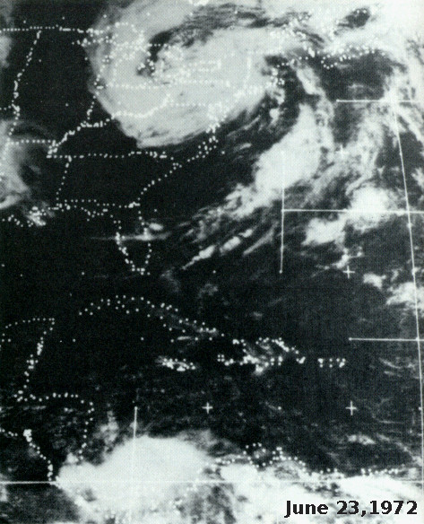 lar front dropped into region from the northwest. As the front approached, a depression formed over the Yucatan on the 14th and moved eastward into the northwest Caribbean Sea. The system strengthened into a tropical storm during the night of the 15th, and a hurricane on the 18th as it moved northward in the Gulf of Mexico. Moving into the Florida panhandle as a hurricane, the system quickly weakened into a tropical depression as it moved through Georgia on the 20th.
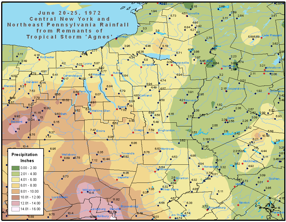
A significant trough in the Westerlies approached Agnes, which led to a second low developing west of Agnes. The two cyclones moved in tandem and strengthened, with Agnes regaining tropical storm strength over North Carolina and moved offshore Norfolk, Virginia. While offshore New Jersey, Agnes became a strong tropical storm again before it swung back inland near the western tip of Long Island, becoming absorbed into the extratropical cyclone over Pennsylvania soon after. It is virtually impossible to determine how much of the rain that fell in the Mid-Atlantic would have fallen had Agnes not existed as a moisture source for the cyclone, but Agnes was likely a major player in the rain event that ensued. The graphics below show the storm total rainfall for both Agnes and the extratropical cyclone to its west, using data provided by the National Climatic Data Center in Asheville, North Carolina."
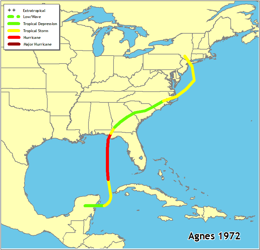 "Hurricane Agnes originated in the Caribbean Sea region in mid-June. Circulation barely reached hurricane intensity for a brief period in the Gulf of Mexico. The storm crossed the Florida Panhandle coastline on June 19, 1972, and followed an unusually extended overland trajectory combining with an extratropical system to bring very heavy rain from the Carolinas northward to New York. This torrential rain followed the abnormally wet May weather in the Middle Atlantic States and set the stage for the subsequent major flooding.The record-breaking floods occurred in the Middle Atlantic States in late June and early July 1972. Many streams in the affected area experienced peak discharges several times the previous maxima of record. Estimated recurrence intervals of peak flows at many gaging stations on major rivers and their tributaries exceeded 100 years. The suspended-sediment concentration and load of most flooded streams were also unusually high. The widespread flooding from this storm caused Agnes to be called the most destructive hurricane in United States history, claiming 117 lives and causing damage estimated at $3.1 billion in 12 States. Damage was particularly highin New York, Pennsylvania, Maryland, and Virginia."
The above text was taken from the report, HURRICANE AGNES RAINFALL AND FLOODS, JUNE-JULY 1972 , By J. F. BAILEY and J. L. PATTERSON, U.S. Geological Survey, and J. L. H. PAULHUS, National Weather Service, National Oceanic and Atmospheric Administration.
|
Rainfall Amounts |
Corning, NY |
Wilkes-Barre, PA |
Elmira, NY |
Forty Fort and Swoyersville, PA |
Additional Information:


 Follow us on YouTube