Nautical charts have always contained a great amount of information – even more so with electronic navigational charts. This information is constantly being updated, necessitating the need to keep your nautical chart suite as current as possible. The Office of Coast Survey’s online NOAA Custom Chart application enables users to create nautical charts directly from the latest official NOAA electronic navigational chart (NOAA ENC®) data. Users now have the ability to create their own nautical charts using individually set parameters, and then save this custom nautical chart as a file that can be viewed or printed.
NOAA Custom Chart is a web-based application that produces a geospatially referenced portable document format (PDF) file which can augment navigation using NOAA ENCs and can also be used as a planning tool or to enhance overall situational awareness. Users are able to select a location and specify the scale and paper size of their custom chart. Display settings are available to portray depths in meters, feet, or fathoms along with changing the color of shallow water based on depth parameters specified by the user. Other display settings include turning depth label contours on or off, an option to display boundaries as plain or symbolized, and displaying or removing the compass rose.
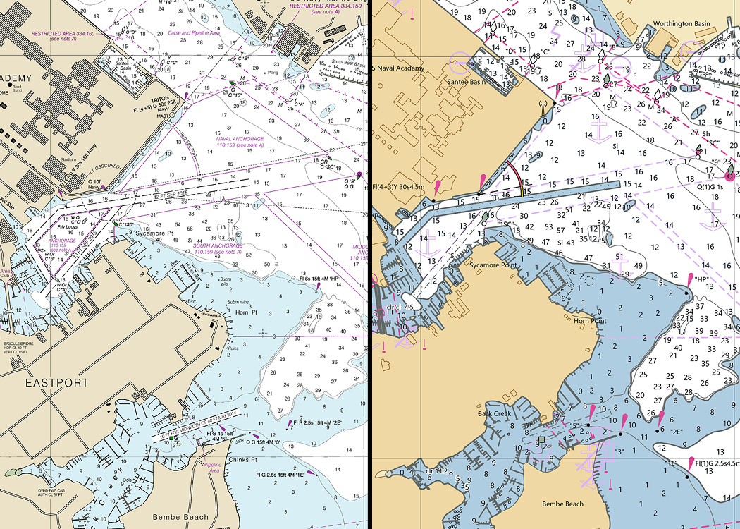
NOAA Custom Charts appear different from traditional paper charts in that some chart symbols may vary slightly, but they have all the latest data found on ENCs. The charts are composed in a standard rectangular format featuring a single chart panel without insets. The data inside the chart panel is presented in a manner similar to traditional paper nautical charts, showing soundings, aids to navigation, compass roses and boundaries. Chart notes, scale and basic information are included below the chart panel. Included in the PDF file are separate pages containing supplemental notes and a zone of confidence diagram, similar to the survey source diagrams seen on traditional nautical charts.
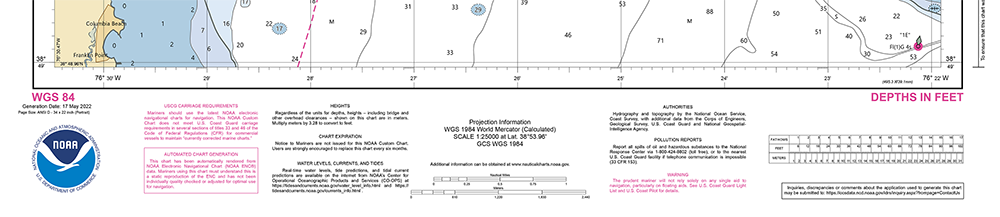
The data portrayed on NOAA Custom Charts is referenced to the World Geodetic System 1984 datum and reference system, and charts are created in the Mercator projection. The best quality output is produced when the custom chart is created at a scale similar to the available ENC data. The scale of an ENC is found in the upper left corner of the red rectangle footprint shown on the locator. If an ENC has a scale set at 1:10,000, the custom chart should be set at the same scale or slightly larger to ensure full coverage. Whenever a custom scale is different from the ENC data scale, there will be undesirable results – either the chart symbols and labels are too dense and difficult to read (using too small of a scale), or reduced positional accuracy of features (using too large of a scale).

NOAA Custom Charts do not have identifying numbers and U.S. Coast Guard Local Notice to Mariners will not be issued for these charts. The Coast Guard will continue to provide information about changes in aids to navigation in the appropriate sections of the Local Notice to Mariners.
Coast Survey’s Weekly Chart Updates website is useful for identifying the location of corrections applied to the ENCs used to create NOAA Custom Charts, and traditional paper charts that have not yet been canceled. These include critical corrections published in a Local Notice to Mariners, as well as routine non-critical corrections that are regularly released by NOAA. These corrections are displayed against a map and can be queried by the user to obtain more information.
NOAA is actively making improvements to the NOAA Custom Chart application and is interested in hearing about users’ experiences and getting suggestions for additional enhancements. You can provide your input through Coast Survey’s online ASSIST customer feedback form.