|
Latest NWS Wilmington, OH Area Weather Briefing (pdf) This briefing is updated for significant weather events. |
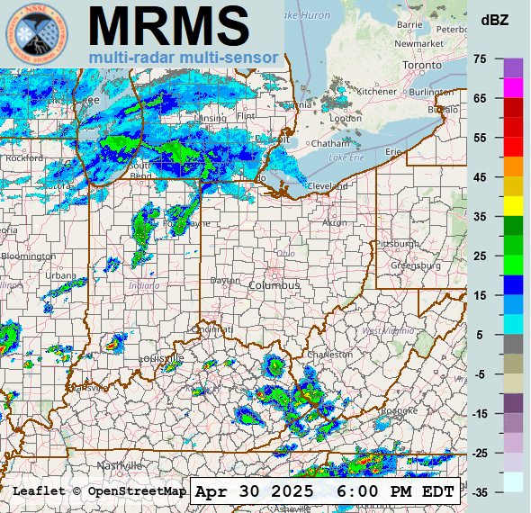
| Live Regional Radar |
 |
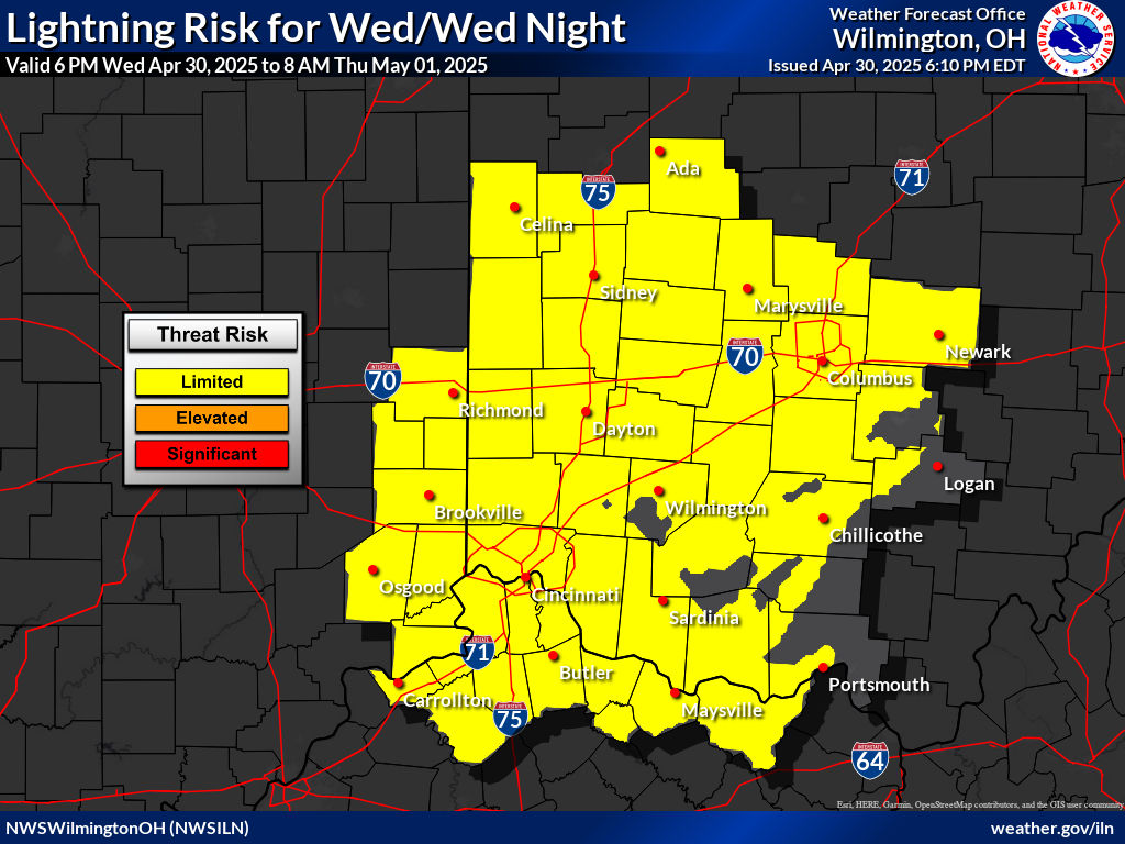
| Local Weather Hazard Outlooks | |
|
|
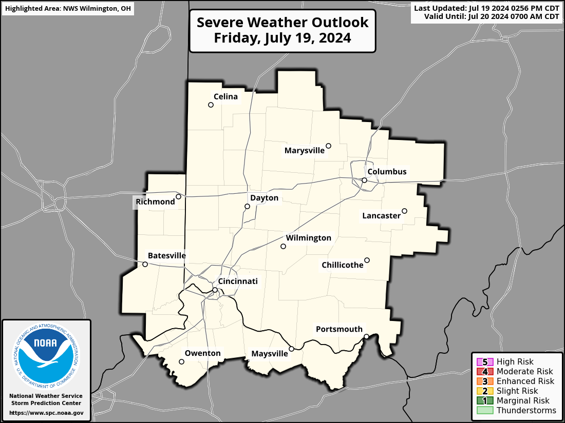
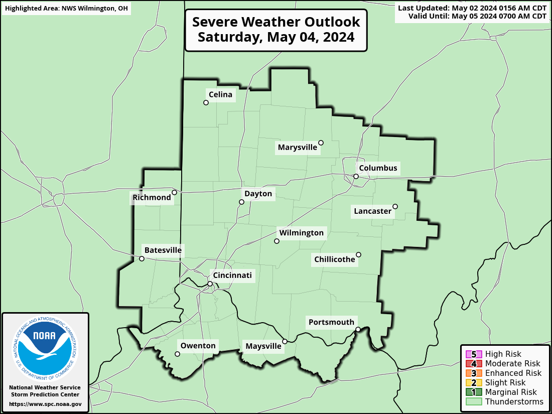
| Day 1 Severe Weather Outlook | |
| Click image to expand. | |
 |
|
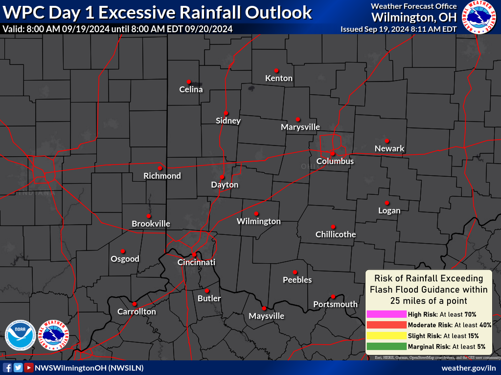
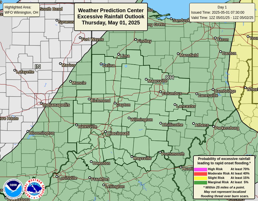
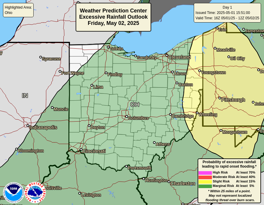
| Day 1 Excessive Rainfall Outlook | |
| Click image to expand. | |
 |
|
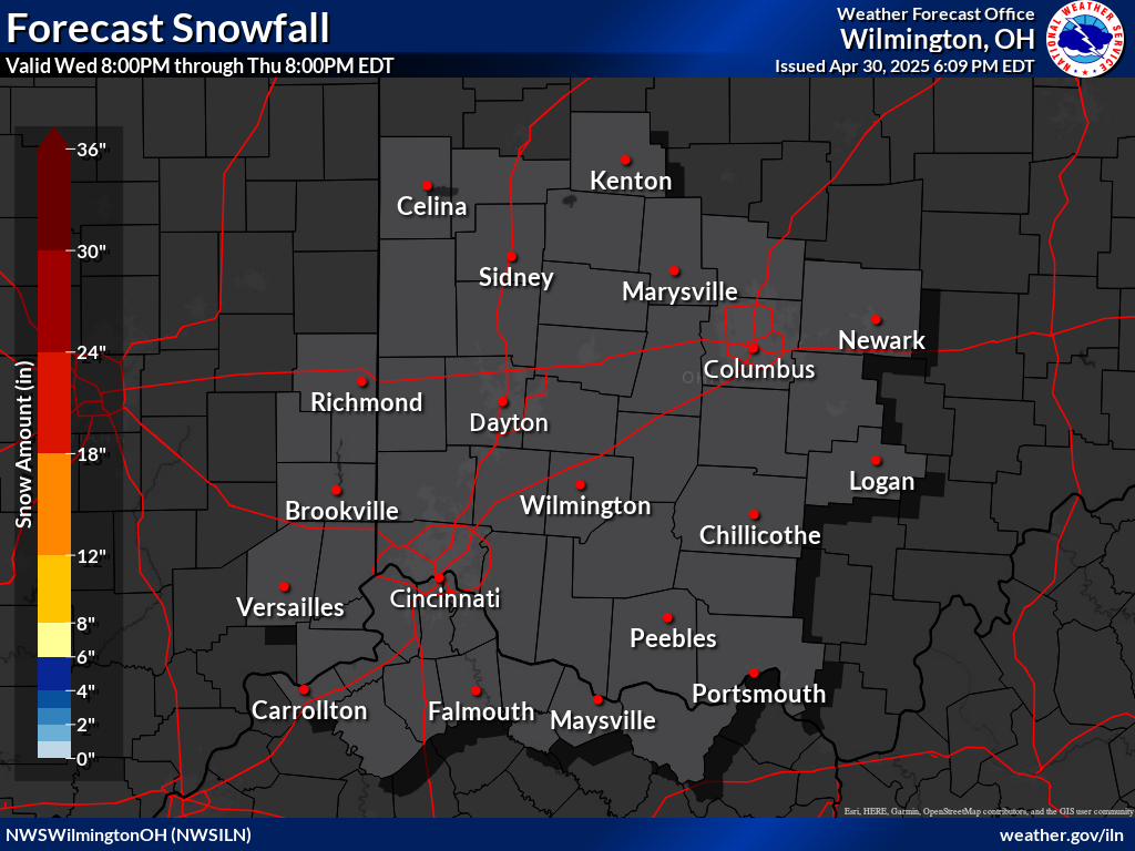
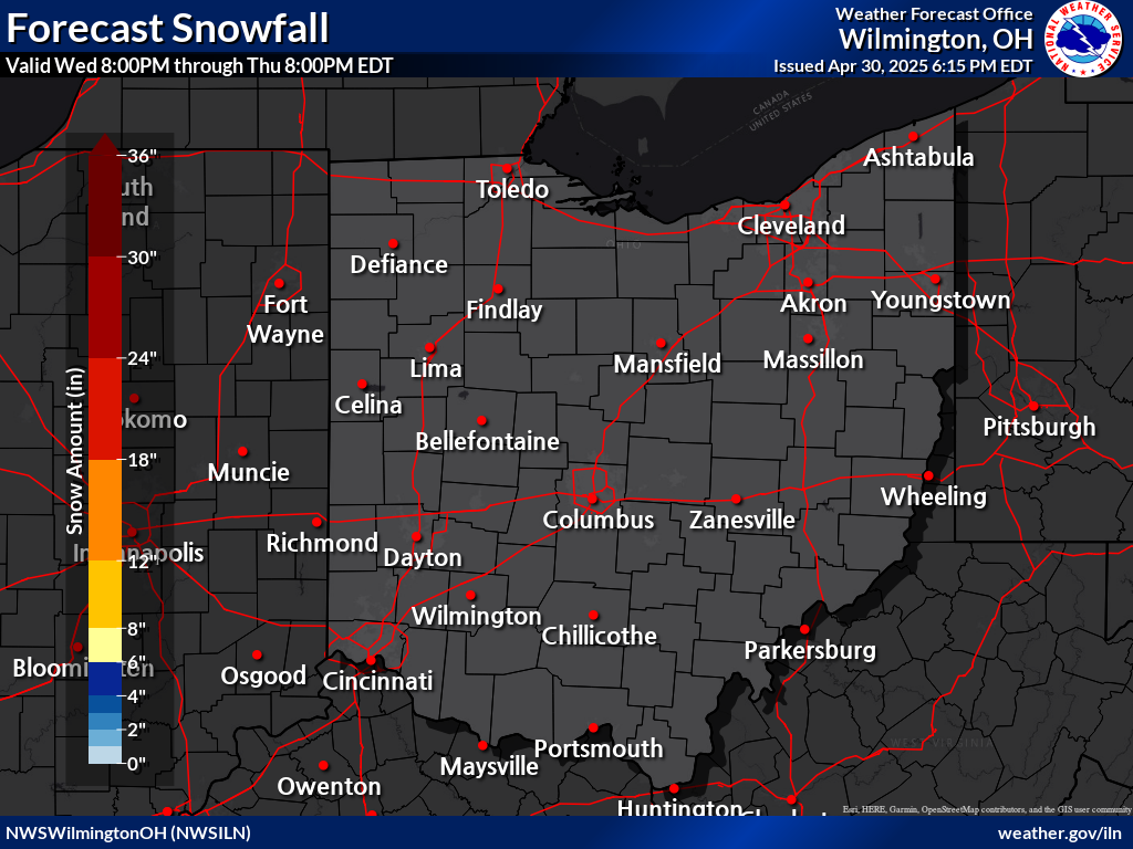
| Snow & Ice Forecasts | |
 |
|
 |
| Current Weather Story | Surface Map Forecast |
 |
 |
| Get additional details in our Area Forecast Discussion... |

 NWS Wilmington, OH Radar Loop |
 Cleveland, OH |
 Pittsburgh, PA |
 Charleston, WV |
 North Webster, IN |
 Indianapolis, IN |
 Louisville, KY |
|
| Click Here for Regional Radar Mosaic | |||
 GeoColor Satellite Image |
 Infrared Satellite Image Infrared Satellite Image |
 Water Vapor Image |
GOES-East Visible |  |
| GOES-East Infrared |  |
|||
| GOES-East Water Vapor |  More Imagery More Imagery |
 United States Surface Analysis |
 United States Surface Analysis with Radar |
 |
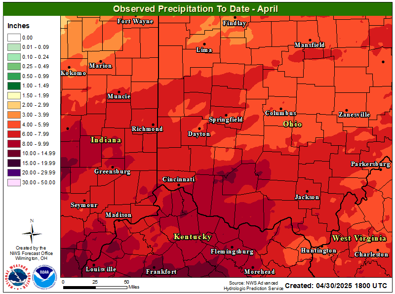 |
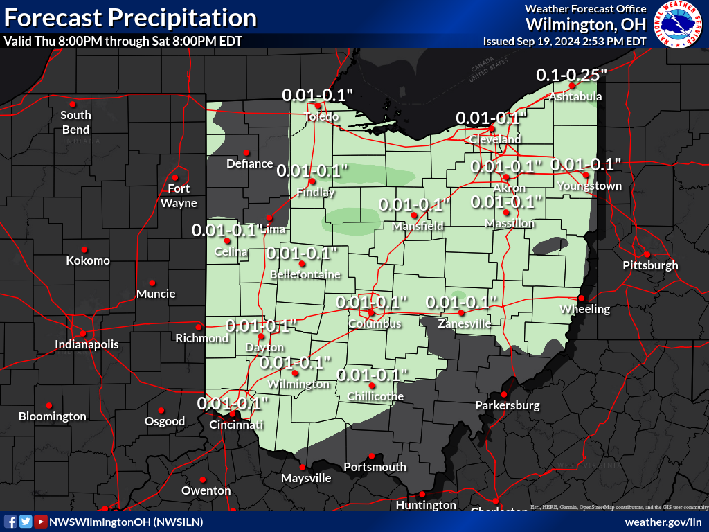
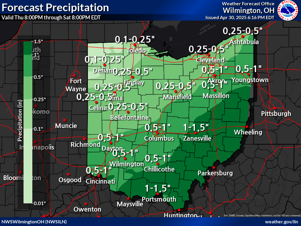
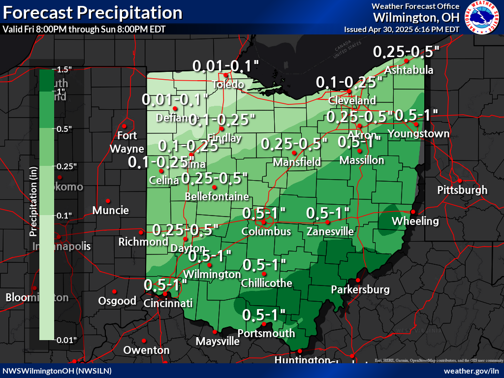
| Days 1-2 | Days 2-3 | Days 3-4 | |||
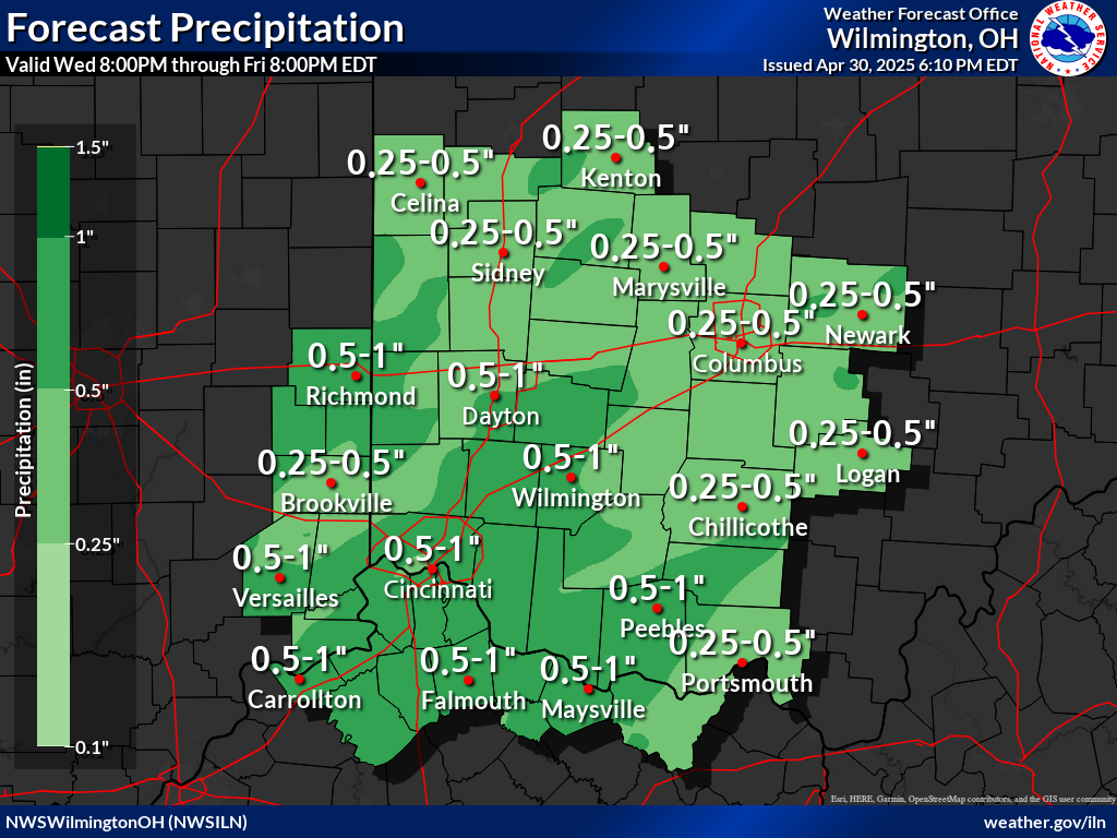 |
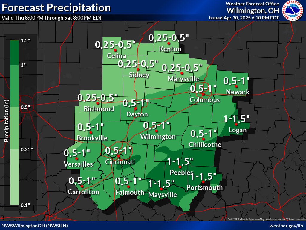 |
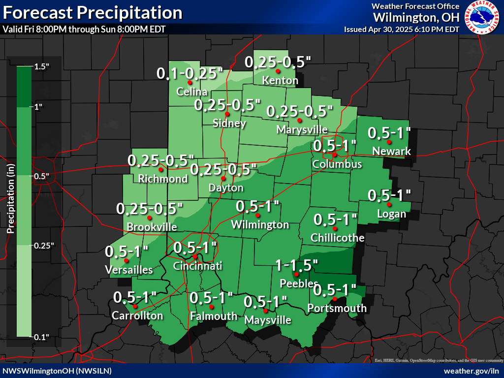 |
|||
| Click Here For Complete Area Forecast Graphics | |||||
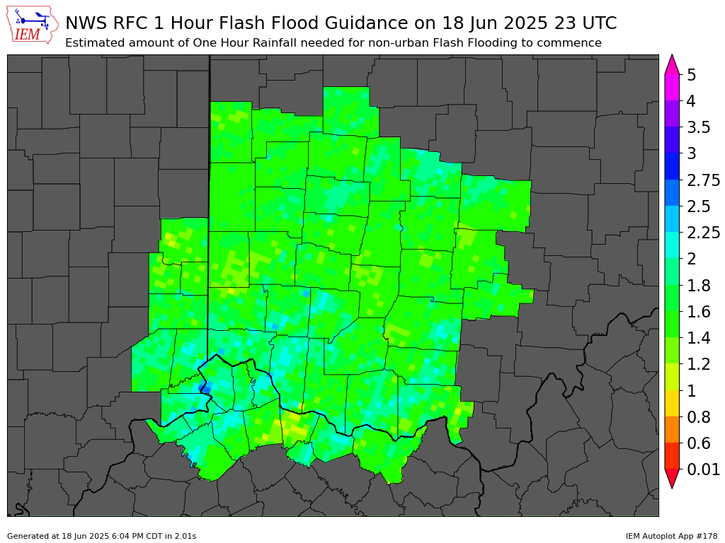
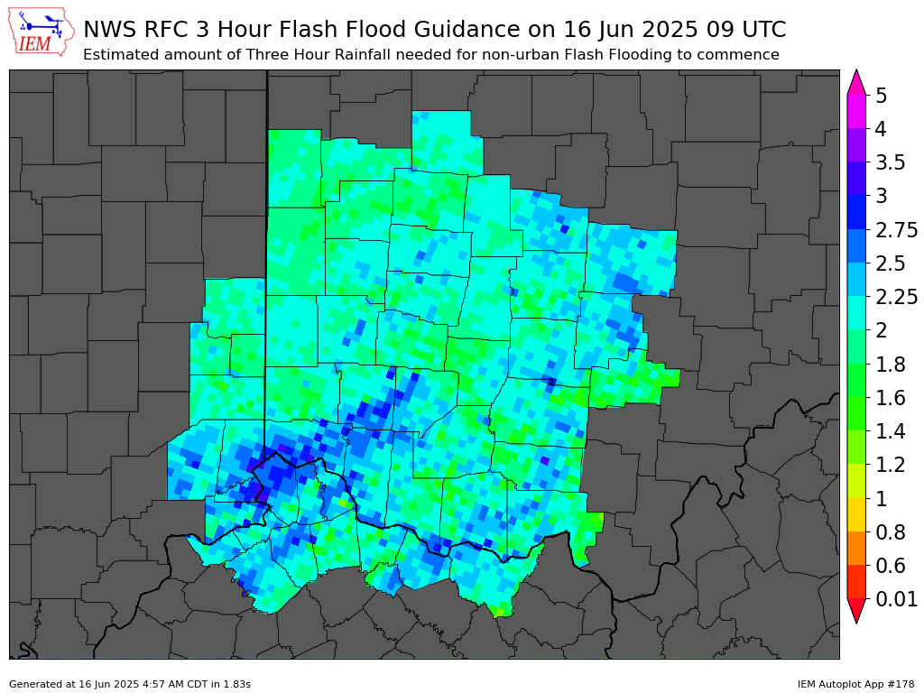
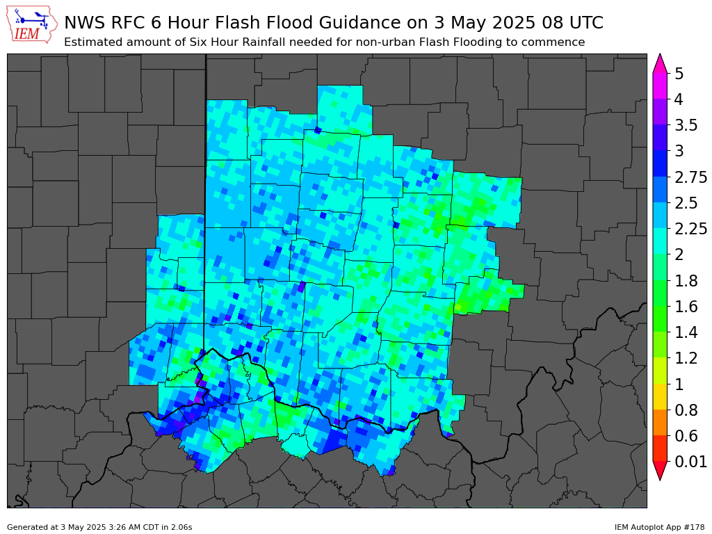
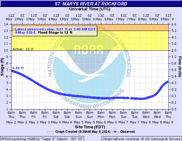
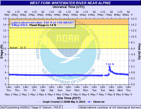
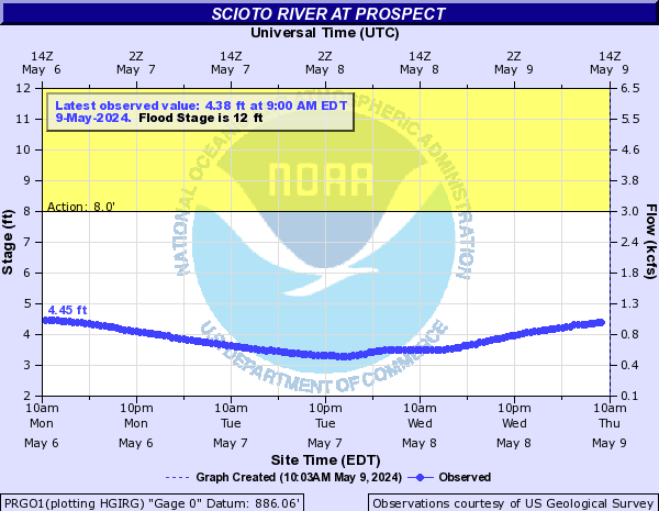
| Flash Flood Guidance |
Flash Flood Guidance (FFG) provides a general indication of the amount of rainfall evenly distributed over various durations (in hours), necessary to cause small streams to overflow their natural banks. During heavy rainfall, accurate interpretation of the guidance consists of the combination of rainfall that has already occurred plus any additional rainfall that can be confidently expected to fall over the same location in the immediate future.
It should be noted that FFG values represent estimates of average soil moisture and stream flow conditions. Flooding may occur with less rainfall than indicated in areas of high rainfall intensities, impervious surfaces, or steep slopes.
| 1 Hour | 3 Hour | 6 Hour |
 |
 |
 |
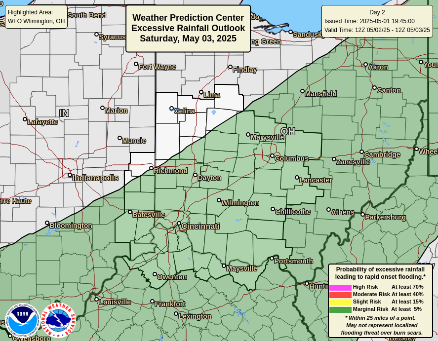
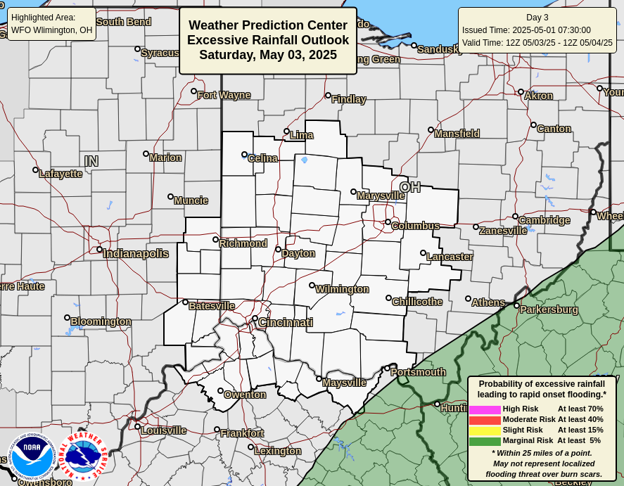
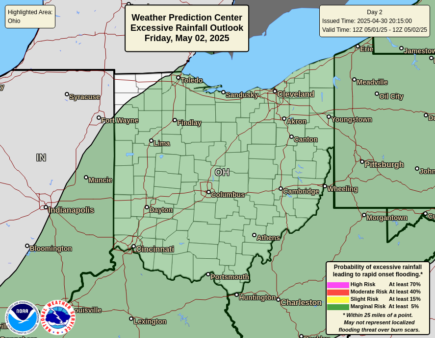
| Day 1 Excessive Rainfall Outlook | Day 2 Excessive Rainfall Outlook | Day 3 Excessive Rainfall Outlook | Middle Atlantic Flood Outlook |
 |
 |
 |
 |
|
|||||||||||||||||||||||||||||||||||||||||||||||||||||||||||||||||||||||||||||||||||||||||||||||||||||||||||||||||||||||||||||||||||||||||||||||||||||||||||||||||||||||||||||||||||||||||||||||||||||||||||||||||||||||||||||||||||||||||||||||||||||||||||||||||||||||||||||||||||||||||||||||||||||||||||||||||||||||||||||||||||||||||||||||||||||||||||||||||||||||||||||||||||||||||||||||||||||||||||||||||||||||||
| Day 1 Severe Weather Outlook | Day 2 Severe Weather Outlook | Day 3 Severe Weather Outlook |
|
 |
 |
| SPC Day 1 Outlook Narrative | SPC Day 2 Outlook Narrative | SPC Day 3 Outlook Narrative |
|
|
||
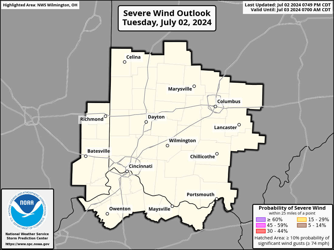
| Day 1 Damaging Wind Outlook | Day 1 Large Hail Outlook | Day 1 Tornado Outlook |
 |
 |
 |
|
|
||
| Day 2 Damaging Wind Outlook | Day 2 Large Hail Outlook | Day 2 Tornado Outlook |
 |
 |
 |
| Day 4 Severe Weather Outlook | Day 5 Severe Weather Outlook | Day 6 Severe Weather Outlook | Day 7 Severe Weather Outlook |
 |
 |
 |
 |
| SPC Days 4-7 Outlook Narrative | |||

National Hazard Probabilities
 |
 |
 |
 |
 |
Today's Storm Reports |
Yesterday's Storm Reports |
| Local Storm Reports Text Products | NWS Cleveland | NWS Pittsburgh | NWS North Webster | NWS Indianapolis | NWS Louisville | |||||||||||||||
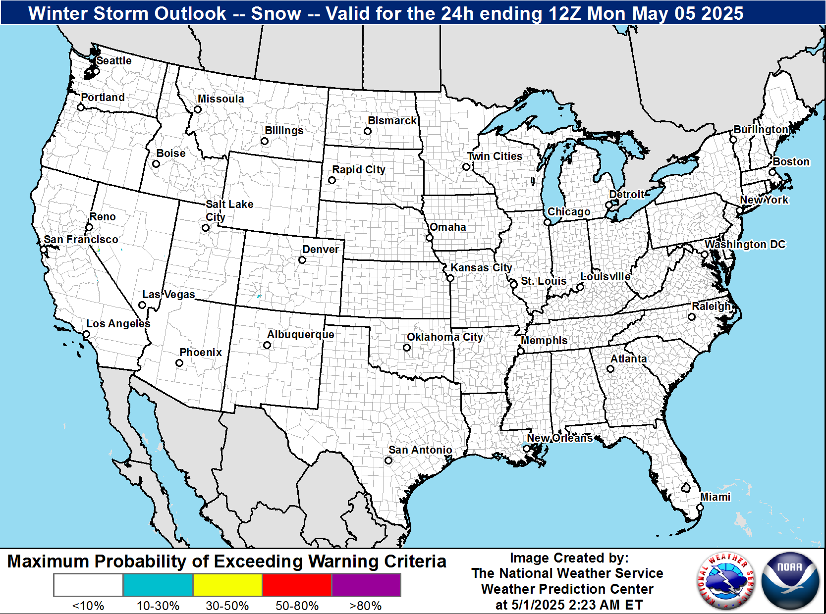
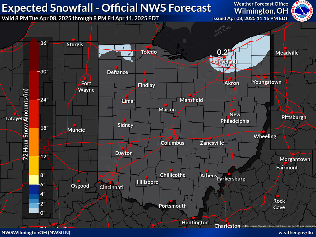
| Today's Snowfall Forecast | Tomorrow's Snowfall Forecast | Day 3 Snowfall Forecast | Day 4 Snowfall Forecast |
 |
 |
 |
 |
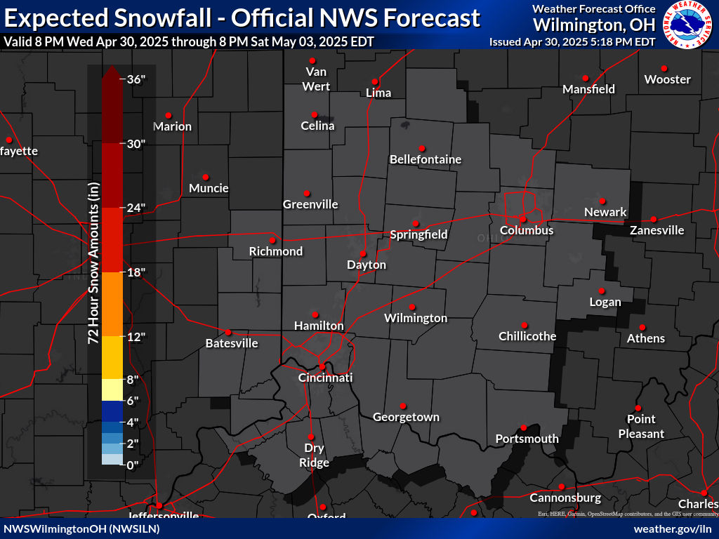
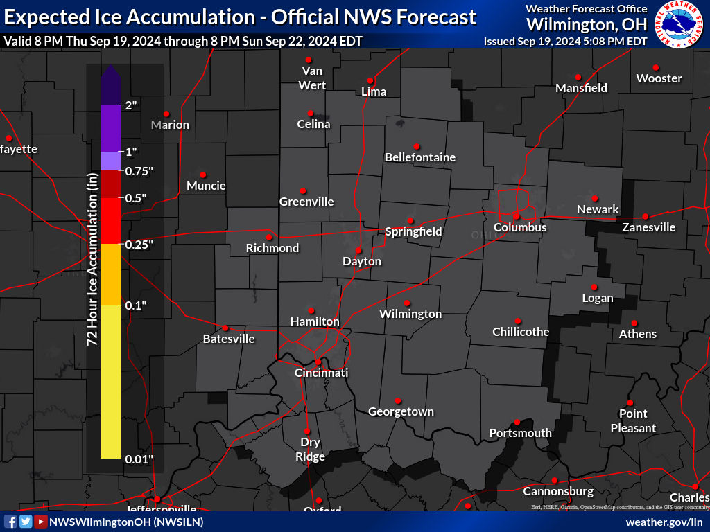
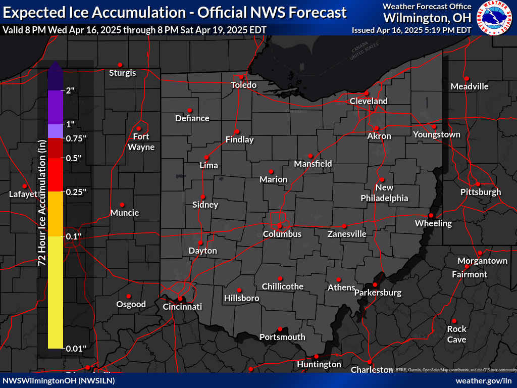
| Storm Total Snowfall Forecast | Storm Total Ice Forecast |
|
|
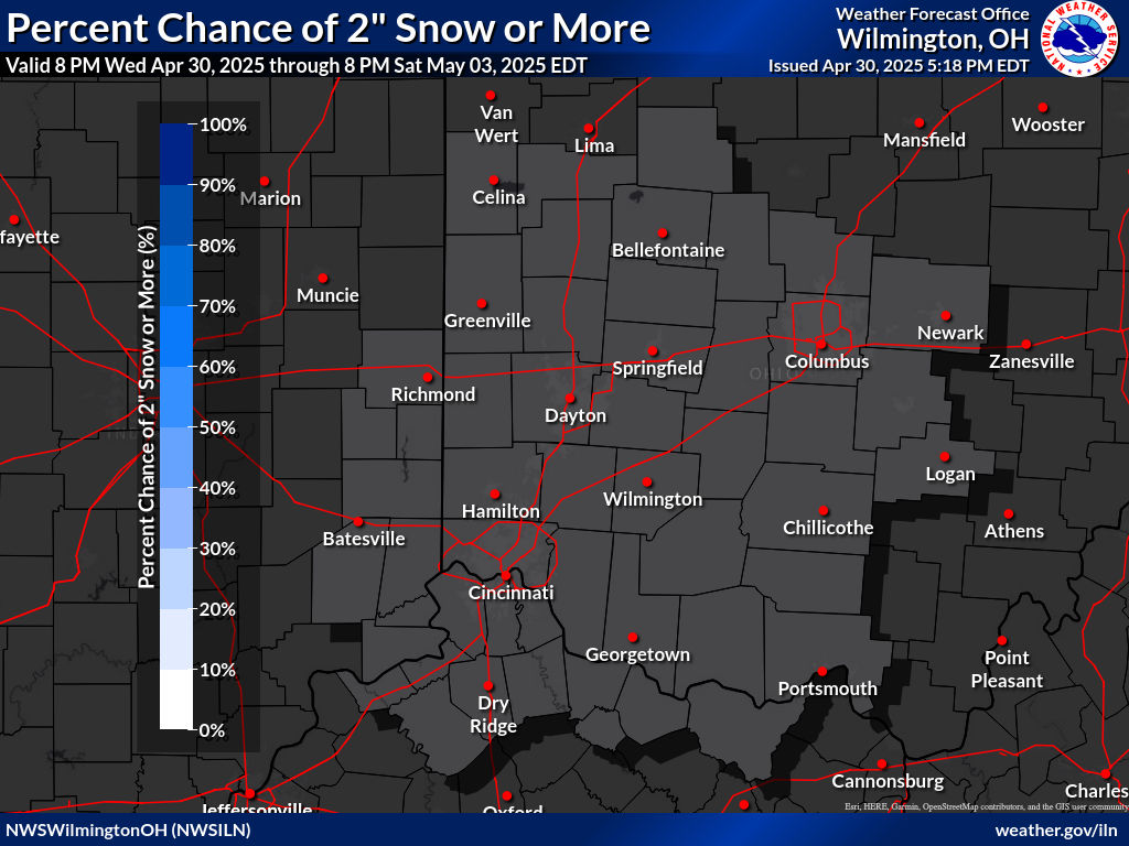
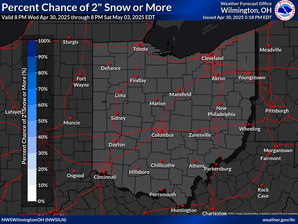
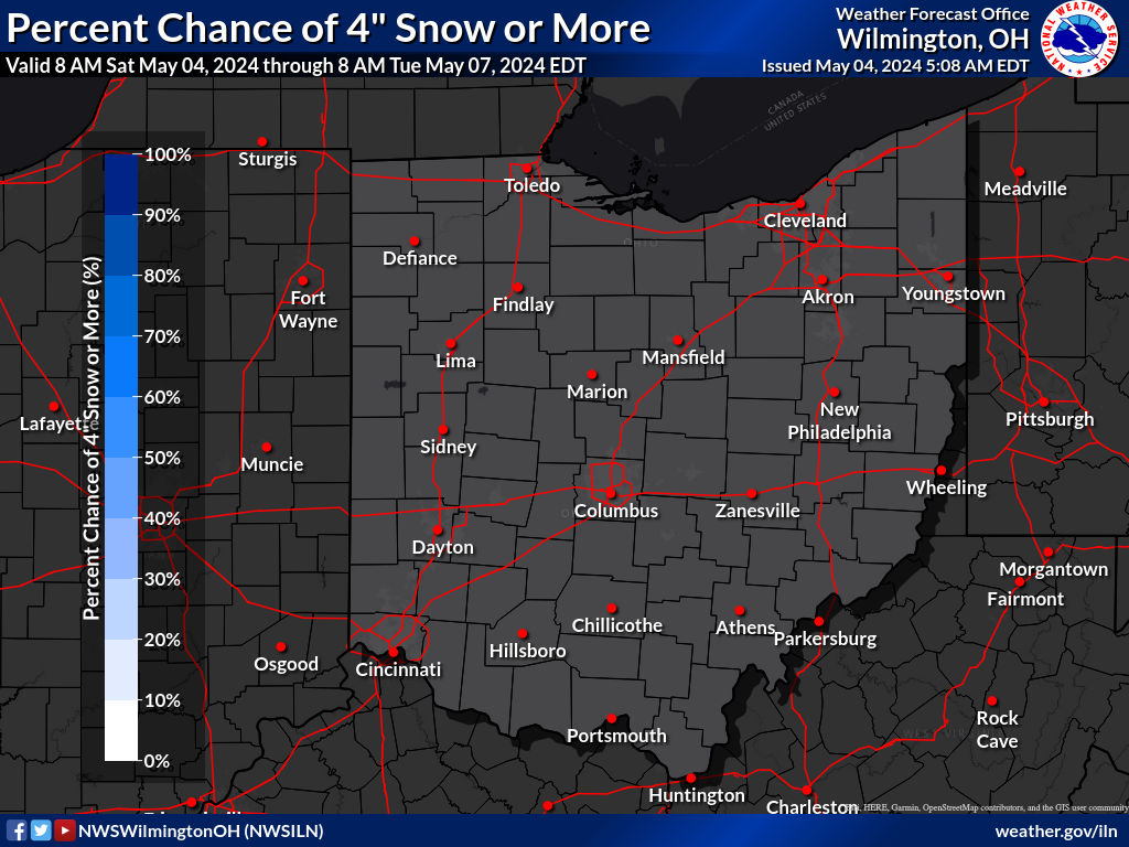
| Probability of Snowfall Of At Least 1" | Probability of Snowfall Of At Least 2" | Probability of Snowfall Of At Least 4" |
 |
 |
 |
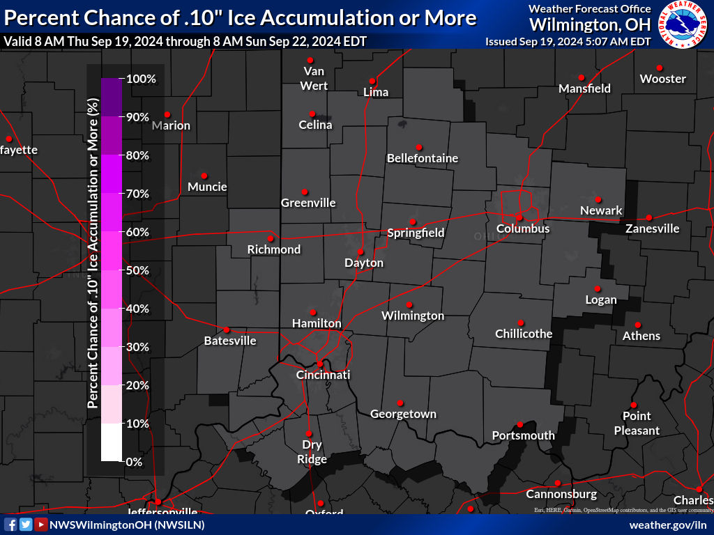
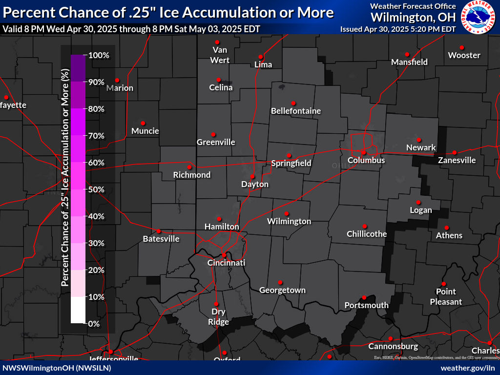
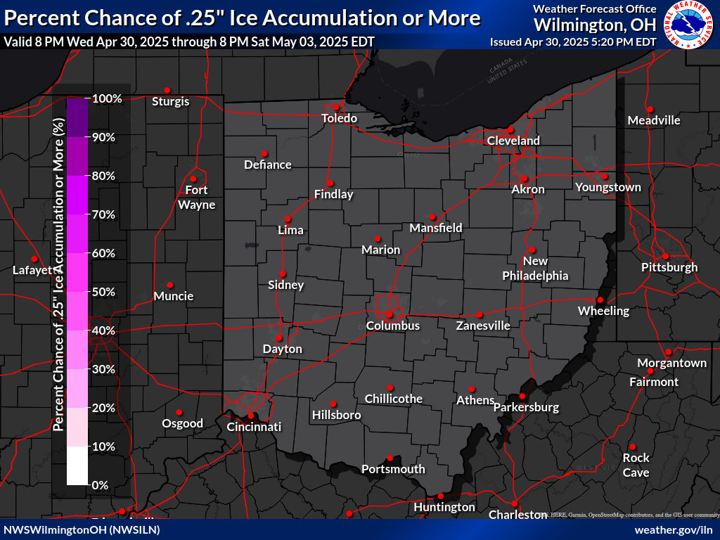
| Probability of Ice Accretion Of At Least 1/10" | Probability of Ice Accretion Of At Least 1/4" | Probability of Ice Accretion Of At Least 1/2" |
 |
 |
 |
| Day 1 Winter Storm Outlook | Day 2 Winter Storm Outlook | Day 3 Winter Storm Outlook | Day 4 Winter Storm Outlook |
 |
 |
 |
 |
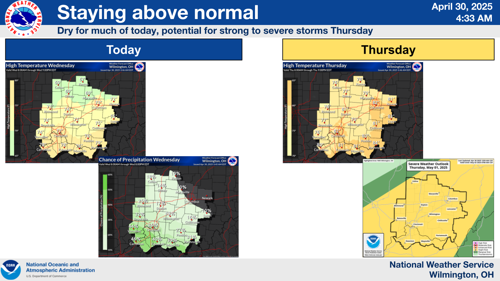
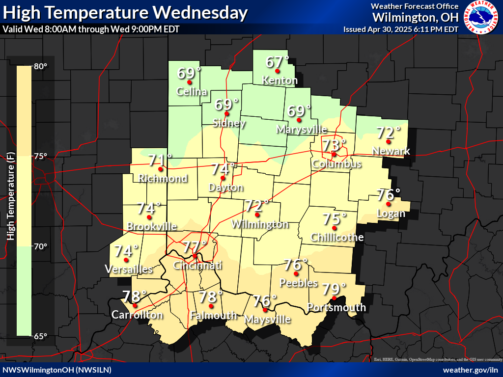
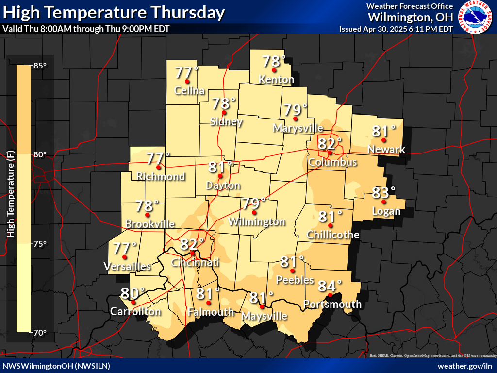
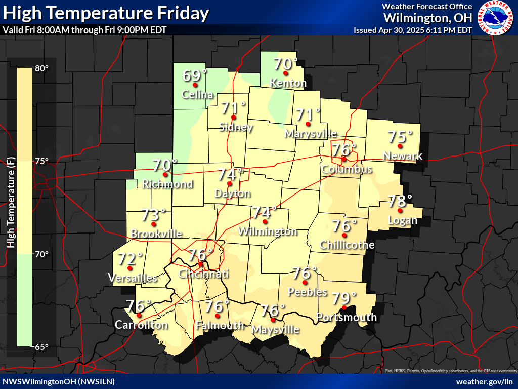
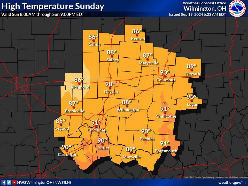
| Today's High Temperatures | Tomorrow's High Temperatures | Day 3 High Temperatures | Day 4 High Temperatures |
 |
 |
 |
 |
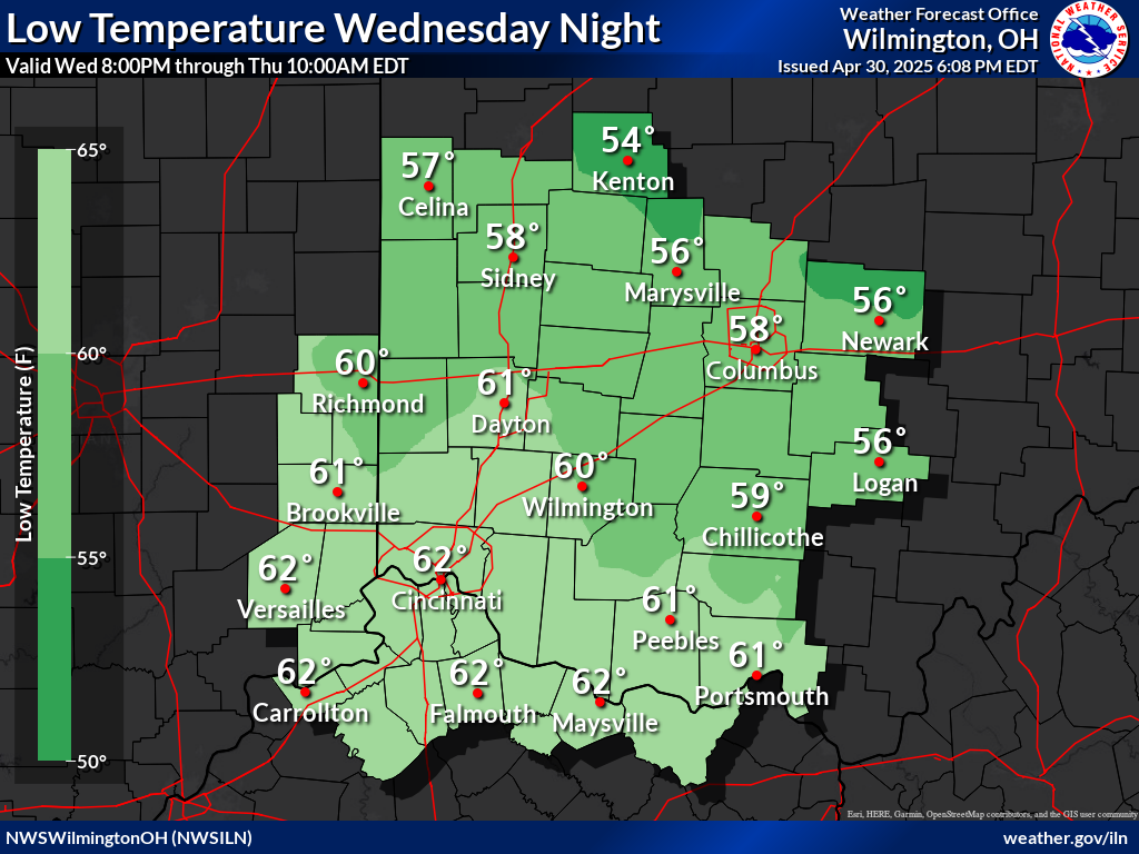
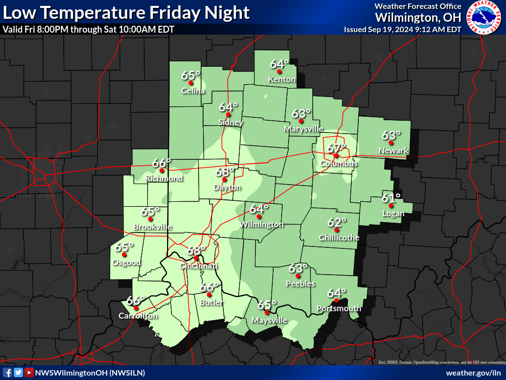
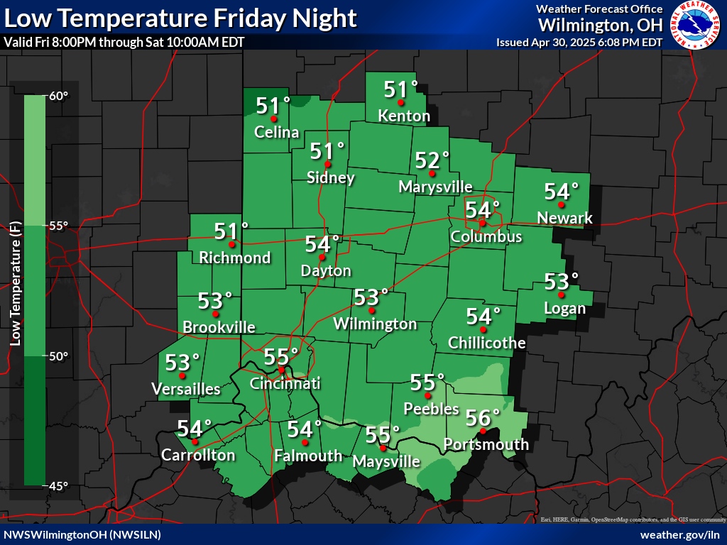
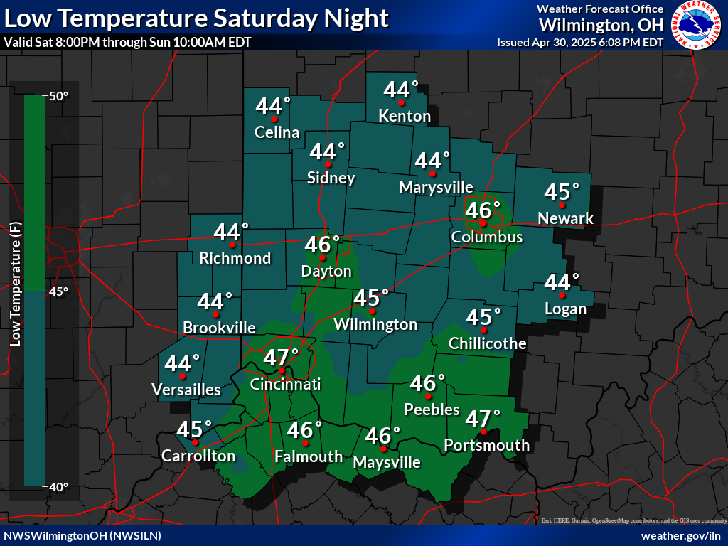
| Today's Low Temperatures | Tomorrow's Low Temperatures | Day 3 Low Temperatures | Day 4 Low Temperatures |
 |
 |
 |
 |
| Click Here For Complete Area Forecast Graphics | |||
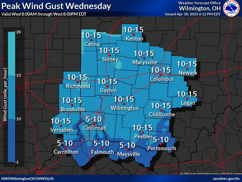
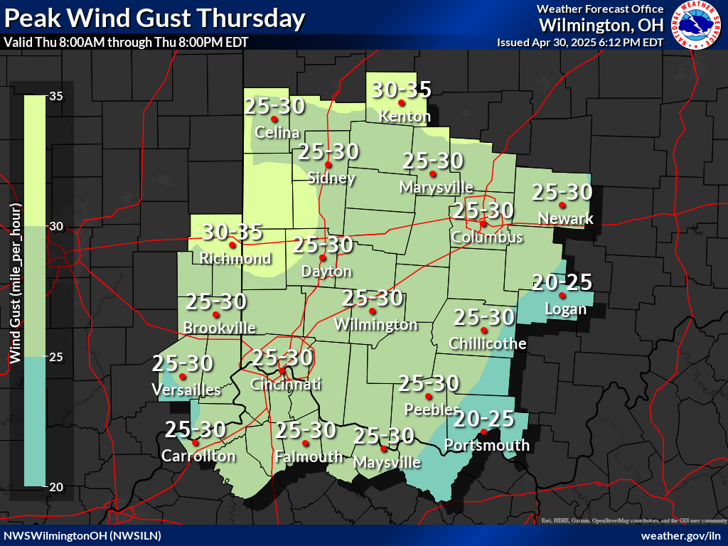
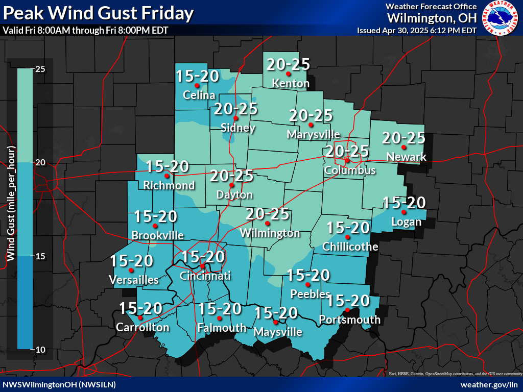
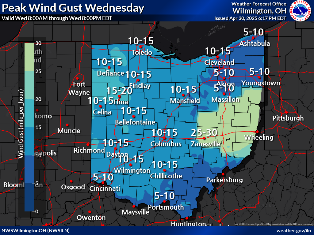
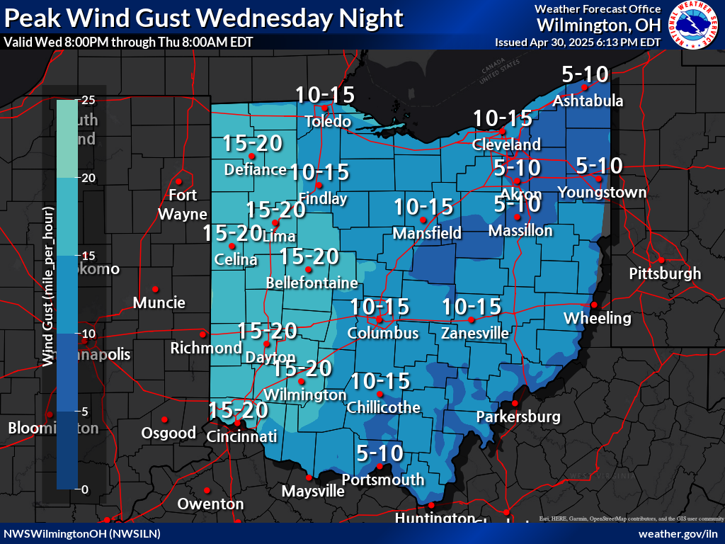
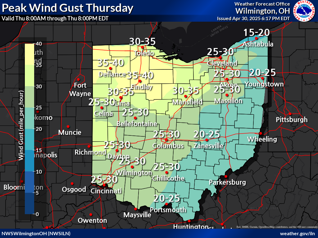
| Today's Maximum Wind Gust | Tomorrow's Maximum Wind Gust | Day 3 Maximum Wind Gust | |
 |
 |
 |
|
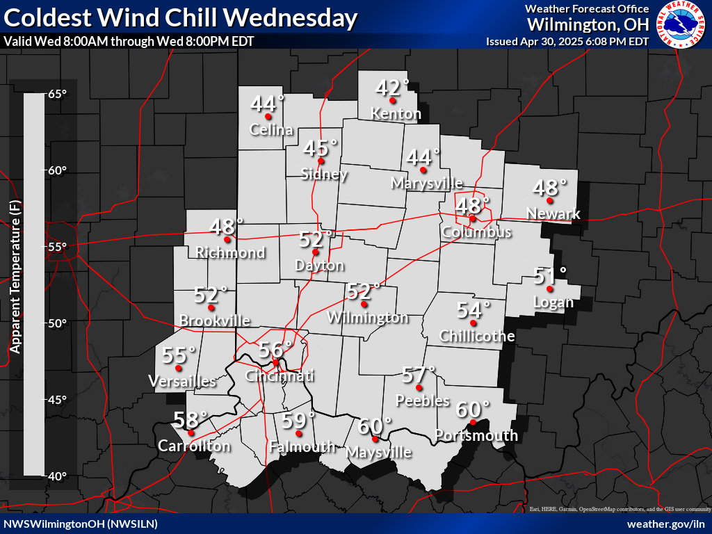
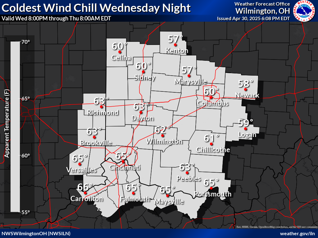
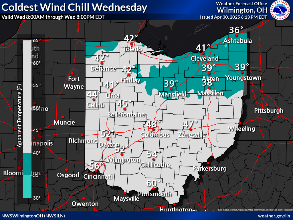
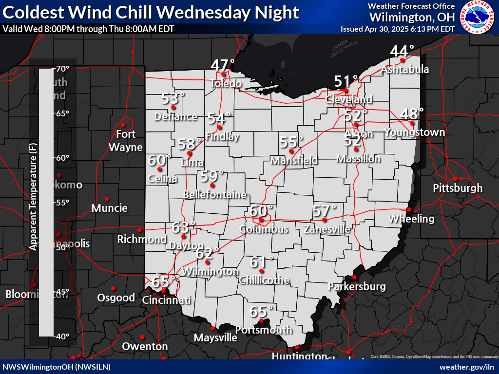
| Today's Minimum Wind Chill | Tonight's Minimum Wind Chill | Tomorrow's Minimum Wind Chill | |
 |
 |
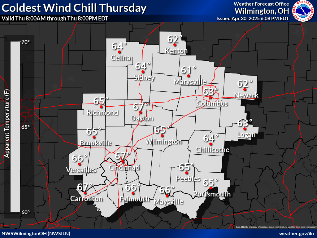 |
|
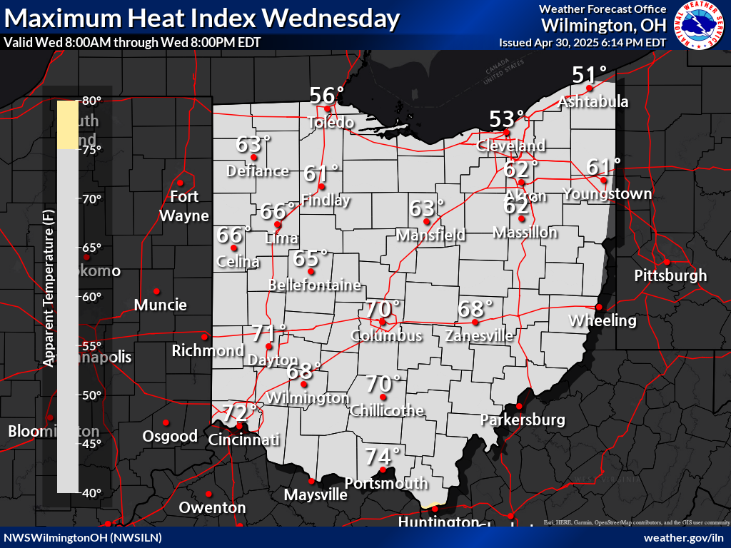
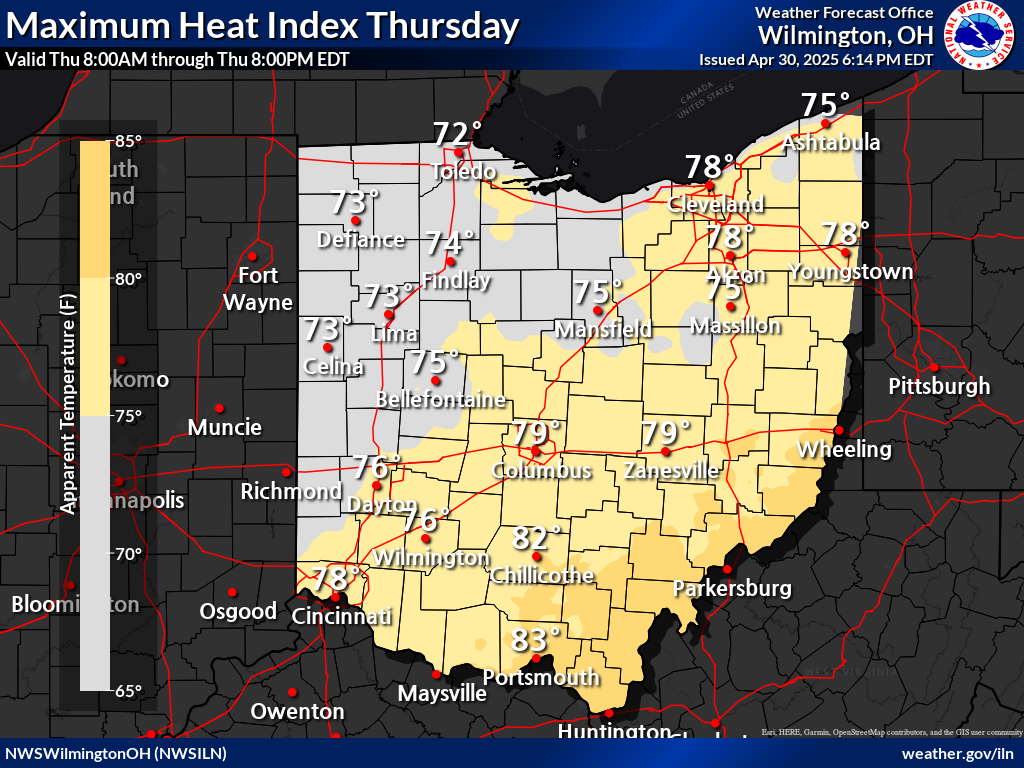
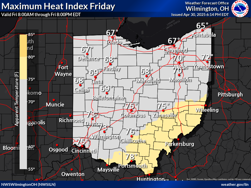
| Today's Maximum Heat Index | Tomorrow's Maximum Heat Index | Day 3 Maximum Heat Index | |
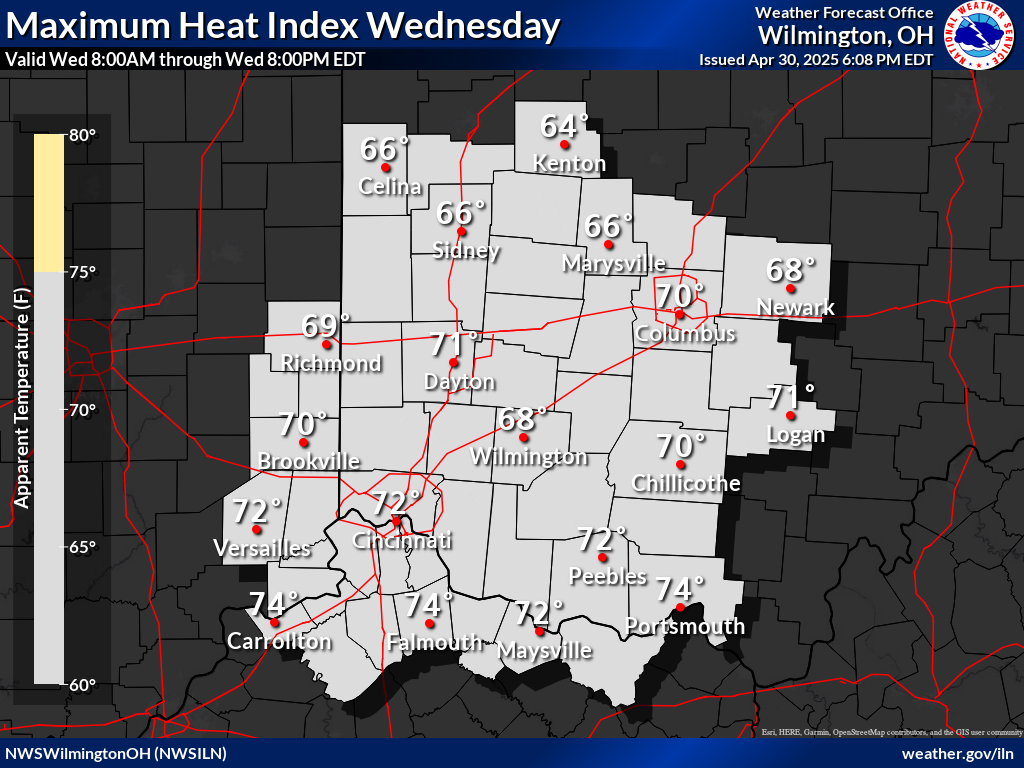 |
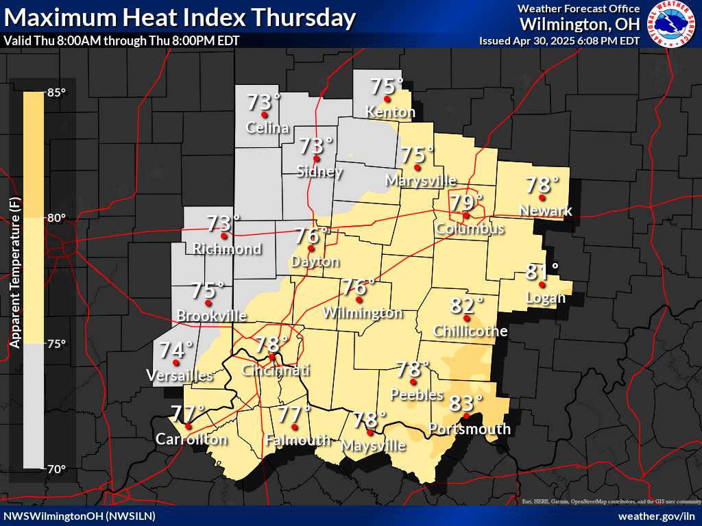 |
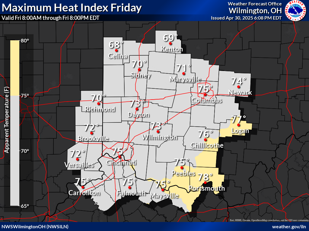 |
|
| Click Here For Complete Area Forecast Graphics | |||
 |
 |
 |
|
 |
| Seasonal Drought Outlook | NICC Significant Fire Potential Outlook |
 |
 |
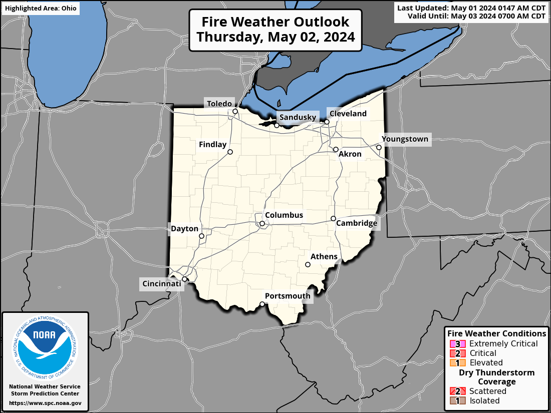
| SPC Fire Weather Day 1 Outlook | SPC Fire Weather Day 2 Outlook | SPC Fire Weather Day 3-8 Outlook |
 |
 |
 |
| Days 3-7 Hazards Outlook (WPC) |
 |
| Days 8-14 Hazards Outlook (CPC) | Days 8-14 Risk of Hazardous Temperatures (CPC) | Days 8-14 Risk of Heavy Precipitation (CPC) |
 |
 |
 |
| 6-10 Day Temperature Outlook (CPC) | 6-10 Day Precipitation Outlook (CPC) |
 |
 |
| 8-14 Day Temperature Outlook (CPC) | 8-14 Day Precipitation Outlook (CPC) |
 |
 |
| **Experimental** Week 3-4 Temperature Outlook (CPC) | **Experimental** Week 3-4 Precipitation Outlook (CPC) |
 |
 |
| One Month Temperature Outlook (CPC) | One Month Precipitation Outlook (CPC) |
 |
 |
| Three Month Temperature Outlook (CPC) | Three Month Precipitation Outlook (CPC) |
 |
 |
|
Latest State of Ohio Weather Briefing (pdf) This briefing is updated for significant weather events. |
| Day 1 Severe Weather Outlook | Day 2 Severe Weather Outlook | Day 3 Severe Weather Outlook |
 |
 |
 |
| SPC Day 1 Outlook Narrative | SPC Day 2 Outlook Narrative | SPC Day 3 Outlook Narrative |
| Day 4 Severe Weather Outlook | Day 5 Severe Weather Outlook | Day 6 Severe Weather Outlook | Day 7 Severe Weather Outlook |
 |
 |
 |
 |
| SPC Extended Range Outlook Narrative | |||
| Day 1 Excessive Rainfall Outlook | Day 2 Excessive Rainfall Outlook | Day 3 Excessive Rainfall Outlook | Ohio Valley Flood Outlook |
 |
 |
 |
|
| Days 1-2 | Days 2-3 | Days 3-4 |
 |
 |
 |
| Storm Total Snow Forecast | Today's Snowfall Forecast | Tomorrow's Snowfall Forecast |
 |
 |
 |
| Storm Total Snowfall Forecast | Storm Total Ice Forecast |
|
 |
| Probability of Snowfall Of At Least 1" | Probability of Snowfall Of At Least 2" | Probability of Snowfall Of At Least 4" |
 |
 |
 |
| Probability of Ice Accretion Of At Least 1/10" | Probability of Ice Accretion Of At Least 1/4" | Probability of Ice Accretion Of At Least 1/2" |
 |
 |
 |
| Today's Maximum Wind Gust | Tonight's Maximum Wind Gust | Tomorrow's Maximum Wind Gust | |
 |
 |
 |
|
| Today's Minimum Wind Chill | Tonight's Minimum Wind Chill | Tomorrow's Minimum Wind Chill | |
 |
 |
 |
|
| Today's Maximum Heat Index | Tomorrow's Maximum Heat Index | Day 3 Maximum Heat Index | |
 |
 |
 |
|
| Click Here For Complete Area Forecast Graphics | |||
| State of Ohio Graphical Hazardous Weather Outlook |
| More Winter Graphics |


 Follow us on YouTube