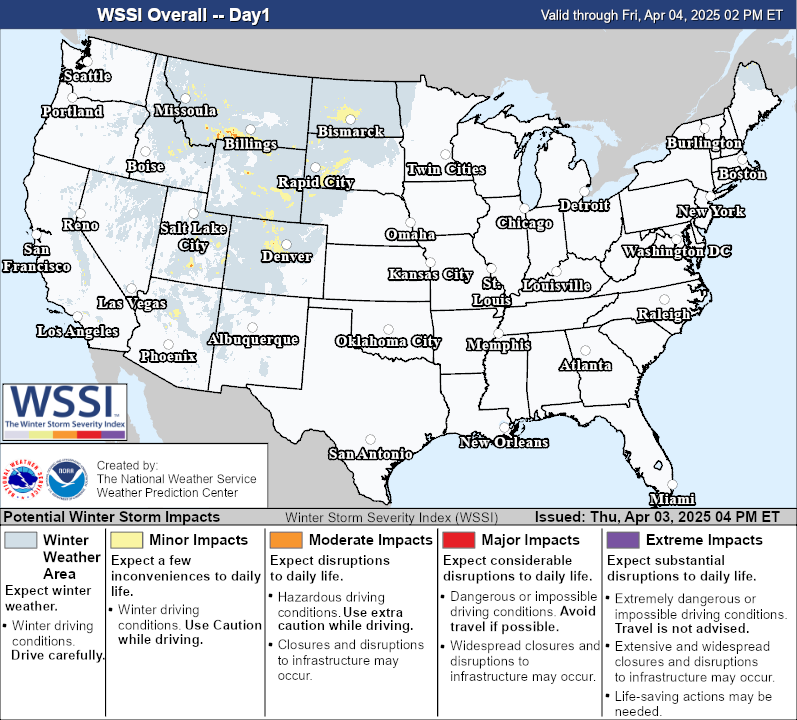
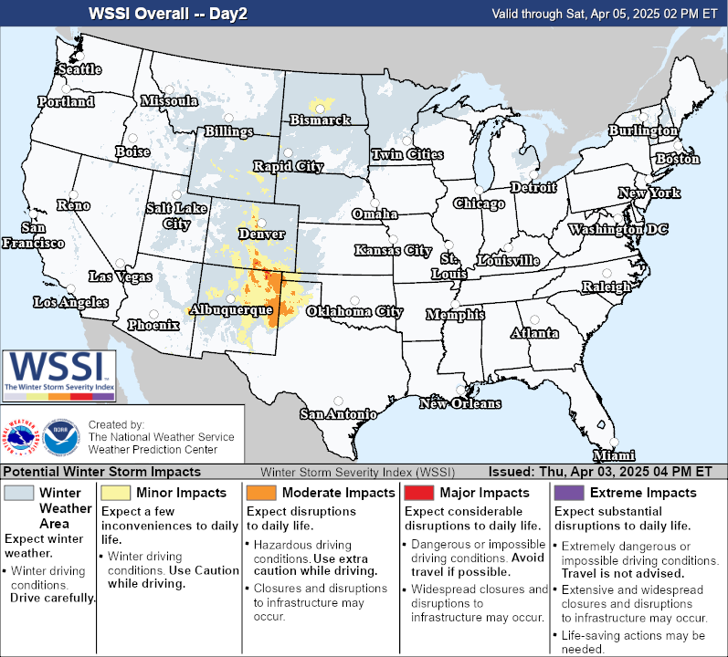
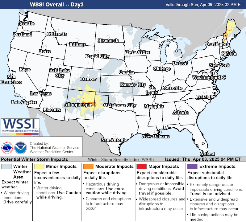
Overall Impact:
Maximum impact from any of the components.
Snow Amount:
Potential impact from snow amount and snow rate.
Snow Load:
Potential impact from the weight of snow on
structures.
Ice Accumulation:
Potential impact from the ice accumulation and
wind.
Flash Freeze:
Potential impact from rapid decreases in temperature
from
above to below freezing with the presence of liquid water.
Blowing Snow:
Potential impact from falling snow combined with
wind.
Ground Blizzard:
Potential impact from snow on the ground
combined
with wind.
Winter Storm Severity Index - Effective From Sat, Mar 08, 2025 11 PM ET Through Tue, Mar 11, 2025 08 PM ET
Last Updated: Saturday March 08, 2025 11:06 PM ET