WHITE CRAPPIE

BLACK CRAPPIE

Crappie are a springtime favorite of Oklahoma anglers. These tasty fish can be caught near shore in great numbers during their spring spawn. Small soft plastic lures, hair jigs and live minnows are essential crappie fishing tackle. March through May is the peak window for bank anglers targeting crappie. Areas with hard bottom, standing timber and brushy cover are ideal habitat.
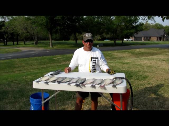
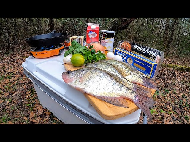
Crappie are tasty table fare. Their flaky white meat is great for fried bites or pan seared for tacos. Bigger fillets can be wrapped in foil with butter, salt and pepper and thrown on the grill or baked in the oven.
Harvest of crappie between 6- and 12-inches is an important tool for a healthy crappie population. Crappie are highly susceptible to stunting when left unchecked, especially in smaller bodies of water. With a liberal daily bag limit of 37 crappie, anglers can have a big impact each year on the future success of their favorite crappie fisheries.
SPECIES PROFILE
- Oklahoma Distribution
Now found statewide in many lakes and rivers, crappie were originally a stream fish in Oklahoma. Both black crappie and white crappie do well in lakes of at least 500 acres. Black crappie prefer clearer water, while white crappie have adapted to inhabit more turbid water. Neither species is suited for farm ponds because they tend to overpopulate these small bodies of water. However, crappie can be found in many ponds throughout the state.
- Description
The most distinguishing characteristic is the marking patterns or spots on the sides of the fish. White crappie, the most prevalent crappie in the state, will have distinct vertical bands of blue/gray spots, whereas black crappie will have only a sporadic, unrecognizable pattern to its black spots. There is also a difference in the number of bony spines in the dorsal fin. White crappie will have 5 to 6, whereas, black crappie will have 7 or 8.
- Habitat
Crappie prefer standing timber and brushy cover in lakes. Spring through fall, crappie can be found in shallow water that has good cover and structure, such as coves, marinas, creek arms and grass flats. During the cold water months, crappie can be found in deeper water adjacent to transition zones (areas of rapid depth change) either on structure or suspended. A schooling fish, crappie will suspend in adjacent open water when there are too many predators near their preferred structure and cover.
- Natural Food Sources
- Minnows
- Shad
- Crayfish
- Mollusks
- Insects
- Spawning
Spawning habits of white crappie are similar to other sunfishes except they usually nest in deeper water. Black crappie constructs their nests and deposits their eggs at even greater depths than white crappie. Females of both species deposit from 3,000 to 15,000 eggs. Spawning occurs in water temperatures 55°F to 65°F. After spawning, males guard the eggs and fry. Crappie prefer hard bottom to spawn, such as logs, rock and gravel.
- Fish Facts
Crappie are a favorite winter fish in Oklahoma. They form loose schools and often when you find a school, others can be located close by. Crappie can be caught year-round and its sweet meat makes exquisite table fare. The average crappie caught in Oklahoma weighs between a half and one and a half pounds. Crappie are a staple food source for saugeye.
FISHING TIPS
Before the spawn, when water temperatures are between 45˚F and 55˚F, crappie will begin moving from their wintering habitat to transition areas (areas of rapid depth change) near their desired spawning area.
For bank anglers, reachable transition areas for casting typically include fishing jetties, long points with coves or shallow bays on either side or the dam. Covered fishing docks and marinas can also provide bank anglers access to transition areas.
For boat anglers, locating pre-spawn fish is best done with electronic fish finding equipment. To get the electronics in the right search areas on unfamiliar water, it's fastest to locate prime spawning habitat first and slowly follow the channel ledge (transition break) toward open water until fish are found. Look for structure features near drop-offs such as brush or rock piles.
During the pre-spawn period, live minnows, hair jigs and soft plastic lures like baby shad fished around transition areas near spawning habitat is an effective way to catch fish.
When crappie get close to spawning, they will begin to feed heavily offering some of the best crappie fishing of the year for both bank and boat anglers. Finding warmer water in relation to the rest of the water body is key. Baitfish and other forage will key in on these areas and crappie will follow. As daytime temperatures warm from March into April, look for several days of south winds and find coves, points or dams on the north side of the water body to target. On a relatively clear body of water, transition areas and the shallows surrounding it that have stained water will be warmer than the rest of the water body.
Crappie prefer hard bottom to spawn. Shallow areas with rocky outcroppings, gravel or hardwood logs typically offer the best bank fishing opportunities in April and May. Areas around boat ramps and old road beds are also hot spots.
Naturally colored tubes, swimbaits, curly tail grubs, hair jigs and inline spinners or a live minnow are all good options for targeting crappie when the spawning cycle begins.
Bobber jigging a baby shad, small hair jig or live minnow is an easy and effective way to stay in the strike zone longer. Crappie can be lazy biters. The longer the bait can stay in front of and above the fish the better. Use a stick bobber for this presentation as crappie rarely submerge the bobber due to their tendency to bite upward and suspend. Instead, the bobber will fall flat on the water indicating to set the hook. This is a great technique for crappie anglers of all skill levels. Type "bobber jigging for crappie" into the YouTube search bar for different video how-tos on presentation, baits and rigging techniques.
Depth control is very important in crappie fishing, especially in water deeper than 4 feet. Crappie eyes sit on the top of their head. They prefer to attack prey from below and behind, so keeping your lure or bait in front of and above a crappie will lead to better bite action.
When crappie are suspended in deeper water, a slip float is the most effective way to target them from the bank. Type "how to slip bobber for crappie" into the YouTube search bar for different video how-tos on presentation, baits and rigging techniques.
Casting and retrieving artificial lures will catch fish, but is typically less productive than using a bobber during the pre-spawn and spawning cycle.
During the post-spawn and summer period, lipless crankbaits, diving crankbaits and jerkbaits can be effective for open water schools or over vegetated flats.
A small lipless crankbait with a silver body and black back is an excellent multi-species cast and retrieve lure for rivers and reservoirs.
Chartreuse is a universally tried and true color for crappie, especially in dingy water. Whites, silvers, blues, greens, oranges, reds and pinks are also effective color choices depending on the body of water.
A live minnow on a 1/8th or 1/4th ounce jig-head is great for dock fishing. Simply let line off your reel until your bait reaches the bottom then reel up a couple feet at a time, leaving the bait still for a minute in between, until you find the depth where crappie are actively feeding. Other weighted or bobber setups are also effective.
STATEWIDE LAKE BRUSH PILES MAP
Female crappie get in and out after dropping eggs on the nest and retreat back to transition areas to rest and feed.
Male crappie provide the parental care to the eggs and fry. They don’t actively “feed” during this time, but they defend which creates prolonged bite action in shallow water.
This is the time to fish small brightly colored lures (pinks, oranges and neon colors) in the areas immediately surrounding the spawning habitat.
Male crappie are not intentionally trying to consume baits while protecting the eggs or fry, but rather injure or warn the intruder, so you have to be quick on the hook set. Try to get your hook point as close to the back of your bait as possible without compromising its swimming action. You can cut a quarter-inch off the front of a soft plastic bait before affixing it to your hook to achieve this or use a small inline spinner like a Rooster Tail that has the hook affixed to the back of the bait. It’s important to keep slack out of your line so you’re in constant contact with the bait.
Once the spawning process has concluded and males have left the fry, go back to targeting the transition areas that have the most cover and bottom structure and use presentations from the pre-spawn period.
During the late spring, summer and fall, target transition areas in the morning and follow the fish toward shallow, shaded cover as the day progresses. Crappie will retreat in schools to suspend in deeper water overnight in order to avoid predation from nocturnal shallow feeders such as walleye/saugeye, catfish and bass.
VIDEO HOW-TO TIPS FROM THE PROS
WRITTEN HOW-TO TIPS FROM THE PROS
- Bank Fishing Top Tip
In smaller bodies of water where transition areas can be reached from the shoreline, year-round crappie fishing can be productive with a slip float presentation. However, fishing is at its best in easily accessible shallow water from late March through early May.
The best fishing will occur during periods of sustained warm air temperatures, particularly overnight lows above 50°F, and stable water levels. The north ends of lakes will warm earlier in the spring. Target coves with good spawning habitat on the north side of the water body, especially when winds have been out of the south for several days.
- Boat Fishing Top Tip
Utilize fish finding electronics to locate schooling and suspended fish year-round. Once fish have been marked you can utilize a 9' to 12' rod to vertically present your bait or lure to fish without parking the boat directly on top of them. You can also cast to the them with a slip float presentation or cast and retrieve.


Habitat to Target
- Woody structure - standing timber, tree lay-downs and brush piles will hold fish all day long.
- Rocks - large rocks, rocky outcroppings, dam/fishing jetty riprap and gravel beds with vegetated cover create prime ambush spots and also funnel food.
- Open Water - areas adjacent to transition zones, such as the middle of coves, creek/river mouths or wind blown sides of points will hold suspended fish when too many predators are on transition structure.
Rod/Reel Setup
- Light to Medium rod
- Spinning, spincasting or baitcasting reel
- 4-pound to 8-pound test line
Top Lures
- Tube
1.5" to 3" tube in shades of green, blue, chartreuse, white or orange
- Editor's pick: 2" Bobby Garland Slab Slay'R in Bluegrass, Gumdrop or Electric Chicken paired with a 1/16th ounce Crappie Pro Overbite Sickle Jig Head
Image
- Curly Tail Grub
2" to 3" curly tail grub in shades of white or chartreuse
- Editor's pick: 2.5" Bobby Garland Stroll'R in Gumdrop, Electric Chicken or Monkey Milk paired with a 1/8th ounce Crappie Pro Mo' Glo Jig Head
Image
- Inline Spinner
1/24th ounce to 1/8th ounce inline spinner in shades of white, chartreuse, pink or orange
- Editor's pick: 1/16th ounce Worden's Original Rooster Tail in Hammered Brass Chartreuse
Image
- Hair Jig
1.5" to 3" hair jig or marabou jig in shades of white or chartreuse
- Editor's pick: 2" 1/8th ounce Lindy Fuzz-E-Grub in Chartreuse Shad
Image
- Swimbait
1" to 3" swimbait in shades of white, chartreuse, blue, pink or orange
- Editor's pick: 1.25” Bobby Garland Itty Bit Swim'R in Screamer, Monkey Milk, Outlaw Special or Electric Chicken paired with a 1/16th ounce Itty Bit Jig Head
Image
- Editor's pick: 2.25” Bobby Garland Slab Hunt'R in Monkey Milk, Bluegrass or Electric Chicken paired with a 1/16th ounce chartreuse Crappie Pro Mo' Glo Jig Head
Image
- Baby Shad
1.5" to 3" baby shad in shades of white, chartreuse, blue or orange
- Editor's pick: 2" Bobby Garland Baby Shad in Screamer, Monkey Milk, Outlaw Special or Electric Chicken paired with a 1/16th ounce chartreuse Crappie Pro Mo' Glo Jig Head
Image
- Creature / Crayfish / Insect
1.5" to 3" creature, crayfish or insect in shades of white, silver, chartreuse, blue, pink or red
- Editor's pick: 2.25" Bobby Garland Mayfly in Bluegrass, Electric Chicken or Mayfly paired with a 1/16th ounce chartreuse Crappie Pro Mo' Glo Jig Head
Image
- Diving Crankbait
2" to 3" crankbait in shades of white, silver or chartreuse
- Editor's pick: Bandit Series 100 in Chartreuse Rootbeer
Image
- Lipless Crankbait
2" to 3" lipless crankbait in shades of white, silver or chartreuse
- Editor's pick: 2-1/2" Cotton Cordell Super Spot in Chrome/Black
Image
- Jerkbait
1.5" to 3" jerkbait in shades of white, silver or chartreuse
- Editor's pick: 1-5/8" Rebel Value Series Minnow in F49 Silver Black or Silver Blue
Image
- Kits
Panfish kits offer great options for anglers of all skill levels
- Editor's pick: Bobby Garland Take Me Too Kit
Image
- Editor's pick: Bobby Garland Deluxe Premium Kit
Image
- Scents
Fish scent additives are a quick and easy way to bring extra life to your lure
- Editor's pick: Bobby Garland Mo' Glo Slab Jam
Image
Common Crappie Brands
- Bobby Garland - Follow on Facebook and Youtube (Bobby Garland Crappie & Bobby Garland Crappie TV) for special offers, fishing tips and latest innovations
- Top Lure: Baby Shad
- Top Colors: Blue Grass, Electric Chicken, Monkey Milk
- Pair with a 1/16th or 1/8th ounce jig head
- Top Jig Head: 1/16th ounce Crappie Pro Mo' Glo
- Pair with a 1/16th or 1/8th ounce jig head
- Johnson
- Top Lure: 1/16th ounce Original Beetle Spin
- Top Colors: Black Chartreuse Orange, Fluorescent Chartreuse, Black Chartreuse
- Strike King
- Top Lure: Mr. Crappie Sausage Head Jig
- Top Colors: Monkey Shine, Tuxedo Black-Chartreuse, Pink Tuxedo
- Kalin's
- Top Lure: Triple Threat 2" Grub
- Top Colors: Chartreuse Shad, Junebug Chartreuse, Blue and Silver
- Pair with a 1/16th or 1/8th ounce jig head
- Top Jig Head: 1/16th ounce Eagle Claw Round
- Pair with a 1/16th or 1/8th ounce jig head
- Mister Twister
- Top Lure: 2-1/2" Sassy Shad
- Top Colors: Chartreuse Flake, Pearl Gold, White Pearl
- Pair with a 1/16th or 1/8th ounce jig head
- Top Jig Head: 1/8th ounce Crappie Pro Mo' Glo
- Pair with a 1/16th or 1/8th ounce jig head
- Bass Pro Shops
- Top Lure: 1-1/2" Crappie Maxx Squirmin' Squirt
- Top Colors: Green Pumpkin Red & Black Flake, Orange Core Chartreuse, Electric Purple Chartreuse
- Pair with a 1/16th or 3/32nd ounce tube jig head
- Top Jig Head: 1/16th ounce Squirt Head
- Pair with a 1/16th or 3/32nd ounce tube jig head
- Worden's
- Top Lure: 1/8th ounce Original Rooster Tail
- Top Colors: Frog, Grasshopper, Hammered Silver White
- Creme
- Top Lure: Pond Favorites Lipless Crankbait
- Top Colors: Black Back
Top Bait
Natural/live bait can be drifted below a bobber or fished near the bottom with weight. Small to medium sized bait-holding hooks are ideal tackle.
- Minnow
A bucket of minnows from a bait store (typically fathead minnows) or freshly netted shad are the preferred live bait choice of crappie anglers. Use minnows or shad in the 2-inch to 4-inch size range.
Image Image
Image
- Crayfish
Family: Cambaridae (freshwater crayfish), in the order Decapoda (shrimp, crabs, and lobsters)
Description: To identify the different species, learn the names of crayfish body parts. Ten appendages are obvious: 4 pairs of walking legs plus 1 pair of pincers (chelipeds) (each pincer has a thumb-like movable finger attached to a “palm”). The body is divided into 2 main parts: at the front is the domelike carapace, comprising both head and thorax and to which the legs attach; and the abdomen, which is the obviously segmented hind part of the body, like the meaty “tail” of a lobster. The shallow indentation between the head and thorax is the cervical groove. At the front of the head are 2 types of “feelers”: 1 pair of antennae (the long ones) and 2 pairs of antennules (the short ones). The triangular extension of the carapace between the eyes is the rostrum.
Size: Depending on species, adult size ranges from 7/8-inch to more than 6 inches (Length excludes antennae and legs).
Image
- Short-Horned Grasshopper
Family: Acrididae (short-horned grasshoppers) in the order Orthoptera (grasshoppers, katydids, crickets)
Description: The short-horned grasshopper family includes many familiar jumpers. They are named for their antennae, which are relatively short compared to those in the "long-horned" (katydid) group. The antennae are usually less than half the length of the body and have fewer than 30 segments. Most short-horned grasshoppers are camouflaged with green, olive, tan, brown, or black, though some are quite colorful. Some have colorful wings that only show in flight. The hind legs are specialized for jumping; the mouthparts for chewing.
Like other members of order Orthoptera, short-horned grasshoppers have the first pair of wings long, narrow, fairly thick, and many-veined, functioning as a cover for the second pair, which are membranous and used for flying.
Image
- Cricket
Family: Gryllidae (true crickets) in the order Orthoptera (grasshoppers, crickets, katydids)
Description: Field crickets and house crickets are celebrated singers. There are many species in North America, and they can be hard to tell apart. They have large heads, hind legs adapted for jumping, and stout, unmovable spines on the hind legs. Species may be black, brown, or tan. Adult females have a needlelike (but harmless) ovipositor extending outward from the abdomen; all have a pair of filament-like circi extending from the abdomen (each cercus functions like an antenna).
Members of the genus Gryllus are usually shiny black, and the different species are often best separated by singing pattern. The house cricket, Acheta domesticus, is light brown or tannish overall; the tan head has three dark cross-bands; the wings of adults extend beyond the tip of the abdomen.
Size: Usually ½–1 inch (not counting appendages; varies with species and age of individual).
Image
- Red Worm
Known under various common names such as manure worm, brandling worm, panfish worm, trout worm, tiger worm, and red wiggler worm, the red worm is a species of earthworm adapted to decaying organic material. These worms thrive in rotting vegetation, compost, and manure. They are epigean, meaning they crawl on the surface of soil, but are rarely found in soil.
Image
- Nightcrawler
Canadian nightcrawlers are one of the largest commonly available worms. They are sometimes called "dew worms" because they are sometimes found outside in the early morning when there is morning dew still on the ground and nearby plants. The scientific name for them is Lumbricus terrestris. Other names include "lobworm" or just "nightcrawlers." Despite the name, Canadian nightcrawlers are believed to have originated in Europe.
Image
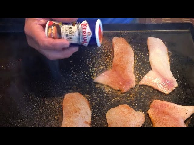
CLEANING TIPS
COOKING TIPS


AREA HIGHLIGHTS
Southwest Region
- Waurika

Waurika Lake
Waurika Lake is located on Beaver Creek, a tributary of the Red River and features excellent fishing opportunities.
Six recreation areas are located around the lake and large expanses of open water provide enjoyment to boating and skiing enthusiasts. Facilities include a full service marina, picnic areas, RV campsites with full hookups, group shelters, restrooms, showers, swimming beaches, change houses, electric outlets, a playground, and both nature and equestrian trails.
Over 300 campsites are located around the lake. Six day-use areas are available, as well as six boat ramps and several primitive access points.
Fishing Tips
Submitted by Fisheries Supervisor Ryan Ryswyk
Crappie are abundant at Waurika lake. Average crappie size is typically larger than many other lakes in southwestern Oklahoma and anglers flock to the lake when they move up shallow to spawn.
There is plenty of bank access around the lake and multiple boat ramps.
Mid to late April is a great time to catch crappie as they move to shallow water to spawn. Popular bank fishing locations include the riprap along Corum Bridge, Walker Creek Bridge, shallow brushy coves and other riprap lined banks.
1" - 3" soft plastic crappie lures paired with a 1/32nd up to 1/8th ounce jig-head are preferred bait for crappie anglers. You can cover a lot of water casting jigs to locate crappie.
Live minnows also work well and can be a great choice once you’ve located a pocket of crappie.
Don’t be afraid to change locations if the bite slows down or stops. You may only need to move a few feet to the next piece of structure whether that be a large chunk of riprap, a stick up or a submerged tree branch.
You may want to try fishing those same spots again in successive days as new crappie may have moved into those shallow spawning locations where you removed fish the day before.
Fishing Contact
Game Warden
Operator
Location
Waurika Lake (Google Map) is located 10 miles north of Waurika between SH 5 and SH 53.
Drive Time
- From OKC - 2 hours
- From Tulsa - 3.5 hours
- From Lawton - 1 hour
Recreational Facilities
U.S. Corps of Engineers manages campgrounds with full RV hookups and boat ramps.
Find a Fishing Campground
Other Fish Species of Interest
Bait & Tackle Nearby
- Down & Out Bait & Tackle
- Walmart Supercenter
- Walmart Supercenter
- Porter Hill Bait Shop
- Little Dam Bait Shop
- Ralph's Resort
- Dj's Bait Shop
- Jones Wholesale Bait Inc
- Academy
- Walmart Supercenter
Physical Description
- Surface area - 10,114 ac.
- Shoreline length - 79.5 mi.
- Volume - 187,463 ac. ft.
- Maximum depth - 52.1 ft.
Management Practices
Lake is stocked with hybrid striped bass and saugeye.
Additional Information
Northwest Region
- Canton

Canton Lake
Canton Lake has great access and facilities for boaters and bank anglers alike. Gently sloping sandy beaches can be found at all of the public access areas. Fishing jetties along the dam and a new recreation area below the dam offer bank anglers easy access to some of the best fishing at the lake.
Renowned as Oklahoma's premier walleye fishery, Canton Lake also supports a robust population of crappie, white bass and catfish.
Canton Lake has become the primary source of walleye eggs for incubation and stocking of other state lakes. Since 1968, community leaders and local merchants have promoted an annual Walleye Rodeo. The four-day event offers visitors the chance to win cash and other prizes that total over $30,000. The community also hosts other festivities which attract fishermen from Oklahoma and surrounding states.
Fishing Tips
Submitted by Fisheries Technician Mack Wood
Crappie fishing from the bank is best in mid-April. Fish are up shallow around rip rap and on brush piles near the shore and fishing jetties on the dam. Jigging around brush piles is best using a slip float. When jigging along rip-rap, let the jig sink then retrieve slowly. Most bites happen when the lure is on the fall.
Local lure favorites include hair jigs, small swimbaits and 1/16th ounce jig-heads paired with tubes or curly tail grubs. Colors vary, but good base colors to start out with include blue, red, white and chartreuse.
Small shiners and fathead minnows fished under slip floats are the preferred live bait choice of local anglers.
Boaters usually have good luck for crappie in late winter and early spring on deeper brush piles and structure using the same lures as described above.
Fishing Contact
Game Warden
Operator
Location
Canton Lake (Google Map) is located 2 miles north of Canton and 18 miles SW of Fairview on Highway 58.
Drive Time
- From OKC - 1.75 hours
- From Tulsa - 2.75 hours
- From Weatherford - 45 minutes
Recreational Facilities
U.S. Corps of Engineers manages campgrounds with full RV hookups, boat ramps and swimming beaches. Canton WMA offers primitive access to the North Canadian River.
Find a Fishing Campground
Other Fish Species of Interest
Bait & Tackle Nearby
- Gilchrist General Store
- Roman Nose General Store
- Walmart Supercenter
- Walmart Supercenter
- Walmart Supercenter
- Atwoods
- Academy
- Walmart Supercenter
- Walmart Supercenter
- Walmart Supercenter
Physical Description
- Surface area - 7,910 ac.
- Shoreline length - 37.8 mi.
- Volume - 116,000 ac. ft.
- Maximum depth - 35.2 ft.
Management Practices
Fall gill netting every year to evaluate fish population. Cedar trees are added to refurbish existing habitats.
Additional Information
- Elmer
 Luke Taylor/ODWC
Lake Elmer
Lake Elmer was constructed by the Oklahoma Department of Wildlife Conservation in 1962. The lake was completely drained in 1978 to facilitate shoreline deepening and the construction of fishing jetties. The lake was re-impounded and restocked with fish in 1979 and again in 2011.
Lake Elmer has one boat ramp and two water wells. Kingfisher is the nearest town in which to obtain picnic and fishing supplies. Good numbers of quality size bass and excellent opportunities to harvest big bluegill can be found at this lake.
The vegetation around the lake is tallgrass prairie type.
Fishing Tips
Submitted by Fisheries Technician Mack Wood
Lake Elmer is a bank anglers paradise. Late March through April is typically the best time to target crappie from the banks at Elmer. Jigging around jetties and brush piles usually provides the most success.
Local lure favorites include hair jigs, small swimbaits and 1/16th ounce jig-heads paired with tubes or curly tail grubs. Red, white and chartreuse are popular colors.
Minnows under small bobbers or slip floats are the preferred live bait choice.
Small Jon boat and kayak anglers should use the same techniques and lures as described above in deeper water adjacent to transition structure, such as the fishing jetties, during the early spawning stages. Bank anglers can reach most of these locations utilizing a slip float.
Fishing Contact
Game Warden
Operator
Oklahoma Department of Wildlife Conservation
Location
Lake Elmer (Google Map) is located in Kingfisher County, 4 miles northwest of Kingfisher (S7,T16N,R7W).
Drive Time
- From OKC - 1 hour
- From Tulsa - 2.25 hours
- From Kingfisher - 5 minutes
Recreational Facilities
The Oklahoma Department of Wildlife Conservation maintains fishing jetties and a boat ramp.
Find a Fishing Campground
Primitive camping is allowed at Lake Elmer.
Other Fish Species of Interest
Bait & Tackle Nearby
- Walmart Supercenter
- Roman Nose General Store
- Walmart Supercenter
- Walmart Supercenter
- Walmart Supercenter
- Academy
- Walmart Supercenter
- Cabela's
- Lucky Lure Tackle
- Lakeview Grocery
Physical Description
- Surface area - 60 ac.
- Shoreline length - 3.4 mi.
- Volume - 1,080 ac. ft.
- Maximum depth - 8 ft.
Management Practices
Spring electrofishing for largemouth bass and hoop netting for channel catfish to evaluate fish populations. Cedar trees are added to refurbish existing habitats. Channel catfish are stocked periodically.
Additional Information
North-Central Region
- Carl Blackwell

Lake Carl Blackwell
Lake Carl Blackwell is a family oriented recreational area which offers sand beaches, swimming, fishing, boating, 24-hour on-water fuel marina, a lake side convenience store, water skiing, camping, hiking, hunting, and miles and miles of exceptional equestrian riding trails.
Camping is available year-round. The lake is well known for producing large saugeye and hybrid striped bass.
Fishing Tips
Submitted by Fisheries Biologist Jeremy Duck
The best bank access for crappie at Lake Carl Blackwell is the rip rap around Ski Point and the dam March - May. The all-weather crappie dock on the west side of Ski Point offers an additional opportunity year-round to catch crappie for bank anglers.
Boat anglers can find crappie in the flooded timber to the northwest of Blackjack Cove and along the rocky shores in the southwestern part of the lake.
The best artificial lures tend to be 2” soft plastics paired with 1/16th to 1/4th ounce jig-heads. Popular jig-head colors are white, black and pink. Popular soft plastic bait colors are Electric Chicken and Monkey Milk.
Bobber fishing with live minnows is always a good choice.
Fishing Contact
Game Warden
Operator
Location
Lake Carl Blackwell (Google Map) is located 2 miles north of SH 51 on SH 51C.
Drive Time
- From OKC - 1 hour
- From Tulsa - 1.25 hours
- From Stillwater - 15 minutes
Recreational Facilities
Oklahoma State University manages campgrounds with full RV hookups, cabins, boat ramps, fishing docks and designated swimming areas. Ski Point boat ramp is ADA compliant.
Find a Fishing Campground
Other Fish Species of Interest
Bait & Tackle Nearby
- Cowboy Corner at Lake Carl Blackwell
- Lake McMurtry West Bait Shop
- Walmart Supercenter
- Academy
- R.C. Bait and Tackle
- Walmart Supercenter
- Magic Bait Co
- Lakeview Grocery
- Walmart Supercenter
- Walmart Supercenter
Physical Description
- Surface area - 3,370 ac.
- Shoreline length - 59.2 mi.
- Volume - 61,500 ac. ft.
- Maximum depth - 45.9 ft.
Management Practices
Hybrid striped bass are stocked. Saugeye are stocked to manage for quality crappie.
Additional Information
- Kaw

Kaw Lake
Kaw Lake is located in north central Oklahoma, approximately 8 miles east of Ponca City on the Arkansas River. Ground breaking ceremonies were held in May 1966 and impoundment of the reservoir occurred in 1976. Construction on the recreation facilities concluded in July of 1980 with the completion of the Osage Cove Public Use Area.
There are nine public use areas and two lake access points located around the lake for visitors to enjoy. Campers can select from over 300 family campsites, many of which are equipped with water and electric hookups. Groups of all types enjoy four group camping areas, three of which are located at the Osage Cove Public Use Area and one located at the Sarge Creek Cove Area. Use of the group camping areas is by reservation only. Interested parties can contact the Kaw Lake Office for reservations.
Ten boat launching ramps provide boaters with easy access to Kaw Lake. Once on the water, boaters can find two full service marinas located at McFadden Cove and Pioneer Park. Swimmers are invited to enjoy designated swimming areas at Pioneer Park and Sandy Park.
Kaw Lake and the Arkansas River have long been known for producing some of Oklahoma's largest catfish. Kaw Lake also offers anglers excellent opportunities to catch crappie, white bass and walleye
Fishing Tips
Submitted by Fisheries Biologist Jeremy Duck
The best bank access for crappie at Kaw Lake is in the Washunga Bay Area, Pioneer Park and the Little Beaver area around riprap and gravel banks.
Boat anglers can find success around the riprap at the Washunga and Hwy 11 bridges, the five fingers area south of Sarge Creek in the flooded timber and the Little Beaver area.
The best artificial lures tend to be 2” soft plastics paired with 1/16th to 1/4th ounce jig-heads. Popular jig-head colors are white, black and pink. Popular soft plastic bait colors are Electric Chicken, chartreuse and black.
Bobber fishing with live minnows is always a good choice.
Fishing Contact
Game Warden
Operator
Location
Kaw Lake (Google Map) is located 11 miles east of Ponca City on SH 11.
Drive Time
- From OKC - 1.75 hours
- From Tulsa - 1.5 hours
- From Ponca City - 15 minutes
Recreational Facilities
U.S. Corps of Engineers manages campgrounds and boat ramps. Easy access to the water's edge is available in many of the public-use areas. The concrete walk along the spillway is also accessible.
Find a Fishing Campground
Other Fish Species of Interest
Bait & Tackle Nearby
- Lakeview Campground, Boat Storage, Bait Shop & Store
- Walmart Supercenter
- Grit & Grace Outdoors
- Bubba's Outdoor Sports
- Academy
- Lake McMurtry West Bait Shop
- Keystone Lake Bait & Store
- Walmart Supercenter
- Walmart Supercenter
- Cowboy Corner at Lake Carl Blackwell
Physical Description
- Surface area - 23,610 ac.
- Shoreline length - 149 mi.
- Volume - 428,600 ac. ft.
- Maximum depth - 74.5 ft.
Management Practices
Walleye are stocked and brush piles are put into the lake for fish habitat.
Kaw Lake Level Data
Additional Information
Northeast Region
- Grand
 Tom Whipple/RPS 2018
Grand Lake
Operated by the Grand River Dam Authority (GRDA), Grand Lake is one of Oklahoma's premier fisheries. Grand Lake has hosted two Bassmaster Classics (2013, 2016) and MLF Redcrest (2022). It is a renowned largemouth bass fishery, but boasts robust populations of catfish, crappie, white bass and paddlefish. Being a destination fishery, Grand Lake offers ample lodging and accommodations.
Fishing Tips
Submitted by Fisheries Biologist Brad Johnston
Grand Lake can sometimes be overlooked as a crappie fishery due to the regulations in place, and its lack of public shoreline access. With a limit of 15 fish and a 10-inch minimum, it does differ from the statewide crappie daily limit of 37 and no size restrictions. Don’t let this deter you though, crappie fishing on Grand Lake has been on fire for the last several years with anglers catching limits of fish in the 10 to 13 inch range.
While Grand Lake produces good crappie action year-round, the springtime spawning event is still the most popular time for targeting this species. This generally occurs from the early to middle part of April through the middle of May.
When the fish are up shallow spawning they are often caught by casting and retrieving small soft plastics on 1/16th or 1/8th ounce jig-heads. Bobby Garland baby shad and slab slay’r, Fle Fly crappie kicker, tubes, inline spinners, and small crankbaits/jerkbaits are popular lure selections.
Changing up the speed of your retrieval to find the right depths and preference of the fish is key to catching fish this time of year. If the bite is slow, a small soft plastic, hair jig, or minnow with split shot below a bobber will help keep the lure in front of the fish longer to help entice them to bite. Popular lure colors are red, orange, chartreuse, white and pink.
Winter time crappie fishing is also popular for anglers on Grand Lake. There are a few privately owned docks that allow fishing to the public for a small fee. These docks allow anglers to access deeper waters that crappie have a tendency to utilize during the colder months, and they also have brush structure that attracts the fish. When crappie are out in deeper water they are generally suspended around bait fish and/or structure. Winter crappie anglers generally use the small soft plastic lures on 1/16th ounce jig-heads, hair jigs, blades and live minnows.
Having access to a boat on Grand Lake opens up a lot of crappie fishing for anglers. Part of the fun of fishing is going out and finding habitat on your own, but not everyone has the time or desire for that these days. There is an interactive map on our website which you can find recent habitat structures that have been deployed by ODWC.
Public shoreline access can be found at several State Parks throughout the lake, as well as some GRDA-owned areas. Most GRDA-owned areas will also have public boat ramps.
Fishing Contact
Game Warden
Operator
Location
Grand Lake (Google Map) is located 15 miles east of I-44 in between US 60, SH 82, SH 28, SH 10 and US 59.
Drive Time
- From OKC - 3 hours
- From Tulsa - 1.25 hours
- From Miami - 15 minutes
Recreational Facilities
Grand River Dam Authority and Oklahoma State Parks manage campgrounds with full RV hookups, boat ramps, fishing docks and designated swimming areas.
Find a Fishing Campground
Other Fish Species of Interest
Bait & Tackle Nearby
- Blue Water Bait & Tackle
- Benge Creek Outfitters
- Blue Moon Bait & Tackle
- Ketch-um Bait Shop
- Honey Creek Outdoors
- Grand Lake Sports Center
- Walmart Supercenter
- Littlefield's Sporting Goods
- Fairland Bait & Tackle
- Shawnee Grocery
- Walmart Supercenter
Physical Description
- Surface area - 41,749 ac.
- Shoreline length - 460 mi.
- Volume - 1,515,414 ac. ft.
- Maximum depth - 133 ft.
Management Practices
Hybrid striped bass are regularly stocked.
Spring River CFS Data
Neosho River CFS Data
Grand Lake Level Data
Additional Information
- Oologah
 Ashlee Boswell/RPS 2020
Oologah Lake
The dam and lake were built by the U.S. Army Corps of Engineers. The project was authorized by the Flood Control Act of 1938 and construction began in 1950. In 1951, construction was halted and resumed in 1955. In 1963, the majority of the project was complete and all facilities were in 1974. In 1976, the City of Tulsa built a pipeline connecting Oologah to the Lynn Lane Reservoir in Tulsa.
Recreation opportunities include a swimming beach, mountain biking, marina, RV and tent camping, picnic tables and a playground. On the east side of the lake, the Will Rogers Country Centennial Trail (18 miles) winds around the shore from the Spillway to Blue Creek Park.
Famous American actor, philosopher, cowboy, and writer, Will Rogers, was born on the Dog Iron Ranch which now sits on the shores of Oologah Lake.
Fishing Tips
Submitted by Fisheries Technician Eric Brennan
The areas listed below offer large sections of shoreline with structure and shallow spawning flats next to deeper water areas where crappie stage pre-spawn.
Mid- to late April is generally the best time to start looking for crappie at Oologah lake. If fish are not found around shallow visible structure, try tying on a slightly heavier lure and casting out to staging areas in 8-12 feet of water.
The most popular artificial lures tend to be small hair or feather jigs and roadrunners in the 1/16th to 1/8th ounce range. White, chartreuse and pink are all good colors selections.
Another popular option is a small soft plastic bait paired with a 1/32nd to 1/8th ounce jig-head. Chartreuse, white, black, blue, red, pink and purple are popular color selections.
By far the most popular option is going to be live bait. Medium shiners fished under a slip cork with a small split shot weight is always a good bet and can even prove to be the winning ticket when other methods are slow.
Fishing Contact
Game Warden
Operator
Location
Oologah Lake (Google Map) is located just east of Oologah on US 169 and SH 88.
Drive Time
- From OKC - 2.25 hours
- From Tulsa - 40 minutes
- From Claremore - 15 minutes
Recreational Facilities
U.S. Corps of Engineers manages campgrounds with full RV hookups and boat ramps.
Find a Fishing Campground
Other Fish Species of Interest
Bait & Tackle Nearby
- The Tackle Box
- Lazy J's Tackle
- JD Tackle Box
- Nabatak Outdoors
- Walmart Supercenter
- Walmart Supercenter
- Walmart Supercenter
- Fischer Bait & Tackle
- Mister Bass Inc
- North Harvard Bait
Physical Description
- Surface area - 29,460 ac.
- Shoreline length - 216.9 mi.
- Volume - 544,100 ac. ft.
- Maximum depth - 72.2 ft.
Management Practices
Hybrid striped bass and walleye are regularly stocked.
Oologah Lake Level Data
Additional Information
East-Central Region
- Greenleaf

Greenleaf Lake
Operated by Oklahoma State Parks. Impounded in 1939 as a water supply for Camp Gruber, Greenleaf's primary purpose now is classified as recreation. Located on the western edge of the Ozarks, Greenleaf is surrounded by hills covered with oak/hickory forest and provides a secluded setting. The only lake access is through Greenleaf State Park, an award-winning state park with camping and other recreational opportunities. The dam is a spillway, so water levels are stable, which has allowed aquatic vegetation to become established. Fishing is the most popular activity on the lake.
Fishing Tips
Submitted by Fisheries Biologist Jon West
Greenleaf lake is tucked away inside Greenleaf state park and is a flow through impoundment of Greenleaf creek. Since it is spillway controlled, it has a stable water level which can make it a good option to fish if other area lakes are flooded.
Greenleaf offers a boat ramp for boating anglers and has access points for the bank angler along the southwest side which includes a jetty and a jetty with a fishing dock. There is an enclosed fishing dock that provides access to deep water and for a small daily fee can be used all year long.
Anglers fishing from boats should concentrate on areas towards the backs of creeks near structure.
When fishing Greenleaf for spring crappie you’ll need to focus on the weedline and pockets within the aquatic vegetation.
Fishing with a 10 ft or longer rod can allow you to drop your jig straight down into the pockets and pinpoint your presentation.
Use a ball head jig paired with a small soft plastic lure in high visibility colors such as pink, chartreuse or bright green.
High visibility line can help you see strikes that happen on the fall and lead to fish that would otherwise be missed.
Fishing Contact
Game Warden
Operator
Location
Greenleaf Lake (Google Map) is located 10 miles north of US 64 on SH 10.
Drive Time
- From OKC - 2.5 hours
- From Tulsa - 1.25 hours
- From Muskogee - 30 minutes
Recreational Facilities
Oklahoma State Parks manages campgrounds with full RV hookups, marina, fishing docks and a boat ramp.
Find a Fishing Campground
Other Fish Species of Interest
Bait & Tackle Nearby
- Dave's Bait & Tackle
- Jimmy Houston Outdoors Store
- Walmart Supercenter
- Walmart Supercenter
- Mike's Outdoors
- Dunham's Sports
- Walmart Supercenter
- Bait Barn
- Mater's Bait & Tackle
- JJ's Bait Shop
Physical Description
- Surface area - 920 ac.
- Shoreline length - 14.1 mi.
- Volume - 14,720 ac. ft.
- Maximum depth - 42.3 ft.
Management Practices
Channel catfish have been stocked in the lake, most recently in 2021. In 2017, retired Florida bass brooders were stocked in hopes to introduce Florida bass genes to increase trophy bass potential.
Additional Information
- Tenkiller

Lake Tenkiller
Impounded in 1952, Lake Tenkiller is the only controlled impoundment on the Illinois River and can experience prolonged lake level fluctuations. Situated in the Ozark highlands, Lake Tenkiller is a deep, clear lake dominated by a shoreline with rocky bluffs and outcroppings. There are numerous public access areas, including two state parks. Lake Tenkiller is very popular for all types of recreation. Due to its depth, the lake provides cool water for the popular year-round trout fishery in its tailwater.
Fishing Tips
Submitted by Fisheries Biologist Jon West
When it comes to bank fishing for springtime crappie on Lake Tenkiller there are several good public access areas you can target:
Some of the more protected areas like the back of Burnt Cabin, Caney Creek and Carlisle Cove also offer a good opportunity for kayak fishing.
At normal pool (632), these areas offer good spawning habitat with easy access to deep water for pre-spawn fish. At slightly higher elevations some of these areas offer button bush that is inundated and provides plenty of structure to target.
Depending on the water clarity, crappie will build nests at depths anywhere from 1ft to greater than 10 ft. Water clarity in Lake Tenkiller is on a gradient with the water becoming more clear as you move down lake.
Fishing at the right depth can be critical since crappie typically feed up. If you are fishing for deeper fish and want to keep your lure in the strike zone longer use a slip cork set to the depth you want.
Use a ball head-jig from 1/32nd to 1/8th ounce in combination with a soft plastic shad imitation or tube in the 2" - 2.5” range. A tried and true jig color for Lake Tenkiller crappie is black and chartreuse or any color mimicking natural shad colors such as pearl.
When searching for fish and wanting to cover more water, using a small Road Runner jig-head can be a good way to key in on active fish. Double jig rigs are a popular option and allow you to work through more lure color variations and quickly figure out what the fish want.
To create a more realistic presentation use a loop knot. This knot will ensure that the jig is always fishing correctly (horizontal) and allows for maximum jig action.
If fish are reluctant to bite consider using a spray-on or dip-in scent or tip the jig with a scented dough product to trigger a response, such as a Crappie Nibble.
When fish are holding tight to brushy structure use a jig with a weed guard or hook cover to fish deep into structure to allow you to be where the fish are while reducing hang ups.
Fishing Contact
Game Warden
Operator
Location
Lake Tenkiller (Google Map) is located 10 miles south of Tahlequah on US 82 and S Indian Rd.
Drive Time
- From OKC - 2.75 hours
- From Tulsa - 1.5 hours
- From Muskogee - 45 minutes
Recreational Facilities
U.S. Corps of Engineers and Oklahoma State Parks manage campgrounds with full RV hookups, boat ramps and designated swimming areas.
Find a Fishing Campground
Other Fish Species of Interest
Bait & Tackle Nearby
- Dave's Bait & Tackle
- Jimmy Houston Outdoors Store
- Walmart Supercenter
- Walmart Supercenter
- Mike's Outdoors
- Dunham's Sports
- Walmart Supercenter
- Bait Barn
- Mater's Bait & Tackle
- JJ's Bait Shop
Physical Description
- Surface area - 12,900 ac.
- Shoreline length - 170 mi.
- Volume - 654,100 ac. ft.
- Maximum depth - 129 ft.
Management Practices
Crappie must be a minimum of 10-inches and have a daily limit of 15.
Tenkiller Lake Level Data
Additional Information
Southeast Region
- Eufaula

Eufaula Lake
Eufaula Lake, the largest reservoir in Oklahoma at 105,500 surface acres, was impounded in 1964. It is operated by the United States Army Corps of Engineers for the purposes of flood control, water supply, hydroelectric power and navigation. Historically, water level fluctuations, turbidity and siltation have created management challenges.
A 14-inch minimum length limit on black bass was enacted in 1987 to increase the number of spawning size bass in the lake. Florida strain largemouth bass were first stocked in the 1980s and continue to be stocked frequently. Reservoir-strain smallmouth bass were first stocked in the lake in 1992 and stockings continued until 1998. Eufaula Lake is an excellent crappie, white bass and catfish fishery.
Fishing Tips
Submitted by Fisheries Biologist Michael Hollie
Eufaula Lake is an excellent year-round crappie fishery that is nationally recognized. Black and white crappie can be found lake-wide, however, crappie tend to be found in greater numbers in the southern end (Gaines Creek Arm) and the northern end (Deep Fork Arm) of the lake.
The best time for bank anglers to target crappie is during the spring spawning period (mid to late April) when fish can be found in the shallow areas around rip rap, gravel banks and woody structures. The best bank fishing locations can be found in the southern end of the lake around Arrowhead State Park, Crowder City Park, Crowder Point, and Hickory Point Recreation Area.
Additional bank fishing locations in the Northern end of the lake can be found around Gentry Creek Cove, Holiday Cove and Lake Eufaula State Park. Enclosed fishing docks can be found at Lake Eufaula State Park, Belle Starr Marina and Area 51 Marina.
The best artificial baits tend to be 2” soft plastics paired with 1/16th to 1/4th ounce jig-heads in a combination of colors from brown, black, orange and chartreuse with chartreuse or pink tails. One can never go wrong with a live minnow and bobber.
Fishing Contact
Game Warden
Operator
Location
Eufaula Lake (Google Map) is located 10 miles south of I-40 on US 69.
Drive Time
- From OKC - 2 hours
- From Tulsa - 1.5 hours
- From Henryetta - 40 minutes
Recreational Facilities
U.S. Corps of Engineers and Oklahoma State Parks manage campgrounds with full RV hookups, boat ramps, marinas, designated swimming areas and trails for hiking, biking, equestrian and ATVs. Eufaula Lake State Park (918) 689-5311 and Belle Starr Marina (918) 689-2132 offer an enclosed fishing dock.
Find a Fishing Campground
Lake Eufaula State Park (Arrowhead Area)
Other Fish Species of Interest
Management Practices
Florida strain largemouth bass are stocked frequently. Fish attractors are maintained to help increase angler success.
Bait & Tackle Nearby
- Eufaula Cove Marina
- Flamingo Fish & Marine
- B & B Bait & Tackle
- Belle Starr Marina
- Newman Wholesale Fishing Tackle Distribution
- Lake Eufaula Marina
- Lakeside One Stop
- Double K Bait & More
- Walmart
- Walmart Supercenter
Physical Description
- Surface area - 105,500 ac.
- Shoreline length - 833.9 mi.
- Maximum depth - 90.2 ft.
- Volume - 2,330,000 ac. ft.
Eufaula Lake Level Data
Additional Information
- Hugo

Hugo Lake
Located in scenic southeastern Oklahoma, this long-established recreation destination offers family fun, boating, abundant fishing opportunities and spectacular sunset views.
Fishing Tips
Submitted by Fisheries Biologist David Bogner
Great crappie fishing can be found in the timbered section of the lake as well as on flooded shorelines. Success can be found using any soft plastic crappie lure paired with a jig-head, as well as live minnows.
Wade fishing for crappie is favored locally and can be very successful when done in flooded backwaters on the upper end of the lake on Hugo WMA or Twin Oaks Point.
Best boat access points include Rattan Landing, Frasier Creek and Virgil Point.
Fishing Contact
Game Warden
Operator
Location
Hugo Lake (Google Map) is located 7 miles east of Hugo on US 70.
Drive Time
- From OKC - 3 hours
- From Tulsa - 2.5 hours
- From Durant - 1 hour
Recreational Facilities
U.S. Corps of Engineers and Little Dixie Community manage campgrounds with full RV hookups, cabins, boat ramps, designated swimming areas and trails for hiking, biking, and equestrian.
Find a Fishing Campground
Other Fish Species of Interest
Bait & Tackle Nearby
- Red Barn Propane - Bait, Tackle
- Walmart Supercenter
- JC's Store
- Walmart Supercenter
- Walmart
- Hookers Live Bait Fire & Ice
- Beavers Bend Marina
- Playin Hooky Bait Tackle and More
- Sardis Lake Custom Lures
Physical Description
- Surface area - 11,592 ac.
- Shoreline length - 98.6 mi.
- Maximum depth - 51.5 ft.
- Volume - 126,741 ac. ft.
Hugo Lake Level Data
Additional Information
- Wister

Wister Lake
A gateway to the beautiful Ouachita National Forest, Wister Lake in southeast Oklahoma offers five camping areas around the 115 miles of scenic shoreline. This outdoor haven offers park visitors a variety of activities including fishing, hiking, camping, biking, boating and water skiing. As an added bonus, the Wister Lake State Park is equipped with a water spray park, a popular destination for children and adults alike.
Fishing Tips
Submitted by Fisheries Biologist David Bogner
Shoreline access is limited with the best access occurring at the fishing dock on Quarry Island and around Victor Landing.
Popular boat fishing spots include the river as well as the brush row west of Victor Landing.
Live minnows and smaller jigs are best, although anglers targeting trophy sized crappie will want to size up their bait accordingly.
Fishing Contact
Game Warden
Operator
Location
Wister Lake (Google Map) is located two miles south of the town of Wister on US 270.
Drive Time
- From OKC - 3 hours
- From Tulsa - 2.25 hours
- From McAlester - 1.25 hours
Recreational Facilities
U.S. Corps of Engineers and Oklahoma State Parks manage campgrounds with full RV hookups and boat ramps. ODWC manages primitive camping sites and two boat ramps throughout on the Wister Wildlife Management Area.
Find a Fishing Campground
Other Fish Species of Interest
Bait & Tackle Nearby
- D&J Bait N Grub
- Atwoods
- JJ's Bait Shop
- Walmart Supercenter
- Sardis Lake Custom Lures
- Double K Bait & More
- Dave's Bait & Tackle
- Rebel Bait Shop
- B & B Bait & Tackle
- Beavers Bend Marina
Physical Description
- Surface area - 6,288 ac.
- Shoreline length - 91.3 mi.
- Maximum depth - 37.6 ft.
- Volume - 50,529 ac. ft.
Wister Lake Level Data
Additional Information
South-Central Region
- Arbuckle

Arbuckle Lake
Arbuckle Lake is a 2,350-acre reservoir formed by the impoundment of Guy Sandy Creek, Buckhorn Creek and Rock Creek approximately 8 miles southwest of Sulphur. It was constructed by the Bureau of Reclamation in 1967 and has a watershed of 126 square miles in south-central Oklahoma. Arbuckle Dam and water levels are managed by the Bureau of Reclamation. Recreational access, patrols and lakeside facilities are managed by the National Park Service.
Fishing Tips
Submitted by Senior Fisheries Biologist Cliff Sager
The best year-round artificial baits include 2" soft plastics with 1/16th or 1/32nd ounce jig heads. Lures with pink, blue and/or green are popular colors.
Wintertime crappie can be found suspended in deep water near the dam and can be targeted with small spoons, jigs or live minnows.
There are numerous ODWC brush pile locations around the lake that will provide year-round opportunity.
The Chickasaw Recreation Area provides covered fishing docks near the ramps at Guy Sandy, Buckhorn and The Point. Brush is maintained under these docks to attract crappie and other sportfish.
Fishing Contact
Game Warden
Operator
Location
Arbuckle Lake (Google Map) is located 6 miles southwest of Sulphur in between SH 7 and US 177 within the Chickasaw National Recreation Area.
Drive Time
- From OKC - 1.5 hours
- From Tulsa - 2.5 hours
- From Ardmore - 40 minutes
Recreational Facilities
The National Park Service manages campgrounds with full RV hookups, boat ramps, covered fishing piers and designated swimming areas.
Find a Fishing Campground
Chickasaw National Recreation Area
Other Fish Species of Interest
Management Practices
Florida strain largemouth bass are stocked annually.
Bait & Tackle Nearby
- Arbuckle Bait Box
- Buckhorn Bait
- Point Bait Shop
- Walmart Supercenter
- Walmart Supercenter
- Academy
- Dickey's Tackle Box
- Jones Wholesale Bait Inc
- Lake Country Store
- Scotty's Blue River One Stop
Physical Description
- Surface area - 2,350 ac.
- Shoreline length - 36 mi.
- Maximum depth - 82 ft.
- Volume - 72,400 ac. ft.
Arbuckle Lake Level Data
Additional Information
- Texoma

Lake Texoma
The freshwater striped bass capital of the world, Lake Texoma is a boundary lake, formed by the Denison Dam on the Red River, that separates Oklahoma and Texas. While temperate bass species and blue catfish dominate the Lake Texoma fishing headlines, it is also a fantastic black bass and crappie fishery.
Fishing Tips
Submitted by Senior Fisheries Biologist Cliff Sager
Local favorites include marabou jigs and tube jigs in white, pink or chartreuse. Sizes will be dependent on water depth and time of year.
Live minnows are a great option around docks or fished near brushpiles or bridge supports.
There are numerous ODWC brushpile locations around the lake that will provide year-round opportunity.
Late March to early April is a popular time to catch the crappie spawn.
Quality bank access areas include:
Fishing Contact
Game Warden
Operator
Location
Lake Texoma (Google Map) is located 5 miles east of Kingston on US 70.
Drive Time
- From OKC - 2.25 hours
- From Tulsa - 3 hours
- From Ardmore - 45 minutes
Recreational Facilities
U.S. Corps of Engineers and Oklahoma State Parks manage campgrounds with full RV hookups, boat ramps and fishing docks.
Find a Fishing Campground
Other Fish Species of Interest
Management Practices
Florida largemouth bass are stocked frequently.
Bait & Tackle Nearby
- Texoma Tackle
- Leelore's Bait & Tackle
- Lighthouse Bait and Tackle
- Walmart Supercenter
- Scotty's Blue River One Stop
- Lake Country Store
- Dickey's Tackle Box
- Walmart
- Walmart Supercenter
- Academy
Physical Description
- Surface area - 88,000 ac.
- Shoreline length - 592.7 mi.
- Maximum depth - 142 ft.
- Volume - 2,722,000 ac. ft.
Texoma Lake Level Data
Additional Information
Central Region
- Arcadia
 Steve Ancik/RPS 2020
Lake Arcadia
Lake Arcadia is Oklahoma City metro's peaceful retreat. Located conveniently off of I-35 in Edmond, Arcadia boasts lake-wide public access. The layouts of all the public access areas offer opportunities for anglers of all skill levels. There's covered docks and sandy beaches near restrooms for those with young kids or physical disabilities. Rocky outcroppings along the banks allow for more adventurous exploration. Lake Arcadia has two inflows, Spring Creek on the northwest end and Deep Fork River on the southern end.
The lake itself is utilized primarily for boating, water sports and swimming May through September, so it does not get the same fishing pressure as other lakes in the area. It has a great shad population and lots of other ingredients for a successful fishery. Walking trails around the lake allow anglers to take advantage of the entire shoreline when water levels are below full pool, but the most maintained (and fished) bank access remains within the parks. Most, if not all, access to fishing requires some form of payment, whether it be park entrance, trail use, etc. All day use fees can be found by clicking here. For all information concerning Lake Arcadia's parks and facilities click here. The Wildlife Department has public access on the south end of the lake that requires either a fishing or hunting license for those over 16, or a conservation passport for those 18 and older, unless exempt (click here for license exemption information), but does not require day use fees.
- Spring Creek Park
- Scissortail Campground
- Edmond Park
- Arcadia Lake Campground
- Lake Arcadia Central St Park
- Department of Wildlife Conservation Education Area (West Parking)
- Department of Wildlife Conservation Education Area (East Parking)
- Memorial Bridge Access
Fishing Tips
Submitted by Aquatic Education/R3 Fishing Coordinator Skylar St.Yves & Fisheries Biologist Keith Thomas
The dam, coves and points below the lake overlook at Lake Arcadia Central St Park have ideal spawning habitat and good bank access. These areas provide bank anglers the best opportunity at good numbers of crappie in April and May.
Winter and pre-spawn crappie hotspots include the docks (one covered, one open) at the Spring Creek Area. Boaters will do well at deep brush piles, rip-rap points, mouths of coves, creek channels and standing timber around the entire lake.
The mouths of most coves in the Spring Creek arm, the Deep Fork arm and the main body produce good fishing action year-round.
Start small with your offerings (lures less than 2" or 1/16th ounce and smaller) until you find a steady stream of fish over 8-inches then you can size up your bait if it makes casting or getting to a certain depth more convenient. Curly tail grubs, baby shad, swimbaits, inline spinners, spoons, slabs, Super Dupers, blades, lipless crankbaits, diving crankbaits, jerkbaits and hair jigs in shades of white, silver and/or chartreuse are all effective lures. Live minnows are the go-to for bait anglers fished below a bobber on a small to medium sized bait-holding hook.
Bobber jigging with a live minnow, baby shad or small hair jig in chartreuse is an easy and effective way to stay in the strike zone longer. Crappie can be lazy biters. The longer the bait can stay in front of the fish the better. Use a stick bobber for this presentation as crappie rarely submerge the bobber. Instead, the bobber will fall flat on the water indicating to set the hook.
Fishing Contact
Game Warden
Operator
U.S. Corps of Engineers / City of Edmond
Location
Lake Arcadia (Google Map) is located in between US 66 to the north, Memorial Road to the south, Post Road to the east and I-35 to the west.
Drive Time
- From OKC - 20 minutes
- From Tulsa - 1.5 hours
- From Edmond - 10 minutes
Recreational Facilities
The City of Edmond manages campgrounds with full RV hookups, boat ramps, fishing piers and swimming beaches.
Find a Fishing Campground
Other Fish Species of Interest
Bait & Tackle Nearby
- Walmart Supercenter
- Academy Sports + Outdoors
- Cabela's
Physical Description
- Surface area - 1,676 ac.
- Shoreline length - 5.6 mi.
- Volume - 29,544 ac. ft.
- Maximum depth - 47.8 ft.
Management Practices
Fish surveys are conducted every five years. Brush piles are put in the lake for fish habitat in addition to stocking saugeye and hybrid striped bass.
Lake Arcadia Level Data
Additional Information
- Bell Cow

Bell Cow Lake
Operated by the City of Chandler, Bell Cow Lake has four public recreation areas (Area A, B, C and D), two boat ramps, a covered fishing dock, picnic tables, pavilions, camping, hiking, restrooms and equestrian trails. Boat docks are ADA compliant.
Bell Cow Lake was constructed in 1990 by the City of Chandler and was opened to fishing in the fall of 1993. In the past, high turbidity and limited aquatic vegetation resulted in poor bass recruitment and low abundance. Introductions of aquatic vegetation were made in the late 90’s and early 2000’s. Florida Largemouth Bass were stocked periodically from 1991 to 2006 to introduce their genetics. Currently Bell Cow lake is being managed as a trophy bass fishery with only one largemouth bass over 22-inches per day may be kept.
With steep drop-offs near shore and ample standing timber, Bell Cow offers a tremendous crappie fishery. Some of the best spawning habitat for crappie is easily accessible at the four public recreation areas. Located nearly half-way between Oklahoma City and Tulsa, Bell Cow Lake is an ideal close to home getaway for the entire family. Chandler Lake is located right across the road and offers additional fishing opportunities. There are fees associated with the public recreation areas at both lakes. Click here for information on fees and facilities.
Fishing Tips
Submitted by Aquatic Education/R3 Fishing Coordinator Skylar St.Yves
Being a newer reservoir, Bell Cow Lake has tremendous standing timber habitat. However, with so much timber, locating areas that hold the most crappie can be a challenge for those new to the lake. The key is to identify timber areas that are located adjacent to prime spawning habitat.
Area A is a great place to start. The two coves on either side of the fishing jetty have ample hard bottom in the shallows leading out to steep drop-offs into the standing timber. It is ideal for good year-round crappie fishing, but really comes to life for bank anglers March - May.
Start small with your offerings (lures less than 2" or 1/16th ounce and smaller) until you find a steady stream of fish over 8-inches then you can size up your bait if it makes casting or getting to a certain depth more convenient. Curly tail grubs, baby shad, swimbaits, inline spinners, spoons, slabs, Super Dupers, blades, lipless crankbaits, diving crankbaits, jerkbaits and hair jigs in shades of white, silver and/or chartreuse are all effective lures. Live minnows are the go-to for bait anglers fished below a bobber on a small to medium sized bait-holding hook.
Bobber jigging with a live minnow, baby shad or small hair jig in chartreuse is an easy and effective way to stay in the strike zone longer. Crappie can be lazy biters. The longer the bait can stay in front of the fish the better. Use a stick bobber for this presentation as crappie rarely submerge the bobber. Instead, the bobber will fall flat on the water indicating to set the hook.
Fishing Contact
Game Warden
Operator
Location
Bell Cow Lake (Google Map) is located 3.5 miles northwest of I-44 via SH 18 and E 890 Rd.
Drive Time
- From OKC - 1 hour
- From Tulsa - 1.25 hours
- From Chandler - 5 minutes
Recreational Facilities
City of Chandler manages campgrounds with full RV hookups, two boat ramps and a covered fishing dock.
Find a Fishing Campground
Other Fish Species of Interest
Bait & Tackle Nearby
- Walmart Supercenter
- R.C. Bait and Tackle
- Walmart Supercenter
- Lakeview Grocery
- Magic Bait Co
- Walmart Supercenter
- Walmart Supercenter
- Walmart Supercenter
- Academy
- Our Acres Bait Shop LLC
Physical Description
- Surface area - 1,153 ac.
- Shoreline length - 13 mi.
- Maximum depth - 39 ft.
- Volume - 15,613 ac. ft.
Management Practices
Bell Cow Lake is being managed as a trophy bass fishery by means of a city-imposed 22” minimum length limit. Largemouth Bass are stocked periodically.
Additional Information
- Liberty
- Image

Lake Liberty
Lake Liberty is a small reservoir located just south of Guthrie. Bank fishing access is limited to the campground and dam. It is a great lake for kayaks, float tubes and small boats. The lake and facilities are managed by the City of Guthrie. Lake Guthrie is 1 mile down the road and offers additional fishing opportunities. Crappie fishing at Lake Guthrie is best along the dam riprap.
Fishing Tips
Submitted by Aquatic Education/R3 Fishing Coordinator Skylar St.Yves
Bank fishing for crappie is best along the dam riprap and the spillway basin behind the dam from March - May. Boating anglers can find good numbers of fish in the cove along the eastern shoreline.
Start small with your offerings (lures less than 2" or 1/16th ounce and smaller) until you find a steady stream of fish over 8-inches then you can size up your bait if it makes casting or getting to a certain depth more convenient. Curly tail grubs, baby shad, swimbaits, inline spinners, spoons, slabs, Super Dupers, blades, lipless crankbaits, diving crankbaits, jerkbaits and hair jigs in shades of white, silver and/or chartreuse are all effective lures. Live minnows are the go-to for bait anglers fished below a bobber on a small to medium sized bait-holding hook.
Bobber jigging with a live minnow, baby shad or small hair jig in chartreuse is an easy and effective way to stay in the strike zone longer. Crappie can be lazy biters. The longer the bait can stay in front of the fish the better. Use a stick bobber for this presentation as crappie rarely submerge the bobber. Instead, the bobber will fall flat on the water indicating to set the hook.
Fishing Contact
Game Warden
Operator
Location
Liberty Lake (Google Map) is located 2.5 miles west of I-35 on West Seward Road.
Drive Time
- From OKC - 40 minutes
- From Tulsa - 1.75 hours
- From Guthrie - 10 minutes
Recreational Facilities
City of Guthrie manages campgrounds, fishing docks, fishing jetties, boat ramps, picnic areas and an equestrian trail.
Find a Fishing Campground
Other Fish Species of Interest
Bait & Tackle Nearby
- Lakeview Grocery
- Magic Bait Co
- Walmart Supercenter
- Walmart Supercenter
- Academy
- Cabela's
- Lucky Lure Tackle
- Walmart Supercenter
- Walmart Supercenter
- Bass Pro Shops
Physical Description
- Surface area - 197 ac.
- Shoreline length - 4.5 mi.
- Volume - 2,471 ac. ft.
- Maximum depth - 26 ft.
Management Practices
Fish surveys are conducted every five years. Brush piles are put in the lake for fish habitat in addition to fish stockings.
Additional Information
- Thunderbird
 Sam Cooper/RPS 2014
Lake Thunderbird
Lake Thunderbird is a sneaky good fishery. It has great sizable populations of just about every sought after game species. There is great public access lake-wide with plenty of places to find crappie from the banks year-round. Lake Thunderbird has a pretty well defined river channel on the south end of the lake with connecting points to rocky and sandy shoals. The coves at all of the public access areas are the easiest places to bank fish. Some public access areas may have fees associated with entrance or facilities. Click here for Lake Thunderbird State Park information.
- Lake Thunderbird State Park
- Lake Thunderbird State Park (Little Axe)
- Lake Thunderbird State Park (South Dam)
- Lake Thunderbird State Park (Little River)
- Lake Thunderbird State Park (West Sentinel)
- North Sentinel Park
- East Sentinel Park
- Post Oak RV Park
Fishing Tips
Submitted by Aquatic Education/R3 Fishing Coordinator Skylar St.Yves
The five coves around Lake Thunderbird State Park (Little River) are the most consistent public fishing areas. These shallow sheltered coves offer ideal spawning habitat with great transition zones around the points.
Mid- to late April is typically the best time of year for bank anglers to locate shallow crappie at Lake Thunderbird.
Start small with your offerings (lures less than 2" or 1/16th ounce and smaller) until you find a steady stream of fish over 8-inches then you can size up your bait if it makes casting or getting to a certain depth more convenient. Curly tail grubs, baby shad, swimbaits, inline spinners, spoons, slabs, Super Dupers, blades, lipless crankbaits, diving crankbaits, jerkbaits and hair jigs in shades of white, silver and/or chartreuse are all effective lures. Live minnows are the go-to for bait anglers fished below a bobber on a small to medium sized bait-holding hook.
Bobber jigging with a live minnow, baby shad or small hair jig in chartreuse is an easy and effective way to stay in the strike zone longer. Crappie can be lazy biters. The longer the bait can stay in front of the fish the better. Use a stick bobber for this presentation as crappie rarely submerge the bobber. Instead, the bobber will fall flat on the water indicating to set the hook.
Fishing Contact
Game Warden
Operator
Bureau of Reclamation / Oklahoma State Parks
Location
Lake Thunderbird (Google Map) is located 12 miles east of Norman on SH 9.
Drive Time
- From OKC - 40 minutes
- From Tulsa - 1.75 hours
- From Norman - 25 minutes
Recreational Facilities
Oklahoma State Parks manages campgrounds with full RV hookups, fishing docks, fishing jetties, boat ramps, picnic areas, an archery range and two marinas.
Find a Fishing Campground
Other Fish Species of Interest
Bait & Tackle Nearby
- Little River Marina
- Calypso Cove Marina
- Alameda Market
- Walmart Supercenter
Physical Description
- Surface area - 5,377 ac.
- Shoreline length - 59.6 mi.
- Volume - 106,670 ac. ft.
- Maximum depth - 58 ft.
Management Practices
Fish surveys are conducted every five years. Brush piles are put in the lake for fish habitat in addition to fish stockings.
Lake Thunderbird Level Data
Additional Information