
PORTLAND, Ore. — Editor's note: On Aug. 4, 2022 the Oregon Department of Forestry announced they're withdrawing their wildfire risk assessment map and will go back to their partners at OSU to create a map that improves the "accuracy of risk classification." They say they'll work with the communities affected and eventually release an updated map, adding: "While we met the bill’s initial deadline for delivering on the map, there wasn’t enough time to allow for the type of local outreach and engagement that people wanted, needed and deserved."
After the infamous 2020 wildfire season, Oregon is taking steps to let people know if their home is in a vulnerable area during wildfire season.
Though it would seem people would want to know if their home is at risk during those summer months, there's been a lot of fallout. Some homeowners, especially in rural parts of Oregon, say it has caused their insurance rates to go way up. But forestry officials say they're trying to save lives.
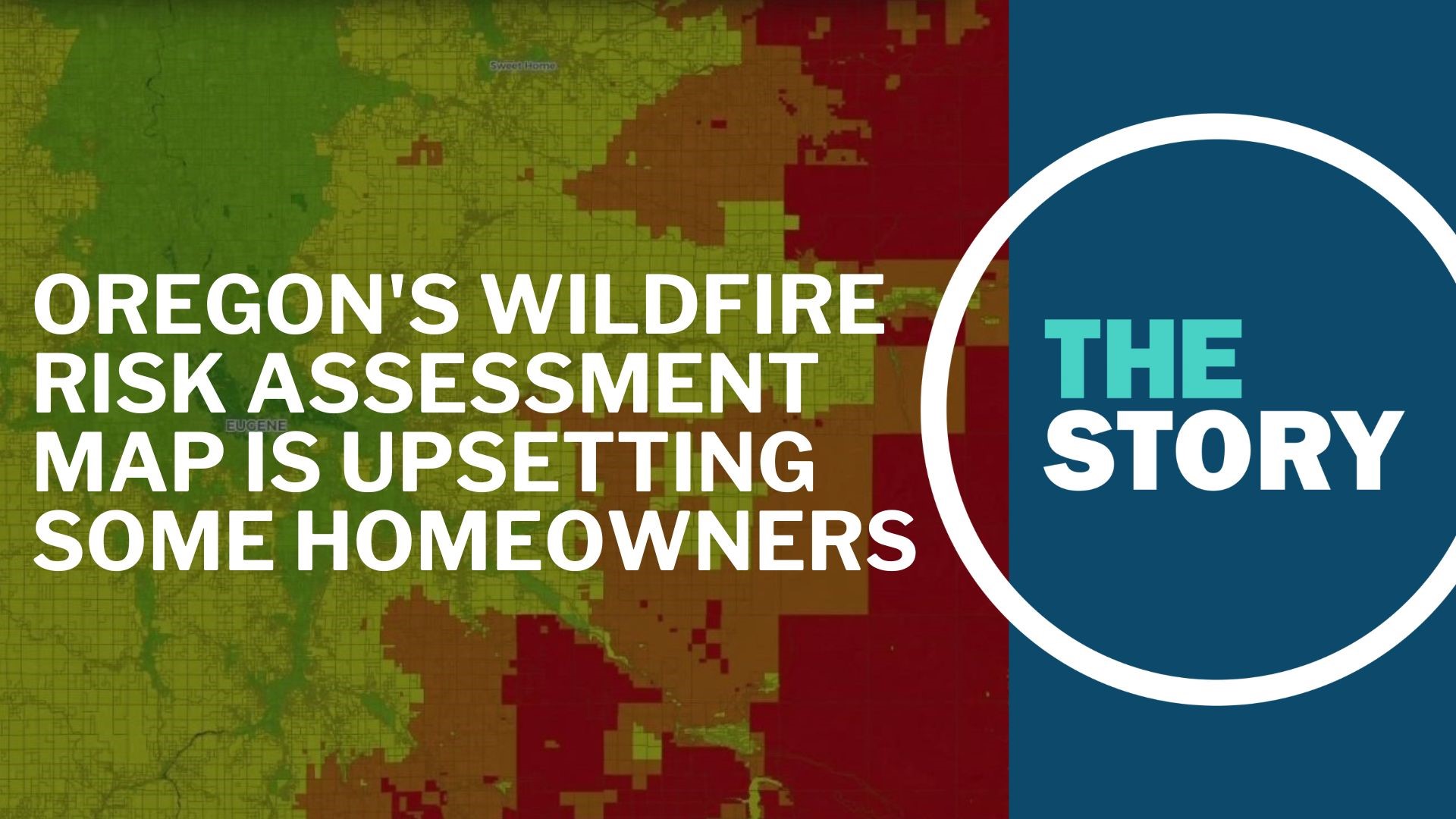
In 2021, Oregon passed Senate Bill 762 to address future wildfires. Part of the law led the state to create a wildfire risk assessment map. It shows the location of homes that are considered at high or extreme risk of wildfires, and whether homeowners should take additional steps to protect their homes.
Those steps could become a requirement come next spring. Derek Gasperini with the Oregon Department of Forestry explained what that might look like.
"There should be time for folks to understand the risk and then understand what defensible space will look like. But there are some best practices for defensible space," said Gasperini. "To make sure forest debris is cleared from the ground around property for a certain number of feet. Limbing trees up from the ground to a certain distance so there is space for firefighters to work and for creating fuel breaks to where a home and lives are not in danger. That really is the purpose of defensible space, not necessarily to keep a fire from starting in that particular geographical area, but to defend lives and property."
ODF said there are about 80,000 homes across Oregon that are in the "high or extreme" risk category that might be required to take some of these protective measures — mostly in southern, central and northeastern Oregon and around the Columbia River Gorge. These are places where the state has had the most wildfires over the past few years.
In the past few weeks, homeowners in these areas have gotten letters about the new wildfire map, and what steps they're advised to take for their properties. The parts of the map that are in red are considered "extreme" risk
A lot of homeowners are upset about this, saying their insurance companies are now raising rates on their homeowners policies — or dropping them from coverage altogether.
ODF has held several virtual town halls to hear these concerns, and some of the meetings have gotten heated.
"I actually received three notices, but I was made aware of the map about three weeks ago when my renewal came up on one of my properties. The insurance company, Travelers, let me know they were not gonna be renewing because of the designation of extreme wildfire. And I'm like, what are you talking about?" one citizen explained. "That's how I was able to access the map. I had no recourse, and so I had to shop other insurance companies, and the result is I was able to get insurance through Safeco because they were the cheapest, but my rate basically doubled. So this insurance issue that people are asking about has already happened."
Others have said their rates have doubled or even tripled in cost, and they are mad.
Oregon Sen. Jeff Golden (D-Ashland) addressed citizens concerns at one of the town hall meeting, saying the insurance issue is real and that if someone does everything they can to protect their property, they should "be sure to have access to insurance at a reasonable rate," adding that there may be some things the legislature can do to make that happen.
Golden also said he has heard from insurance companies that ever since the Camp Fire in northern California, companies have been developing their own wildfire risk maps, which have already made it more challenging for people to secure policies.
Opponents also argue the map was put together too quickly and includes too many errors and irregularities in categorizing homes as high or extreme risk. They say it's unfair to homeowners who are now on the hook for making changes to their properties, with their only recourse being to file an appeal with ODF by mid-September.
"We had issued a letter saying the maps are flawed and inaccurate, and that is because I heard that directly from state agencies. I was literally repeating what I was told by those who put the maps out," said Oregon Rep. Kim Wallan (R-Medford). "For instance, there is an example of a duplex where half of the duplex is listed as extreme and other half of the duplex is not. And where you have properties that have manicured landscaping, flat lands that is all green and is listed as extreme, or across the street, you have vegetation that is not irrigated and clearly dry brush and is not listed as extreme."
A number of Republicans in Oregon are now asking ODF and the state of Oregon to at least pause the process, take time to review each geographical site and create a new map.
KGW reached out to Gov. Kate Brown's office on the matter. A spokesperson issued the following statement:
"Governor Brown believes that the wildfire risk map, required by SB 762, is an important tool to help inform decision making and planning related to mitigating wildfire risk for communities throughout Oregon. We understand that there are concerns with the initial map release, and our office is working closely with the Oregon Department of Forestry (ODF) to help ensure those concerns are addressed. The agency is taking feedback very seriously and is considering all options moving forward to ensure public engagement, as outlined in law, is thorough and meaningful."