Volcanoes in American Samoa
Volcanic activity in American Samoa is within the area of responsibility of the U.S. Geological Survey’s Hawaiian Volcano Observatory, based in Hilo on the Island of Hawai‘i. Tutuila, Ofu-Olosega and Ta‘ū are potentially active volcanoes within the United States Territory of American Samoa. All are considered low threat.
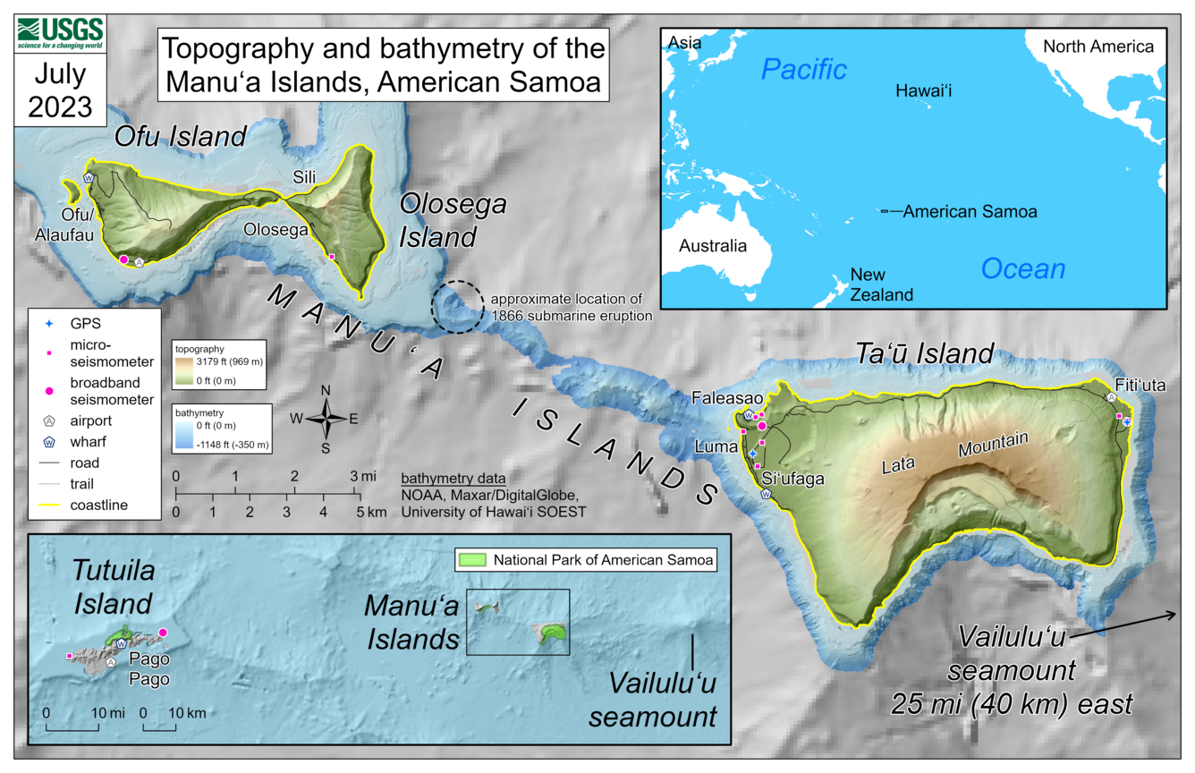
Ta'u Island

Taʻū Island is located at the east end of the Samoan Islands, in the United States Territory of American Samoa
Ofu-Olosega

Ofu and Olosega are two islands formed from two shield volcanoes in the United States Territory of American Samoa.
Tutuila Island

Tutuila is a shield volcano in the United States Territory of American Samoa.

American Samoa volcanoes formed from a hotspot
Volcanoes in American Samoa formed from hotspot volcanism. As the Pacific Plate passes northwest over the Samoan hotspot, eruptions form submarine volcanoes and islands. This is similar to how the Hawaiian Islands form as the Pacific Plate passes over the Hawaiian hotspot. The islands in American Samoa are the tops of large shield volcanoes, most of which are below the ocean surface.
Volcanoes in American Samoa are progressively younger and closer to the hotspot. Volcanoes formed from the Samoan hotspot's eruptions are primarily basaltic shield volcanoes, with summit calderas and rift zones where eruptions are more likely to occur. Eruptions from hotspot volcanoes typically include slow-moving lava flows and low-level explosions of lava that are localized to a small area. Information about these hazards, which are similar to those in Hawaii, can be found at this HVO website.
Tutuila Island, Ofu-Olosega, and Ta‘ū Island are volcanoes in American Samoa that are considered potentially active. The youngest dated eruption in American Samoa is on Tutuila Island from approximately 1700–1400 years ago. However, submarine eruptions have occurred more recently at two locations in the past two centuries. Currently, the Samoa hotspot is considered to be located beneath Vailuluʻu seamount, a submarine volcano about 45 kilometers (28 miles) east of Taʻū Island.
Active volcanoes in American Samoa: