Photogrammetrically Controlled Galileo Image Mosaics of Europa
- Primary Authors
- Michael Bland, Lynn Weller
- Originators
- USGS Astrogeology Science Center
- Publisher
- USGS Astrogeology Science Center
- Publication Date
- 2021-03-22
- Abstract
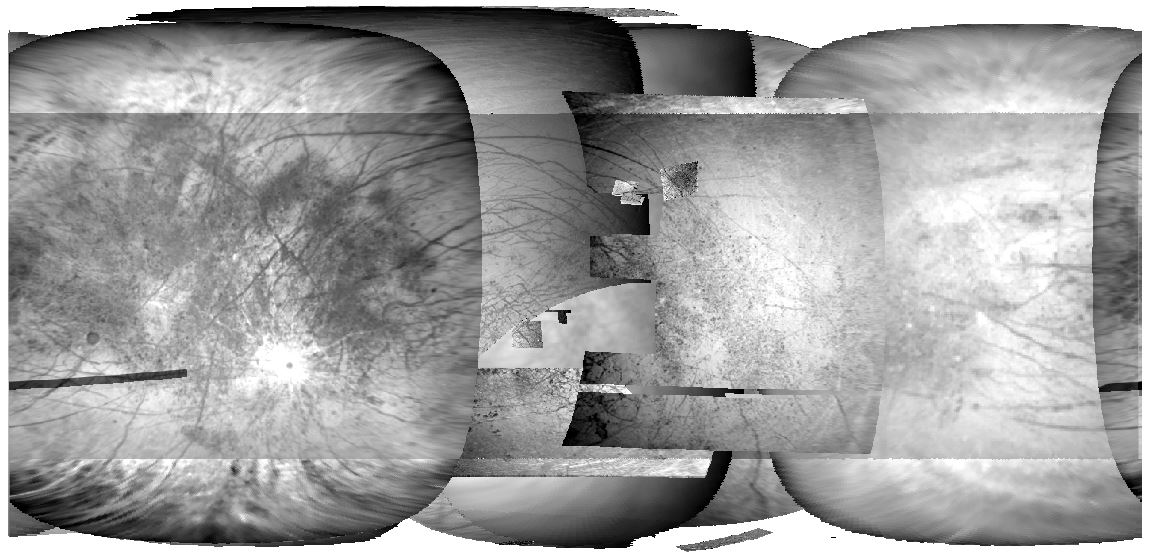
- The Solid State Imager (SSI) on NASA's Galileo spacecraft acquired more than 500 images of Jupiter's moon, Europa, providing the only moderate- to high-resolution images of the moon's surface. Images were acquired as observation sequences during each orbit that targeted the moon. Each of these observation sequences consists of between 1 and 19 images acquired close in time, that typically overlap, have consistent illumination and similar pixel scale. The observations vary from relatively low-resolution hemispherical imaging, to high-resolution targeted images that cover a small portion of the surface. Here we provide average mosaics of each of the individual observation sequences acquired by the Galileo spacecraft. These observation mosaics were constructed from a set of 481 Galileo images that were photogrammetrically controlled globally (along with 221 Voyager 1 and 2 images) to improve their relative locations on Europa's surface. The 92 observation mosaics provide users with nearly the entire Galileo Europa imaging dataset at its native resolution and with improved relative image locations. DOI: 10.5066/P9VKKK7C Data also available for streaming from SpatioTemporal Asset Catalog (STAC) browser. (navigate to "Jupiter Analysis Ready Data" folder). Reference: Bland, Michael T., Weller, Lynn A., Archinal, Brent A., Smith, Ethan, Wheeler, Benjamin H. (2021) Improving the Usability of Galileo and Voyager Images of Jupiter's Moon Europa, Earth and Space Science, Volume 8, Issue 12, doi: 10.1029/2021EA001935.
- Purpose
- The Solid State Imager (SSI) on NASA's Galileo spacecraft provided the only moderate- to high-resolution images of Jupiter's moon, Europa. Unfortunately, uncertainty in the position and pointing of the spacecraft, as well as the position and orientation of Europa, when the images were acquired resulted in significant errors in image locations on the surface. The result of these errors is that images acquired during different Galileo orbits, or even at different times during the same orbit, are significantly misaligned (errors of up to 100 km on the surface). Previous work has generated global mosaics of Galileo and Voyager images that photogrammetrically control a subset of the available images to correct their relative locations. However, these efforts result in a "static" mosaic that is projected to a consistent pixel scale, and only use a fraction of the dataset (e.g., high resolution images are not included). The purpose of this current dataset is to increase the usability of the entire Galileo image set by photogrammetrically improving the locations of nearly every Europa image acquired by Galileo, and making them available to the community at their native resolution and in easy-to-use regional mosaics based on their acquisition time. The dataset therefore provides a set of image mosaics that can be used for scientific analysis and mission planning activities.
Contact and Distribution
- Format
- Regional Mosaic
- Access Constraints
- None
- Access Scope
- Astropedia
- Use Constraints
- None
- Supplemental Information
- https://planetarymaps.usgs.gov/mosaic/Europa/Europa_mosaics/Europa_Mosaics_NPolar.zip, https://planetarymaps.usgs.gov/mosaic/Europa/Europa_mosaics/Europa_Mosaics_SPolar.zip, https://doi.org/10.5066/P9VKKK7C, https://doi.org/10.1029/2021EA001935
- Native Data Set Environment
- ISIS v3
- Astrogeology Theme
- Geographic Information System (GIS), Photogrammetry, Remote Sensing
- Mission Names
- Galileo
- Instrument Names
- SSI
- Online Package Link
- https://astrogeology.usgs.gov/search/map/photogrammetrically_controlled_galileo_image_mosaics_of_europa
- External File Size
- 1.6 GB
- Online File Link
- https://planetarymaps.usgs.gov/mosaic/Europa/Europa_mosaics/Europa_Mosaics_Equirectangular.zip
- Contact Address
- 2255 N. Gemini Drive
- Contact City
- Flagstaff
- Contact State
- AZ
- Contact Postal Code
- 86001
- Contact Email
- astroweb@usgs.gov
- Currentness Reference
- Publication date
- Progress
- Complete
- Update Frequency
- As needed
- Logical Consistency
- A global least-squares bundle adjustment of our final Europa tie-point network calculated latitude, longitude, and radius values for each point by minimizing residuals globally, and resulted in root mean square (RMS) uncertainties of 246.6 m, 307.0 m, and 70.5 m in latitude, longitude, and radius, respectively. The total RMS uncertainty was 0.32 pixels. This work enables direct use of nearly the entire Galileo and Voyager image data sets for Europa. We are providing the community with updated NASA Navigation and Ancillary Information Facility Spacecraft, Planet, Instrument, C-matrix (pointing), and Events kernels, mosaics of Galileo images acquired during each observation sequence, and individual processed and projected level 2 images.
- Completeness Report
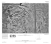
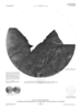
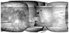
- The dataset includes 481 Galileo images with pixel scale between 5.7 m/pixel and 19532.4 m/pixel. 33 Galileo images of Europa (i.e., with Target=Europa in the label) were not included because 1) they contained no visible target (usually navigation or eclipse images), or 2) there was significant ghosting of the target, or 3) they were too noisy to identify features, or 4) they had very high emission angles and saturation levels (E19 eclipse images). These remaining images were combined into 92 different observation mosaics that cover most of Europa's surface, with the exception of the polar regions.
- Process Description
- In order to improve the locations of Galileo and Voyager images we developed a global network of image tie points (a control network) using the USGS' Integrated Software for Imagers and Spectrometers (ISIS). The control network is the input to the photogrammetric control process, in which a least-square bundle adjustment is performed to triangulate the ground coordinates (latitude, longitude, and radius) of each tie point and minimize location residuals globally. We used the ISIS jigsaw application to perform all of the bundle adjustments. In order to create a global control network for Europa images, we first generated three independent networks: a Voyager-only network, a Galileo-only network, and a "bridge" network that included key Voyager and Galileo images. Each of these networks was bundle adjusted separately to ensure a "clean" network (i.e., free from image mis-registrations). The three clean networks were then merged into a single network and bundled together to update images locations. The final bundle solution used constraints of 500 m in radius and 1 degree on camera angles. We adjusted the orientation of Europa (parameterized as the prime meridian offset W_o) to ensure the data are aligned with the IAU-defined coordinate system for Europa (i.e., the longitude of the crater Cilix must be at 182 degrees west, or 178 degrees east). We then used ISIS to trim each image to remove regions with high emission and incidence angles. In general, we set the maximum emission and incidence angle to 90 degrees; however, 25 images used maximum angles between 80 and 90 degrees to remove distorted data. ISIS was then used to project all images within a single observation to a common pixel scale (equivalent to the smallest pixel scale in the observation sequence, pixel scales typically only varied by 10s of meters between images) and equirectangular projection. Average mosaics were created using ISIS' automos application. Additional details are provided in Bland et al. 2021.
- Source Title
- Improving the Usability of Galileo and Voyager Images of Jupiter's Moon Europa
- Source Online Linkage
- https://doi.org/10.1029/2021EA001935
- Source PDS Archive
- Galileo
- Attribute Accuracy Report
- Accurate to Control Net
- Horizontal Positional Accuracy Report
- Accurate to Control Net
- Vertical Positional Accuracy Report
- Accurate to Control Net
Geospatial Information
- Target
- Europa
- System
- Jupiter
- Minimum Latitude
- -90
- Maximum Latitude
- 90
- Minimum Longitude
- -180
- Maximum Longitude
- 180
- Direct Spatial Reference Method
- Raster
- Object Type
- Grid Cell
- Bit Type (8, 16, 32)
- 32
- Quad Name
- Radius A
- 1560.8
- Radius C
- 1560.8
- Horizontal Coordinate System Units
- Degrees