 An official website of the United States government.
 Official websites use .gov
A .gov website belongs to an official government organization in the United States.
Official websites use .gov
A .gov website belongs to an official government organization in the United States.
 Secure .gov websites use HTTPS
A lock or https:// means you’ve safely connected to the .gov website. Share sensitive information only on official, secure websites.
Secure .gov websites use HTTPS
A lock or https:// means you’ve safely connected to the .gov website. Share sensitive information only on official, secure websites.
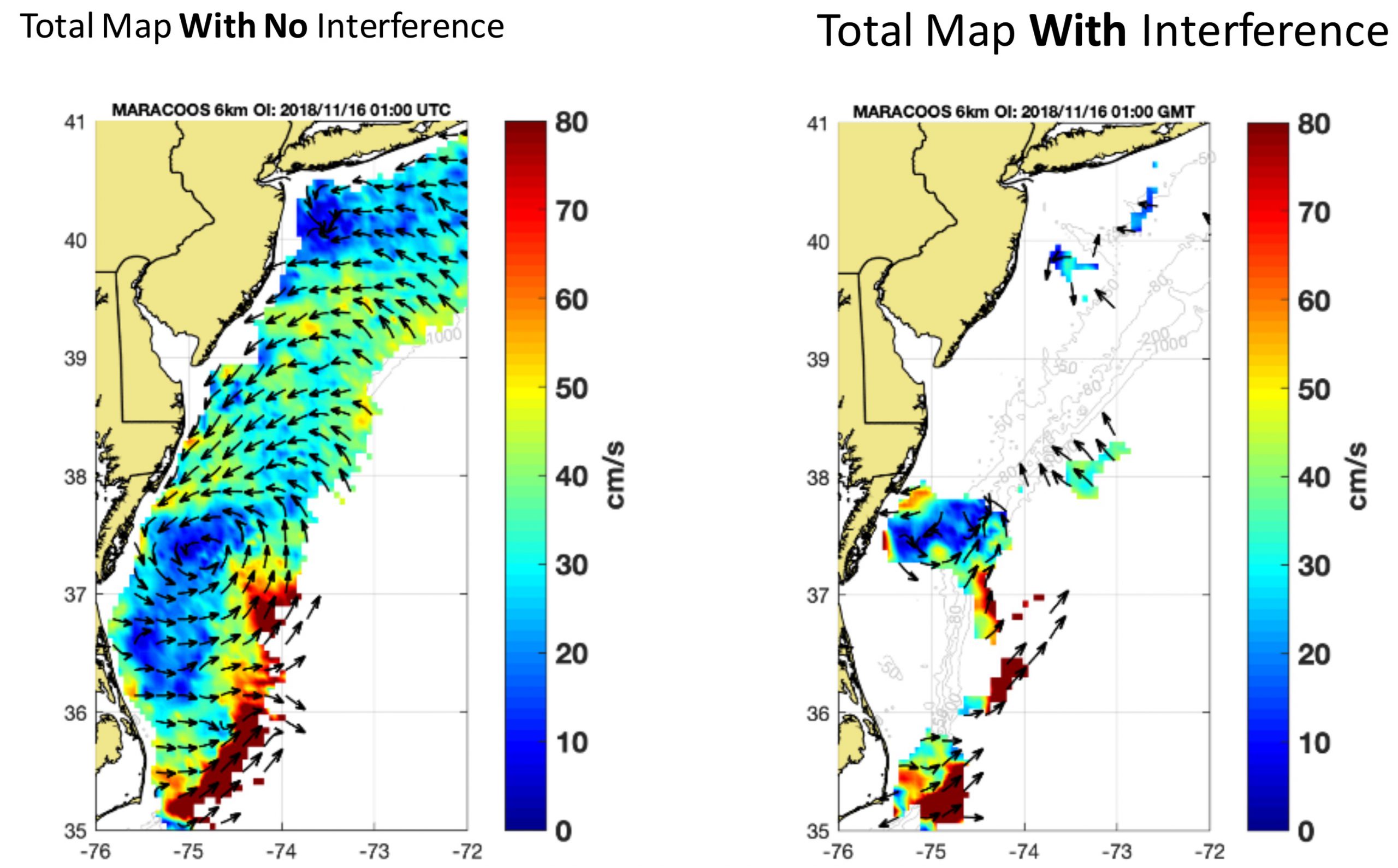
Caption: A snapshot of the present-day coverage of HFR-based surface currents from the MARACOOS HFR array at left, with the current speed shown in color and the direction by the arrows. At right, the same snapshot, but with the portions that would be affected by all planned offshore wind energy installations within the Mid-Atlantic Bight removed. This simulation illustrates the worst-case scenario of potential future HFR observations of surface currents given the planned offshore wind energy installations.