
When water managers talk about the 2020-21 water year, they describe it beginning in October and ending in September. The irrigation is done, and the harvest complete.
By October, we expect rain or even snow — and the fires to go out — and the planting of winter wheat and new trees, anticipating regrowth in spring.
Over winter, snow piles up in the mountains, creating a cushion that slowly melts to irrigate and nourish crops, provide passageway for migrating salmon in creeks and streams, and recreational opportunities for people on lakes and rivers. Rain and snowmelt recharge our aquifers, and support our rain forests, and communities both east and west.
In the big picture, snowpack generates power for the entire region at dams on the Columbia River. It creates a corridor for container ships making ports of call at Portland below the major dams and barges moving cargo and crops to and from Clarkston through the Snake River.
Yet, here we are in September, despite recent rain, looking at conditions that are some of the driest in recorded history.
In April, a huge reserve of water, stored in the form of snow in the high Cascades, measured in at a whopping average of 132% of normal, statewide. It appeared we were set.
Now wildfires still smolder, and 11 Eastern Washington counties are drier than they’ve ever been, since data was first tracked in 1895.
According to the National Weather Service, overall from March to August, the state saw 6.90 inches of precipitation. Normal during that time frame is 13.03 inches — a more than a 6-inch deficit, making the statewide water year the second driest in history.
Also, from March to August, nearly three-fourths of the state experienced record dryness and the other quarter was “much below normal,” that is, in the bottom 10%. Not a pretty picture even for the rainiest parts of Washington.
For example, to end the current drought in the lower Columbia River area, Ecology Drought Coordinator Jeff Marti noted that we’d need 11 inches of rain by next April. The odds of that kind of rebound are low and has only happened fewer than five times over the last 120 years.
“The question is, will we have a full recovery before next spring?” Marti said. “The odds for significant improvement of conditions are pretty good for Western Washington. But I’m less optimistic about the east side. Based on historic climatology, the odds for significantly ameliorating current conditions is about 1 in 5 across Eastern Washington. For a full recovery in Eastern Washington, the odds are about 1 in 20.”
National Oceanic and Atmospheric Administration (NOAA) data shows through the month of August, Grays Harbor County has had the fourth driest “water year” — water years begin with the typical storm season, Oct. 1 — since records began to be kept in 1895.
From March through August of this year, NOAA’s water value (surface water supply) for the county stands nearly 11 inches lower than the average value over the last 125-plus years, normally more than 27 inches.
Reviewing the data and analyzing the odds help us to anticipate conditions and provide assistance where we can. This year the snowmelt captured in storage protected the irrigated farmer, but there wasn’t enough precipitation held in the loamy soil for the dryland farmer. So there’s lots to watch in the months to come.
La Nina effect
While a La Nina forecast increases the odds of a wetter winter, it doesn’t guarantee it, Marti said.
“And even a good La Nina could leave areas of lingering deficits, so people need to be vigilant,” he added. “Remember, last winter was a La Nina winter as well.
“This may be sobering, but we want to lay out what we know to try to help farmers, legislators, water managers and others to make the best decisions for what they need. We can’t tell people what will happen, but we can at least share what we know about probabilities.”
Putting a fine point on the unexpected, Marti noted that on Aug. 26, the Nooksack River in Whatcom County experienced record low flows — this in a basin where snowpack was 120% of normal.
“Back in April, looking at our awesome snowpack, I certainly wouldn’t have expected that this year the Nooksack would be establishing some record day-of-year lows,” said Marti. “You never can turn your back and relax because things can deteriorate.”
Nearly zero precipitation in spring, and a heat wave doming the state early in summer, led to rapid runoff from melting snow. The watersheds with storage, particularly the Yakima River Basin and the Columbia mainstem, have largely been unscathed. Still, soil is parched, and water stored in reservoirs is low.
For those areas where precipitation has been nil, and where they lack irrigation, it has been particularly difficult.
Washington wheat, lentil, chickpeas, and potatoes are a huge trading commodity — in the billions of dollars. Federal drought emergency assistance is on the way for many, but that doesn’t provide comfort for next year.
“We’re still on the clock,” Marti said, as we look to the end of one water year and anticipate another.
The Daily World staff writer Dan Hammock contributed to this report.
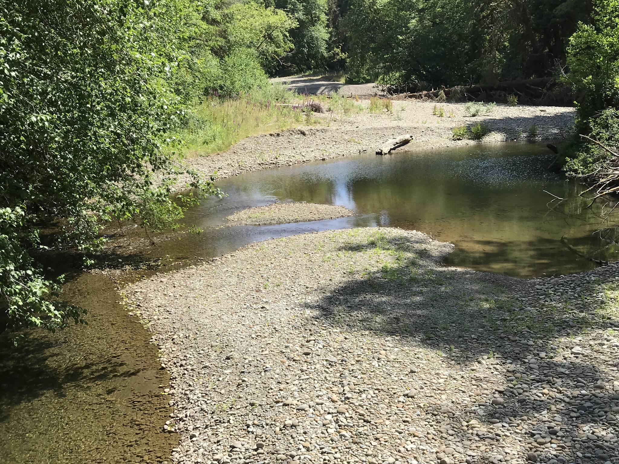
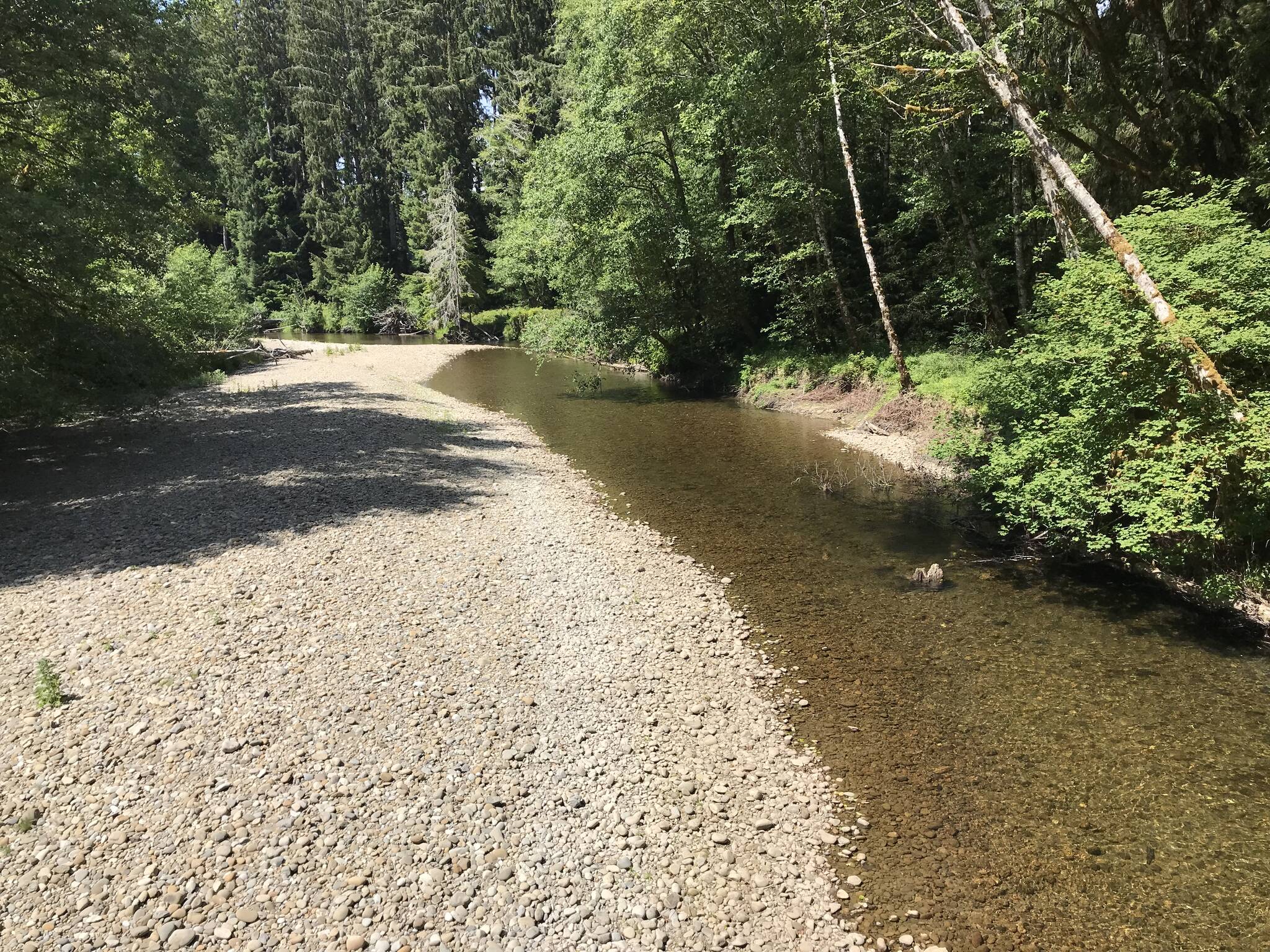
Low water conditions on the Salmon River, a tributary of the Queets River, in 2019, which was a similarly dry year to 2021. (Courtesy Department of Ecology)
