In 2021, GLOS funded a project to create small “Mussel Kits” that could turn ordinary fish finders or other echo sounders aboard everyday vessels into basic lakebed surveyors.
These palm-sized devices allowed the participating vessels to contribute crowdsourced bathymetry (CSB) data to a centralized database, eventually contributing to the shared Great Lakes lakebed map.
“Mussel Kits” were designed and built by Orange Force Marine, a survey and specialized marine services company based in Port Stanley, Ontario. Founders Derek Niles and Colin Thomson have built 24 kits and have begun installing them on volunteer “vessels of opportunity”—vessels equipped with adequate navigation systems and that regularly travel throughout the Great Lakes.
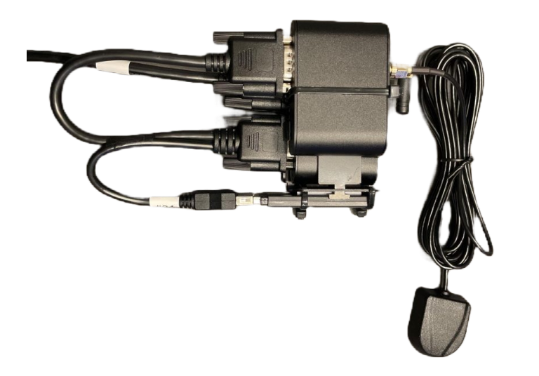
As a vessel navigates, the Mussel Kit, working alongside the echo sounder collects a series of points file containing:
- Latitude and longitude
- Depth
- Date and time
- Vessel information
As the on-board single beam echosounders scan far less of the lakebed than expensive survey-grade multi-beam or side-scan sonar devices on survey vessels, crowdsourced bathymetry works at scale by:
- Putting dozens or hundreds of low-cost kits on boats,
- Transmitting data automatically to a centralized hub,
- Over time, as vessels traverse the same section of the lake time and again, combining the data to create a high-density surface of the lakebed.

Data quality is a paramount concern in the hydrographic community. So, in order to contribute this Great Lakes data to the International Hydrographic Organization’s (IHO) crowdsourced bathymetry initiative, data has to come from an approved organization, or “Trusted Node.” Data also has to pass a series of quality control tests including removing:
- Data collected while the boat sat idle over the same point, like while docked.
- Data with erroneous latitude and longitude due to GPS error.
- Data showing impossible depth measurements.
- And more.
GLOS became certified as a Trusted Node and set to work building a data pipeline direct from their cloud-based server to the IHO’s Digital Bathymetry Data Center (DCDB), which stores, verifies, and visualizes the data.
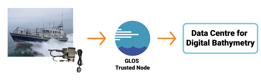
Once Orange Force Marine determines that a vessel is a good candidate for a Mussel Kit based on the electronics configuration and sailing profile, they install the kit, calibrating each based on the vessel’s sensors and dimensions, and then watch the data come in as the vessel goes about it’s daily business on the Lakes.
The Mussel Kit collects and uploads the data in the background so boat operators have no extra work. Every few weeks, once the data has been quality controlled, it appears on the DCDB.
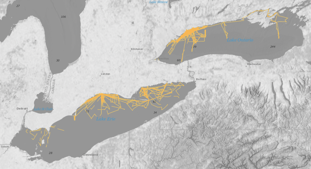
Currently, 12 GLOS-funded kits are installed on vessels mostly on the Canadian side of Lakes Erie and Ontario, with more planned for installation in other lakes, on both sides of the border over the winter months.
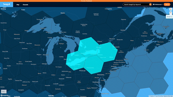
To help people understand how much of the lake is yet to be mapped, GLOS is developing a layer on Seagull that can visualize areas where high-density data has been collected. The layer can highlight unmapped areas so that, eventually, those operating crowdsourced bathymetry-collecting vessels can consider covering those areas.
Crowdsourced bathymetry is just one method that can contribute to mapping the remaining 85% of the lakes. Used alongside traditional surveying methods and combining with newer, autonomous system options, a complete lakebed map is possible in the near future.
View and download the data at the DCDB.
Interested in equipping your vessel with a Mussel Kit? Email Derek Niles at dniles [at] orangeforcemarine.com.