By, Annie Raymond
In 1959, following the International Geophysical Year of 1957-58, scientists from twelve nations conducting active research in Antarctica came together and signed the Antarctic Treaty. In the years following, 42 additional countries acceded to the treaty. The treaty preserves the entire continent and surrounding waters solely for purposes of peaceful scientific collaboration and bans resource extraction and military activity. McMurdo Station on Ross Island, operated by the United States through the United States Antarctic Program, a branch of the National Science Foundation (NSF), has emerged as the largest year-round station and primary logistics hub for the region. The first U.S. Operation Deep Freeze happened prior to and in support of the International Geophysical Year of 1957-58. Since then, Operation Deep Freeze has continued annually and has become the name for supply sealift missions to McMurdo, delivering fuel, food, and supplies to scientists in Antarctica.
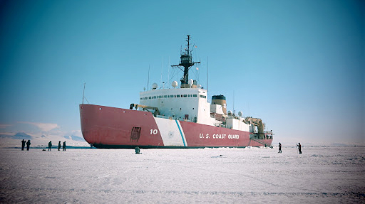
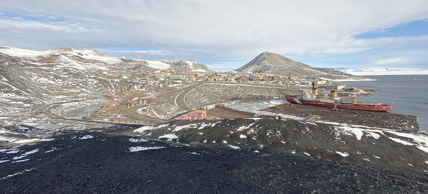
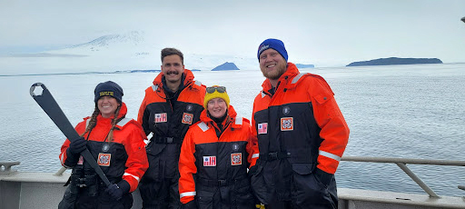
From November 25, 2021 to February 11, 2022, the Office of Coast Survey, Navigation Response Branch team members Lt. j.g. Collin McMillan, Michael Bloom, and Annie Raymond traveled aboard the U.S. Coast Guard heavy icebreaker Polar Star on its 25th Operation Deep Freeze. The Polar Star’s primary mission involves cutting a channel through the ice and clearing the way for supply vessels to reach McMurdo Station, Antarctica. The Coast Survey team joined the regular mission in order to conduct a hydrographic survey of Winter Quarters Bay at McMurdo in support of the National Science Foundation’s Antarctic Infrastructure Modernization for Science project. In particular, the foundation is looking into building a permanent pier structure in the bay. The current pier at McMurdo is made from ice and gravel in layer cake fashion and needs to be periodically rebuilt, as it is very susceptible to warming conditions and wave action.
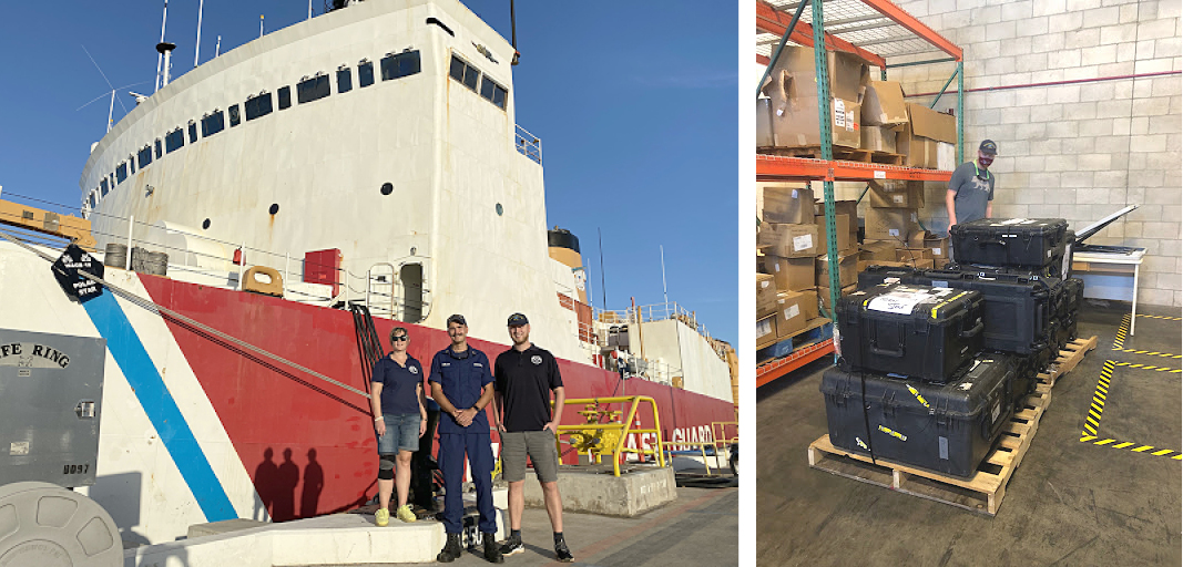
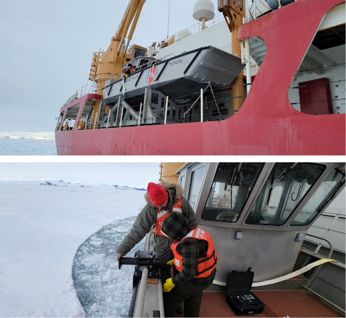
The Coast Survey team met the ship on Thanksgiving in Honolulu, Hawaii along with 16 cases of the Mobile Integrated Survey Team (MIST) kit. The kit contents includes a multibeam sonar and mount, global positioning antennas, multiple sensors, and processing equipment. The contents of the kit – specifically the sonar mount – are designed to deploy on vessels of opportunity and are flexible enough to be mounted to a variety of different boat designs.
Preparing and testing the equipment
Prior to deployment, team members Mike Annis, Annie Raymond, Patrick Faha, and Timothy Wilkinson met up with the Polar Star at its homeport in Seattle to test fit the MIST kit on their deployable landing craft vessel. Following the successful test fit, Mr. Annis and the rest of the Antarctic survey team, traveled with the kit to NOAA’s Florida Keys National Marine Sanctuary for a combination shakedown, training, and survey mission in conjunction with the National Marine Fisheries Service and National Center for Coastal and Ocean Science. The trip provided the team important experience with the entire MIST kit deployment process – from setup and mobilization, to operation and takedown – and most importantly troubleshooting and teamwork.
Transit towards Antarctica
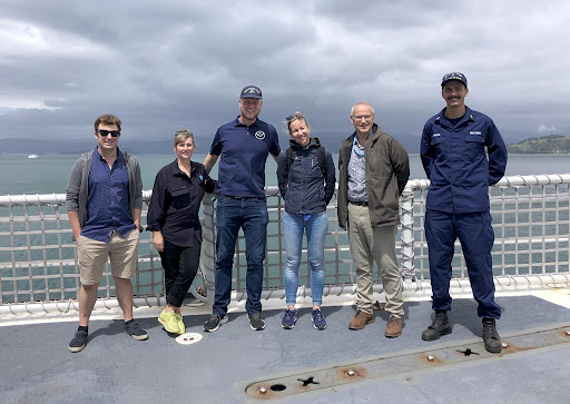
After departing Honolulu, the Polar Star stopped in Wellington and Lyttelton, New Zealand where the survey team had the opportunity to meet members of the New Zealand Hydrographic Office, Land Information New Zealand (LINZ) in Wellington. The hydrographic office provided the team with valuable charts, information about McMurdo, and offered tidal data from their tide station in the region. Land Information New Zealand is the primary hydrographic office responsible for nautical charts of the Ross Sea area of Antarctica. The team offered to provide all survey data acquired from the trip to the hydrographic office and shared a hope that additional survey time would be available for the vast un-surveyed areas in and around McMurdo and Ross Island.
Arriving in Antarctica
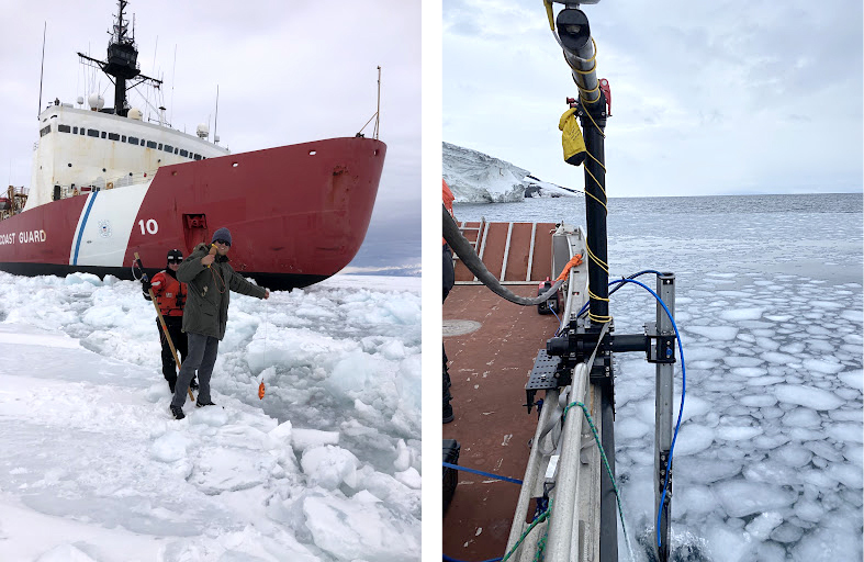
The Polar Star reached the Antarctic Circle and ice edge around the turn of the new year and began the process of cutting and re-cutting a channel into the fast ice in the Ross Sea toward McMurdo. Aboard the cutter, the survey team eagerly awaited the day the ice would clear from Winter Quarters Bay and survey work could commence. In the interim, the team assisted NOAA Corps Marine Science Officer Lt. Lydia Ames with the deployment of data buoys, presented a tech talk to the crew on why they were on board and what the response teams do, worked on updating documentation, cleaned and organized cases, and installed and tested equipment.
On February 1, the ice finally cleared enough from Winter Quarters Bay and survey operations commenced as soon as weather permitted and within the window provided by the supply ships. In spite of the inhospitable conditions and sub-zero sea water temperatures, the only equipment casualty was a sensor. It’s unknown if the sensor failed due to age, operating outside of its specified temperature range, or some other factor. Without the backup sensor in tow, the team was able to establish a work-around by taking more frequent measurements of water conductivity, temperature, and depth, replacing the batteries after every other cast due to the cold temperatures.
Total surveyed areas and conclusion
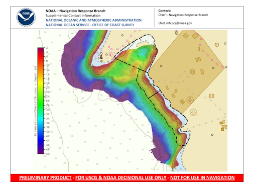
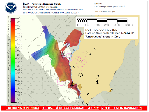
In total the team was able to complete all of the National Science Foundation’s assigned priority areas and fill in gaps in un-surveyed areas in McMurdo Sound. The overall total area surveyed was 2 square international nautical miles (6.88 square kilometers) and 1.39 square international nautical miles (4.78 square kilometers) in un-surveyed areas. With depths ranging from 2 to 530 meters and with 18 deep sound velocity casts and many more surface only sound velocity casts. Data collected will be provided directly to the National Science Foundation, Land Information New Zealand, and the National Geospatial-Intelligence Agency. The data will also be publicly available via NOAA’s National Centers for Environmental Information.
While the project demonstrated the versatility of deploying the MIST kit, it also highlighted the lack of redundancies and corresponding single points of failure existing with the current kit. Aging systems are also an emerging issue and the harsh Antarctic conditions introduce accelerated wear and tear to exposed equipment. Extending the versatility of the kit and increasing the ability to complete future cooperative projects, would mean adding more redundancies to systems, upgrading aging equipment, and certifying more personnel on its use.
In addition to the three-member team deployed, the mission would not have been possible without these additional NOAA employees who were instrumental in project planning and operations – Cmdr. Megan Guberski, Mike Annis, Vanessa Russell, Grant Froelich, Tiffany Gaymon, and Lt. Lydia Ames. The project would also not have been possible without the support and cooperation of the entire crew of the USCG cutter Polar Star, the National Science Foundation, and the support and cooperation of Land Information New Zealand – thanks to all.
Nicely written and very well explained. Were there any surprises resulting from survey data?
I enjoy getting the Ocean Conservancy calendar and other information about their work. I grew up at the beach in California. Warm water warm weather. But I enjoyed this lengthy article on the exploration of the Antarctic Particularly I was pleased to see women scientists as part of the team from NOAA. And impressed to learn how these scientists can function in freezing and below freezing temperatures. Thanks.