
Sand in the Southeast
Sand is a critical resource for the Southeast United States. Our sandy beaches draw millions of people to live and visit, and offshore sand shoals provide valuable ecological habitats. Since sand is a finite resource, there is a need to find a balance between its socio-economic and ecological use. Multiple organizations are working to improve long-term sand management. Explore the resources below to learn more about sand in the Southeast, how to access available data, and opportunities to further collaboration across the region.
Click on the icons to go to the following sections:

Understanding Sand in the Southeast U.S.

Socio-Economic Values:
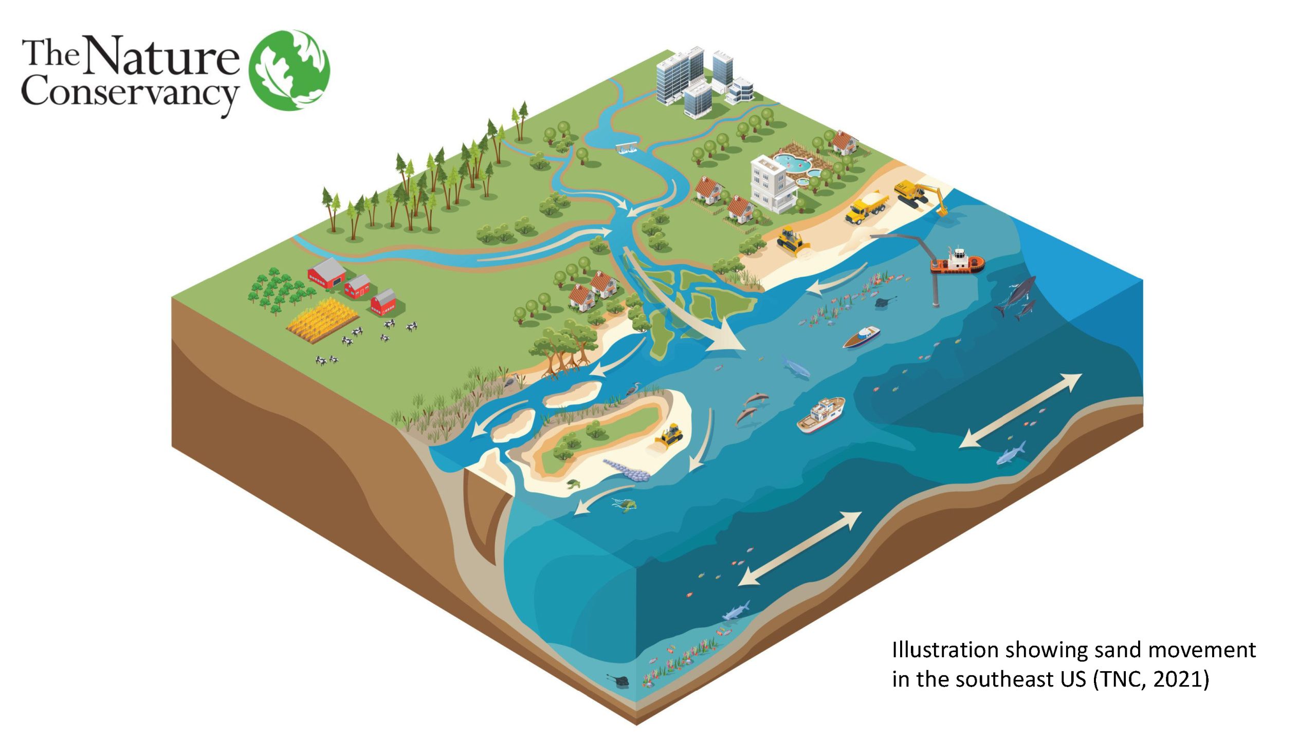
Offshore shoals, riverine deltas, and oceanfront beaches are some of the Southeast Atlantic coastal features comprised of sand. These features have ecological and socio-economic value across the region. How we manage this connected system will impact the long-term sustainability of our coast. And the connected nature of sand, which sand is deposited from river systems and travels along the coast with wave energy, necessitates working across boundaries.
- A well-developed beach system absorbs wave energy, decreases coastal flooding, and provides a buffer to sea level rise – functions that provide protection to oceanfront communities and infrastructure.
- Beaches also provide recreational opportunities for people, boosting state and local economies.
- Shoals contribute greatly to the recreational fishing industry, a major economic section for the South Atlantic region.
- The nation’s beaches generate about $225 billion a year for the national economy and contribute approximately $25 billion in federal tax revenue, which not only makes them valuable to our nation’s and state’s economy, but also critical to local coastal economies (USACE).
Ecological Values:
- Beaches provide natural habitat for a variety of plants and animals, including shorebirds and sea turtles.
- Sandy shoals located offshore provide habitat for benthic invertebrates, fishes, and food for shorebirds and larger predatory fishes.
QUICK FACTS
- Between 2008-2018, South Atlantic states completed 208 beach nourishment projects using over 105 million cubic yards of sand.
- Over $2.5 billion has been spent on beach nourishment projects across the southeast.
- The nation’s beaches generate about $225 billion a year for the national economy and contribute approximately $25 billion in federal tax revenue.

Accessing Sand Data and Tools
Sand and beach data are compiled, assessed, and distributed at multiple scales which can make it challenging to find existing resources. Below are brief descriptions and direct web links to several key resources. Click here to access a table of sand resources identified during the project.
State Resources
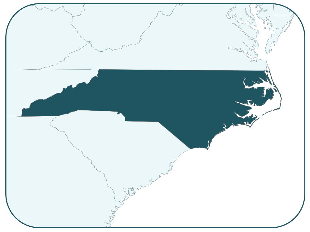
NORTH CAROLINA
A cooperative agreement with BOEM supported an Offshore Sand Resources Investigation completed in 2016. Data was originally shared through a North Carolina Coastal Atlas, which is no longer active.
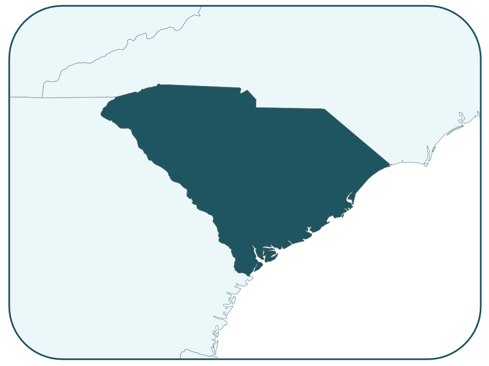
SOUTH CAROLINA
South Carolina does not maintain an online tool relating to state sand data; however, a South Carolina Offshore Sand Resources – Data Inventory and Needs Assessment was completed in 2016 with support from BOEM.
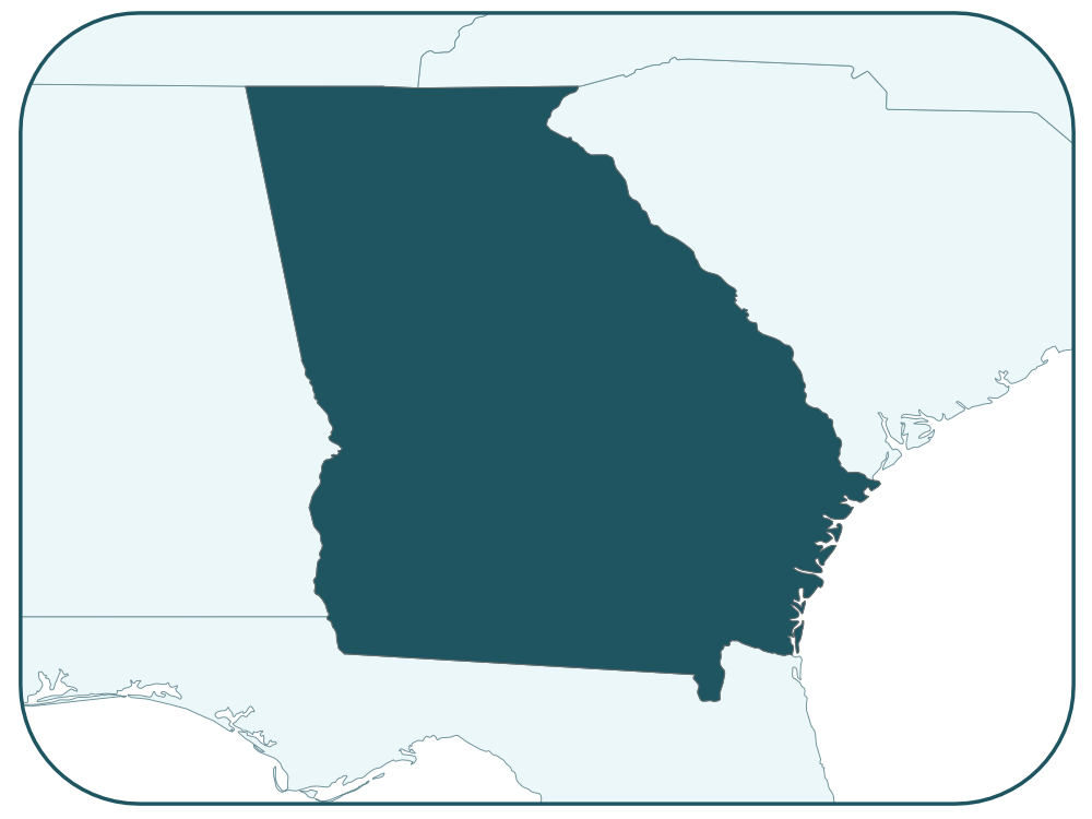
GEORGIA
The Georgia Coastal Hazards Portal provides access to a variety of data sets, including sediment distribution and characteristics, through an online mapping tool.
FLORIDA
Florida’s Regional Offshore Sand Source Inventory (ROSSI) is accessible through an online portal maintained by the FL Department of Environmental Protection
Federal Resources
The three federal agencies with online sand resources information are the Bureau of Ocean Energy Management (BOEM), United States Army Corps of Engineers (USACE), National Oceanic and Atmospheric Administration (NOAA). To visit a specific site, click on the associated image.
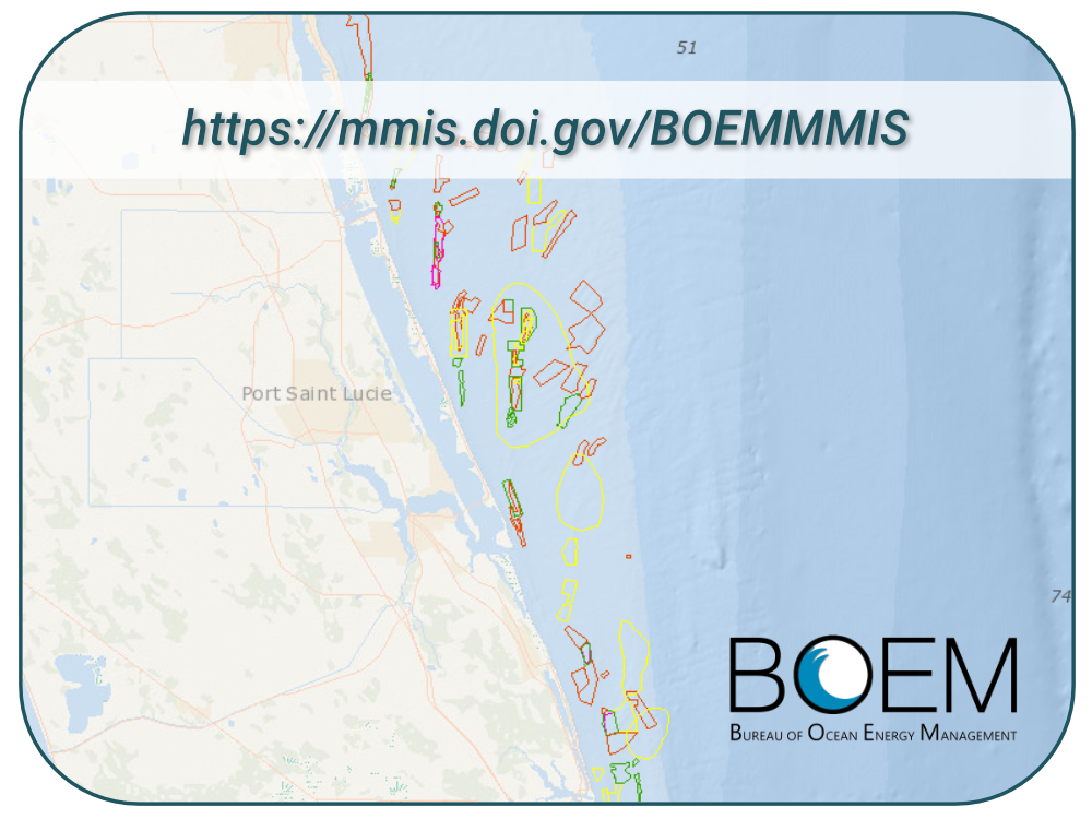
BOEM Marine Minerals Information Systems (MMIS)
An interactive tool that provides public access to data and information relevant to offshore mineral resources throughout the United States
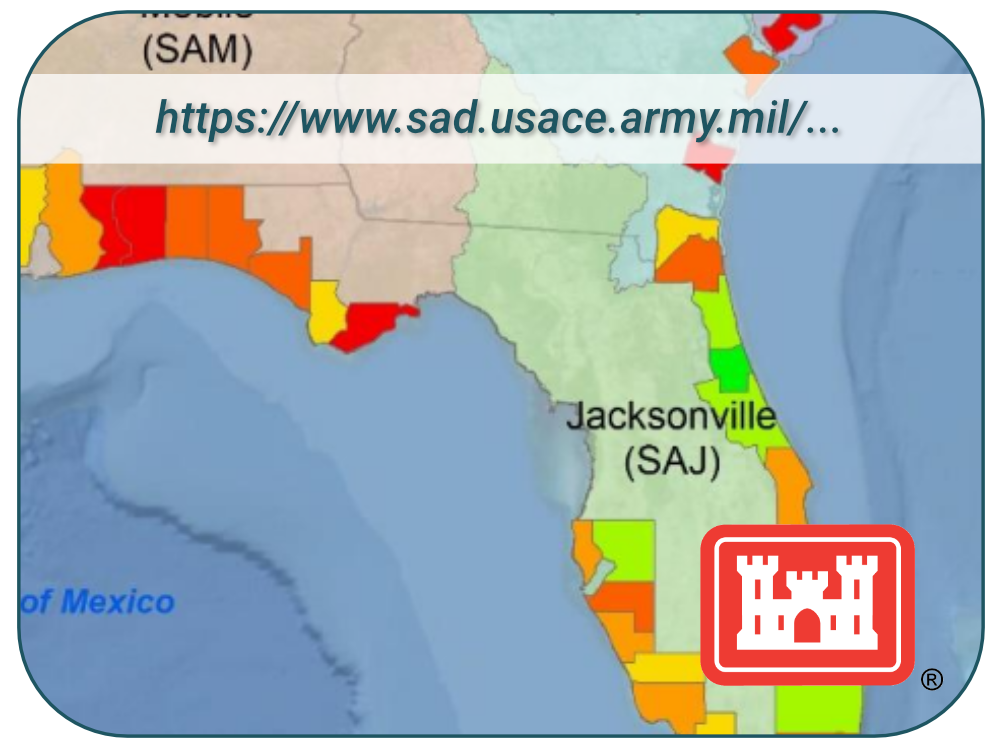
USACE Sand Availability and Needs Determination (SAND)
As part of the South Atlantic Coastal Assessment, the SAND analysis quantifies sand needs and available sand resources for current Southeast beach nourishment projects for the next 50 years
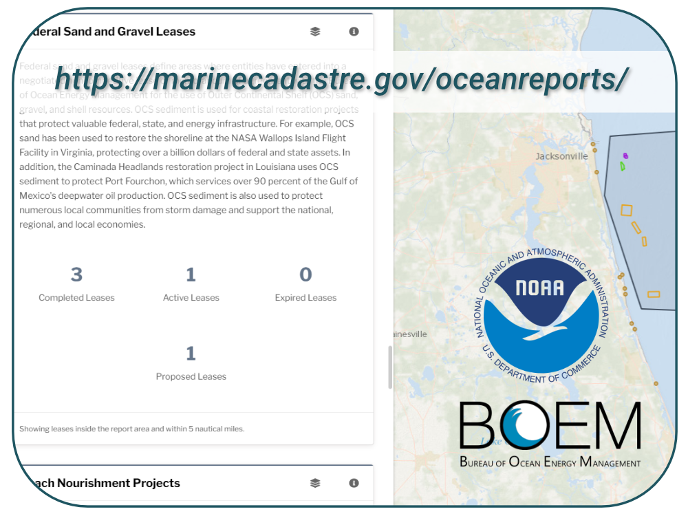
NOAA/BOEM Ocean Reports
Using data from the federal Marine Cadastre, the Ocean Reports website provides specialized “ocean neighborhood analyses,” including maps and graphics, by analyzing more than 100 ocean datasets instantaneously

Opportunities and Recommendations
To better understand how existing data is used and what opportunities there are for additional collaboration across the region, interviews were conducted with sand constituents from across the region. An overview of the interview process and recommendations are available to review here.
Following are recommendations that stemmed from conversations with government agencies, consultants, and researchers:
Accessing Data and Tools
- Advance existing resources that are used to help identify potential sand borrow sites, including:
- Federal data sources and online tools, including BOEM’s Mineral Management Information System (MMIS)
- Topographic and bathymetric maps to identify sites based on geological featuresSand research studies led by government agencies and universities
- Continued sand research studies led by government agencies and universities
- Connect and facilitate access to existing sand data resources
Exisiting Data Gaps
- Fill data gaps that exist within state waters
- Use the potential borrow sites identified by BOEM to prioritize areas for detailed data collection
- Monitor/track changes at borrow sites to understand the biological impacts and viability of reuse
- Identify ways to collate and share data collected by engineering firms and consultants on behalf of local governments. This data is primarily available through technical reports submitted with permit requests.
Permits and Regulations
- Evaluate the impact state and local beach sand requirements (e.g. grain size, color) have in limiting the number of viable sand sources (including beneficial use) and identify best practices.
- Review restrictions of different funding sources on project design, particularly related to new and innovative project design and methodology
- Review the processes used for emergency post-storm permitting as these can present greater challenges than the general permit process
Collaboration and Funding
- Enhance regional collaboration between federal, state and local partners and across public and private constituents
- Share best practices for data sharing and access with state and local governments
- Identify new sources of funding sources, including state and local mechanisms, to support sand data collection, research, and management
Regional Ocean Data Sharing Project Overview: Southeast Sand Resources
Project Description: The project is designed to enhance collaboration across the varied sand/seafloor related projects underway across the southeast and to better understand decision-maker needs in order to prioritize data collection and inform future tool development around sand management in the southeast.
Long-term Vision: A user-friendly collaboration mechanism that engages state, federal and local stakeholders in the long-term sustainable management of sand in the southeast.
Objectives:
- Foster collaboration amongst organizations mapping sand resources and seafloor habitat across the southeast (BOEM, US ACE, NOAA, state agencies and universities)
- Connect technical leads with coastal managers and communities to share existing data/tools and discuss their relevance
- Better understand the critical gaps for long-term sand management across the region.
- Develop communication materials that can be used by diverse partners to share the importance of and needs related to sand in the southeast
Steering Committee:
| Jill Andrews Georgia Department of Natural Resources | Bob Crimian The Nature Conservancy | Barbara Neale South Carolina Department of Health and Environmental Control |
| Robert Brantly Florida Department of Environmental Protection | Debra Hernandez Southeast Coastal Ocean Observing Regional Association | David Stein National Oceanic and Atmospheric Administration |
| Heather Coates North Carolina Department of Environmental Quality | John McCombs National Oceanic and Atmospheric Administration | Megan Treml National Oceanic and Atmospheric Administration |
| Mary Conley The Nature Conservancy | Clay McCoy United States Army Corps of Engineers | Lora Turner Bureau of Ocean Energy Management |
Contact
If you are interested in learning more, please email SUSD_OCN@TNC.ORG.