
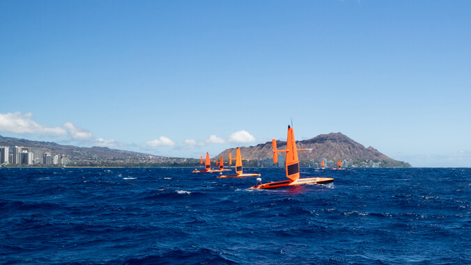
Three Saildrone Explorers, uncrewed surface vehicles used to measure ocean data, embarked on a six-month journey around Hawaiʻi Island, Maui, Oʻahu and Kauaʻi to evaluate ocean health across the state. The University of Hawaiʻi at Mānoa and the National Oceanic and Atmospheric Administration’s Pacific Marine Environmental Lab (PMEL), and the Cooperative Institute for Climate, Ocean, and Ecosystem Studies (CICOES), are working with Saildrone Inc. to pilot this effort.
The 23-foot ocean drones will send back critical data and images in real-time to scientists in Hawaiʻi and Washington State so they can assess how climate change and ocean acidification are impacting our coastal waters.
The saildrones left from Pacific Shipyards International in Honolulu Harbor on Oʻahu in March and the official mission started on April 1.
Each saildrone will collect critical ocean chemistry observations around Hawaiʻi to better assess the state’s vulnerability to ocean chemistry changes. This effort is a part of the $50 million gift from Dr. Priscilla Chan and Mark Zuckerberg to the Hawaiʻi Institute of Marine Biology in 2022 to improve Hawaiʻi’s ocean health.
The saildrones will provide information about Hawaiian Island nearshore water quality and chemistry in a way that has not been possible using previous shipboard approaches. Advanced
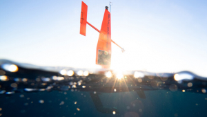
safety protocols including automated dynamic positioning and piloting based on real-time
measurements of GPS location, winds, and currents; 24/7 on-watch mission managers to oversee all operations; Automatic Identification System for identifying and avoiding other vessels; and highly visible lights and markings keep the vehicle safe even close to shore.
“These ocean drones will be out sampling continuously for the next six months, providing a thousand times more ocean chemistry measurements in coastal waters than has ever been available,” said Christopher Sabine, PhD, UH Mānoa interim Vice Provost for Research and Scholarship and oceanography professor in the School of Ocean and Earth Science and Technology (SOEST).
Beginning off of Hawaiʻi Island, two saildrones will zigzag between the island’s coastline and five kilometers offshore, and the third saildrone will sail a direct continuous route around the island. The instruments will only monitor atmospheric and ocean properties and will not collect any data that can be used to identify people, marine mammals or fish locations.
“The saildrones will be measuring different water quality measurements and this will help tell us a little bit about how our water chemistry is changing with climate change, and with changing ocean conditions in our nearshore environment,” said Amy Markel, an oceanography PhD student who is working with Sabine on this project.
‘Hot spots’ of ocean acidification
The saildrone’s integration of pH and carbon dioxide measurements gives researchers the ability to better understand whether nearshore waters are accumulating fossil fuel emissions. They will be able to develop maps from field measurements to help them look for “hot spots” of ocean acidification.
With these maps, researchers can determine where it will be safe for organisms that use calcium carbonate to accrete (build) their skeletons or shells (corals, oysters, crabs, etc.), or where the carbon water chemistry will likely erode or reduce these organisms’ ability to build their bodies.
It’s important to recognize where there may be areas that are more vulnerable to changing carbon chemistry, or spots where organisms may have a lower ability to accrete.
A collaborative effort
This effort is a collaboration between UH Mānoa (who is covering the cost for two saildrones), CICOES (who is covering the cost of one saildrone with funding from the Integrated Ocean Observing System Ocean Technology Transition program), and Saildrone Inc. who will be operating the vehicles.
“Saildrone is thrilled to partner with UH Mānoa and CICOES on this important mission to better understand ocean chemistry around the Hawaiian Islands,” said Matt Womble, Saildrone Director of Ocean Data Programs. “In 2013, Saildrone performed the first ‘no-handed’ Pacific Crossing from San Francisco to Oʻahu; 10 years on, we’re proud to continue our work in Hawaiʻi, further demonstrating the capabilities of our Explorer-class vehicles to better understand how oceans are changing.”
The research is also connected to a NOAA-funded project to assess the vulnerability of the Hawaiian Islands to climate change and ocean acidification.
