NOAA hydrographic survey ships, navigation response teams, and contractors are preparing for the 2023 hydrographic survey season. The ships and survey vessels collect bathymetric data (i.e. map the seafloor) to support nautical charting, modeling, and research, but also collect other environmental data to support a variety of ecosystem sciences. NOAA considers hydrographic survey requests from stakeholders such as marine pilots, local port authorities, the Coast Guard, and the boating community, and also considers other hydrographic and NOAA science priorities in determining where to survey and when. Visit our “living” ArcGIS StoryMap to find out more about our mapping projects and if a hydrographic vessel will be in your area this year!
Atlantic Coast
Cape Cod Bay, MA – Wellfleet Harbor and Provincetown Harbor need new hydrographic surveys to update the nautical chart. Much of the area was last surveyed in the 1930s.
Tappan Zee Bridge – A hydrographic survey is needed around the newly constructed Tappan Zee Bridge. The new bridge has a different pier orientation than the former bridge and has changed what portions of the river are open to commercial traffic. This survey will ensure that there is no remaining demolition/ construction debris or obstructions within the navigable channels, allowing commercial traffic to maximize use of the waterway.
Sakonnet River, RI – Bathymetric data is needed to update nautical charts of the Sakonnet River – existing data is from 1957 and 1963.
Approaches to New York – This project, a continuation of the 2021 project, includes the eastern traffic separation scheme for large vessels calling upon the Port of New York and New Jersey as well as the southern approach along the coast of New Jersey. The new data collected will supersede 1970s chart data, providing modern bathymetric data to update nautical charting products as well as support the Nippon Foundation-GEBCO Seabed 2030 global mapping initiative.
Patapsco River, MD – The Patapsco River, including Baltimore Harbor is in need of a modern hydrographic survey. The data from this survey will update NOAA’s nautical products.
Potomac River, MD – There is a need for modern bathymetry in the Potomac River with the majority of the data from prior to 1974. The data collected for this project will serve many purposes. It will be used to update nautical charts and products, and will provide forecasters at NOAA’s National Water Center with bathymetric data for critical hydrodynamic modeling.
Southwest Chesapeake Bay Rivers – This 500 square nautical mile project spans four rivers in the southwestern Chesapeake Bay watershed: the Potomac, Rappahannock, James, and York Rivers. These rivers are home to millions of people in a range of environments from rural farmland to heavily populated regions such as Washington, DC and Hampton Roads, Virginia.
Albemarle Sound, NC – Albemarle Sound, last surveyed in the 1920s, is a large, shallow, low-salinity estuary which extends approximately 50 nautical miles inland from the Outer Banks barrier islands. For this project, approximately 500 square nautical miles of modern, high-resolution hydrographic data will be collected in Albemarle Sound and connecting rivers.
Approaches to Wilmington, NC – The region around Wilmington, North Carolina experiences high vessel traffic transiting the eastern seaboard of the U.S. as well as traffic to and from the port. Numerous historic storms and hurricanes have impacted this region, potentially changing the seafloor from the last surveys in the 1940s and 1960s. This project will identify hazards and changes to the seafloor, provide critical data for updating nautical charting products, and improve maritime safety.
Approaches to Charleston, SC – The region around the Port of Charleston experiences high vessel traffic including container ships, tankers, cargo vessels, fishing vessels, passenger vessels, and pleasure craft. Little modern bathymetry exists in this area, with charted data from the 1970s, 1940s, and prior. This project will provide critical data for updating nautical charting products to increase maritime safety in the region.
Calibogue and St. Helena Sound, SC – The U.S. Coast Guard reported multiple groundings on shallow areas in both sounds. The data from this survey will update the nautical charts.
Green Island Sound and Delegal Creek, GA – This area reportedly needs a new hydrographic survey to update nautical products and services.
Coast of Georgia – Three areas off the coast of Georgia, are in need of a vessel based hydrographic survey. Satellite derived bathymetry was used to update charts in this area and a hydrographic survey is needed to ground truth the data and update critical navigation areas. The three areas are Sapelo Sound. Doboy Sound, and Altamaha Sound.
Pacific Coast
Offshore Oregon – The primary objective of this project is to collect bathymetric, acoustic backscatter, and water column data for surficial geology, benthic habitats, sub-bottom faults, geologic hazards and sedimentary processes. Data from this project will support a variety of disciplines including offshore energy projects and infrastructure, marine spatial planning, ecosystem assessments, and marine geohazards.
Columbia River – This project area is a 147-mile stretch of the Columbia River from the Bonneville to McNary Dams. The information from this survey will be used to identify fish habitats, monitor shoaling and sedimentation, and model water flow from tributary rivers. This area is also in need of new hydrographic surveys to update the nautical chart.
Southern Puget Sound – This area needs new hydrographic surveys to update the nautical chart and includes the Port of Olympia, the southernmost deep-water port on Puget Sound. Much of the area was last surveyed in the 1930s. The survey data collected will be used to update the nautical chart and will also support environmental studies in the area.
Port Gamble, WA – A modern hydrographic survey is needed in Port Gamble Bay due to reports of significant changes in bathymetry. Also new sediment caps were placed in the bay and the new survey will confirm the depths of the new sediment caps.
Gulf of Mexico
Approaches to Galveston – This project covers approximately 880 square nautical miles between the Galveston entrance and Sabine Bank Channels, an area where safe maritime commerce is critical to the regional economy and environment. The current nautical charts show numerous reported wrecks and obstructions with their positions reported to be approximate; these pose a risk to surface navigation. The updated bathymetry in this region, last fully surveyed in 1963, will mitigate hazards, identify changes to the seafloor, and resolve position uncertainty of known hazards to navigation.
Approaches to Calcasieu – Since 2020, the Louisiana Coast has been hit by six hurricanes and two named tropical storms, several of which caused serious damage to the Port of Lake Charles. The proposed survey area was identified as an area of significant need, and correspondence with the Lake Charles Pilots Association revealed a critical need for updated hydrographic data and charting products in the approaches and anchorages to the Port of Lake Charles.
Mobile River, AL – There is little modern bathymetry in the project area and the data collected for this project will serve many purposes. It will be used to update nautical charts and products, and will provide forecasters at NOAA’s National Water Center with bathymetric data for critical hydrodynamic modeling.
Neches River, TX – The Neches River is a deep-water ship channel running up to the Port of Beaumont. The Sabine Pilots requested a modern hydrographic survey in the Neches River to address known chart discrepancies, chart a potential shoaling area and verify depths in the navigable areas.
Mississippi Sound, Intracoastal Waterway – The Gulf Intracoastal Waterway in Mississippi Sound, between Cat Island and St. Joe Pass needs a modern hydrographic survey to update the nautical charts in the area. The area has been affected recently by storms that have potentially changed the seafloor.
Hookers Point, FL – Hookers Point is in East Bay in the northeast part of Tampa Bay and is part of the Port of Tampa Bay which is used by many sea going barges and vessels. The pilots have requested a hydrographic survey in an area called “Dead Man’s Zone”, which has not been surveyed in some time.
Florida Keys, FL – The National Centers for Coastal Ocean Science and National Marine Fisheries Southeast Fisheries Science Center requested support to assist with hydrographic surveys. The survey data will fill critical gaps in bathymetric coverage supporting expansion of habitat maps and dive surveys of fishery resources. Furthermore, there are unverified chart features that could be potential navigational hazards in the region.
Great Lakes
Southern Lake Michigan – This project is located in southwestern Lake Michigan and extends from northern Milwaukee to the suburbs of northern Chicago. The majority of the charted data predates 1950 with the Milwaukee region last surveyed in the 1970s. Conducting a modern hydrographic survey in this region will provide critical data for updating charting products and services, increasing maritime safety for the southern Wisconsin and northern Illinois shorelines.
Duluth and Two Harbors, MN – Accurate updated charts are required outside the breakwater of Duluth Harbor and inside Two Harbors. The data from this project will help support the Great Lakes Restoration Initiative’s habitat mapping program. It will also be used to update nautical products and hydro health model in this area.
Lake Ontario – This area is south of the St. Lawrence River, off the coast of New York. The data from this project will help support the Great Lakes Restoration Initiative’s habitat mapping program. It will also provide modern bathymetry for updating nautical charting products, improving the safety of maritime traffic and commerce as well as supporting the Lakebed 2030 mapping initiative.
Alaska
Approaches to Nome – The project covers an area of 1,874 square nautical miles, in northern Norton Sound that stretches from Golovnin Bay to Cape Woolley. This survey area serves as a major transit route for shipping traffic to Nome, which serves as a critical port for seasonal shipping traffic to the Bering Strait and Northern Alaska. In September 2022, Typhoon Merbok struck Western Alaska causing great flooding and damage to the Nome region, potentially changing the seafloor and depositing debris. Most charted data in the project area is from the 1930s and earlier. The bathymetric and feature data acquired as part of this project will be used to update nautical charting products and services as well as support the Nippon Foundation-GEBCO Seabed 2030 Project. Additionally, this project will provide support for regional tidal products by installing temporary water level measuring station(s) in the vicinity of Golovnin Bay.
Pribilof Islands – Accurate navigational charts are integral to safe transit and continual delivery of goods and services for the Pribilof Islands. Additionally, the islands are one of the few areas to provide a potential lee for vessels transiting in the Bering Sea in inclement weather. The majority of the area was last surveyed in the 1950s; this project will provide modern bathymetric data for updating charting products, improving maritime safety, as well as support the Nippon Foundation-GEBCO Seabed 2030 Project.
Togiak Bay – Portions of Togiak Bay were last surveyed in the 1980s with the outer reaches having never been surveyed. This project will provide modern bathymetric data in an area of high hydrographic risk, improve maritime safety, and support the Nippon Foundation-GEBCO Seabed 2030 Project.
Bristol Bay – Seventy percent of the project was last surveyed between 1945 and 1960; the rest has never been surveyed. Modern bathymetry and feature data will be used for updating nautical charting products in the area, improving navigational safety, and supporting the maritime services available to the remote coastal communities including the Port of Naknek, Ekuk, and Port Heiden.
Seascape Alaska – This project will collect high resolution multibeam echo sounder, backscatter, and water column data to map the seafloor in support of marine geohazards studies and to update nautical charting products. These data will also be used by NOAA Fisheries to support the delineation of trawlable and untrawlable areas.
Approaches to Revillagigedo – This project is a continuation of the 2020 work to provide modern bathymetric data in the region of the Revillagigedo Channel, Clarence Strait, and Dixon Entrance in Southeast Alaska. The region is heavily trafficked by large cruise ships and other tourism vessels, commercial and recreational fishing vessels, is a part of the Alaska Marine Highway System, and is home to the Metlakatla Indian Community on Annette Island. The majority of the region has no modern bathymetry; a quarter of the project area was last surveyed in the 1970s, while the remainder of the area was previously surveyed in the 1880s and 1920s. Conducting a modern hydrographic survey in this area will identify the hazards and changes to the seafloor, improve the hydrographic health model, and provide critical data for updating nautical charting products to improve maritime safety.
Pacific Islands
American Samoa and Pacific Remote Islands – The ecosystem surrounding American Samoa and the U.S. Pacific Remote Island Area (PRIA) are experiencing stress imposed by climate change and other environmental factors. For this project, NOAA Ship Rainier will be operating around American Samoa and PRIA, conducting an extensive hydrographic survey to map bathymetry and habitat around the islands, pinnacles, and reefs in support of nautical charting and habitat mapping. This project will also study the health of coral reef systems, ocean chemistry, and fisheries habitat. The team has developed a strategy to map the waters from nearshore to depths greater than 1,000 meters by collecting bathymetry and backscatter data, while performing coral reef assessment dives and collecting other oceanographic observations.
Data collected during this mission are pivotal to long-term biological and oceanographic monitoring of coral reef ecosystems in American Samoa and PRIA, building on information collected during previous monitoring and mapping surveys. Oceanographic and ecological time series data will allow scientists to evaluate potential changes in environmental conditions and coral reef health. This will enable federal and state resource managers to more effectively conserve coral reef ecosystems of American Samoa and PRIA, and manage ecosystem services.
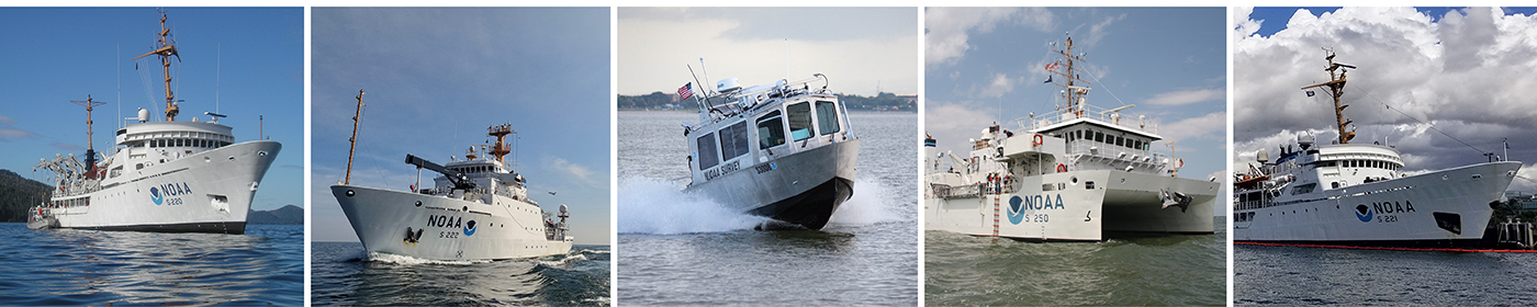
NOAA’s four hydrographic survey ships – Thomas Jefferson, Ferdinand Hassler, Rainier, and Fairweather – are operated and maintained by the Office of Marine and Aviation Operations, with hydrographic survey projects managed by the Office of Coast Survey. NOAA’s navigation response teams are managed by the Office of Coast Survey.